MyTopo
Cambridge Springs NE Pennsylvania US Topo Map
Couldn't load pickup availability
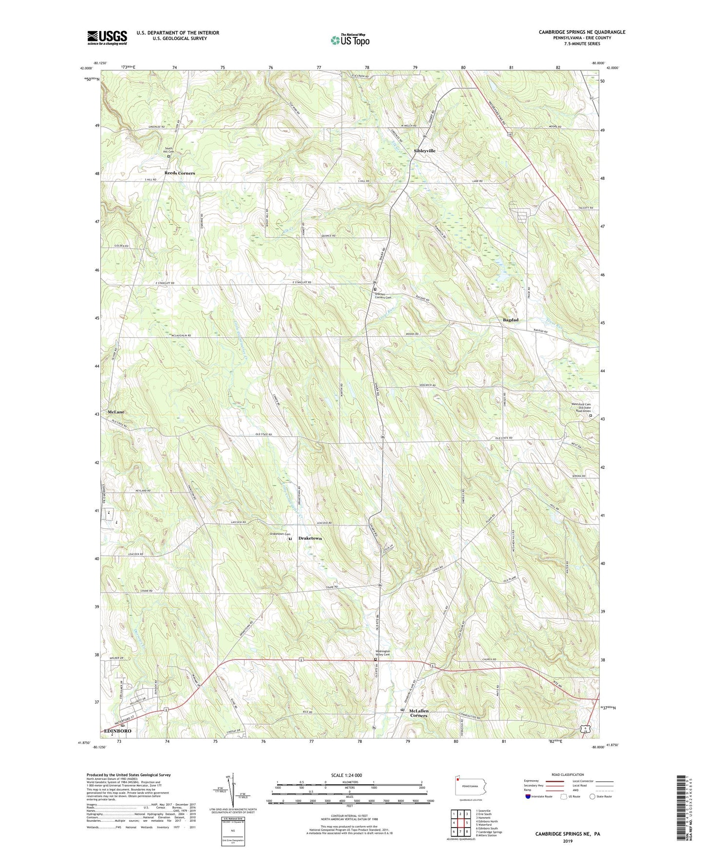
2023 topographic map quadrangle Cambridge Springs NE in the state of Pennsylvania. Scale: 1:24000. Based on the newly updated USGS 7.5' US Topo map series, this map is in the following counties: Erie. The map contains contour data, water features, and other items you are used to seeing on USGS maps, but also has updated roads and other features. This is the next generation of topographic maps. Printed on high-quality waterproof paper with UV fade-resistant inks.
Quads adjacent to this one:
West: Edinboro North
Northwest: Swanville
North: Erie South
Northeast: Hammett
East: Waterford
Southeast: Millers Station
South: Cambridge Springs
Southwest: Edinboro South
This map covers the same area as the classic USGS quad with code o41080h1.
Contains the following named places: Albrecht Farms, Ash School, Aubury School, Bagdad, Black School, Borough of Edinboro, Carlson Airport, Crescent Hill Farms, Draketown, Draketown Cemetery, Edinboro Post Office, Elegeer Farms, Gardner School, General McLane High School, Gleeten School, James W Parker Middle School, Kula Farms, Macon School, McLallen Corners, McLallen Post Office, Phelps Corners, Reeds Corners, Saints Church, Sedgewick School, Sharpes Corners Cemetery, Sharps Corners, Showman Farms, Sibleyville, South Hill Cemetery, South Woods Golf Course, Stancliff School, State Game Lands Number 192, Strong School, Strongs Corners, Township of Washington, Union School, Washington Valley Cemetery, Washington Valley Church, Waterford Cemetery - Old State Road Annex, WRIE-AM (Erie)