MyTopo
New Lebanon Pennsylvania US Topo Map
Couldn't load pickup availability
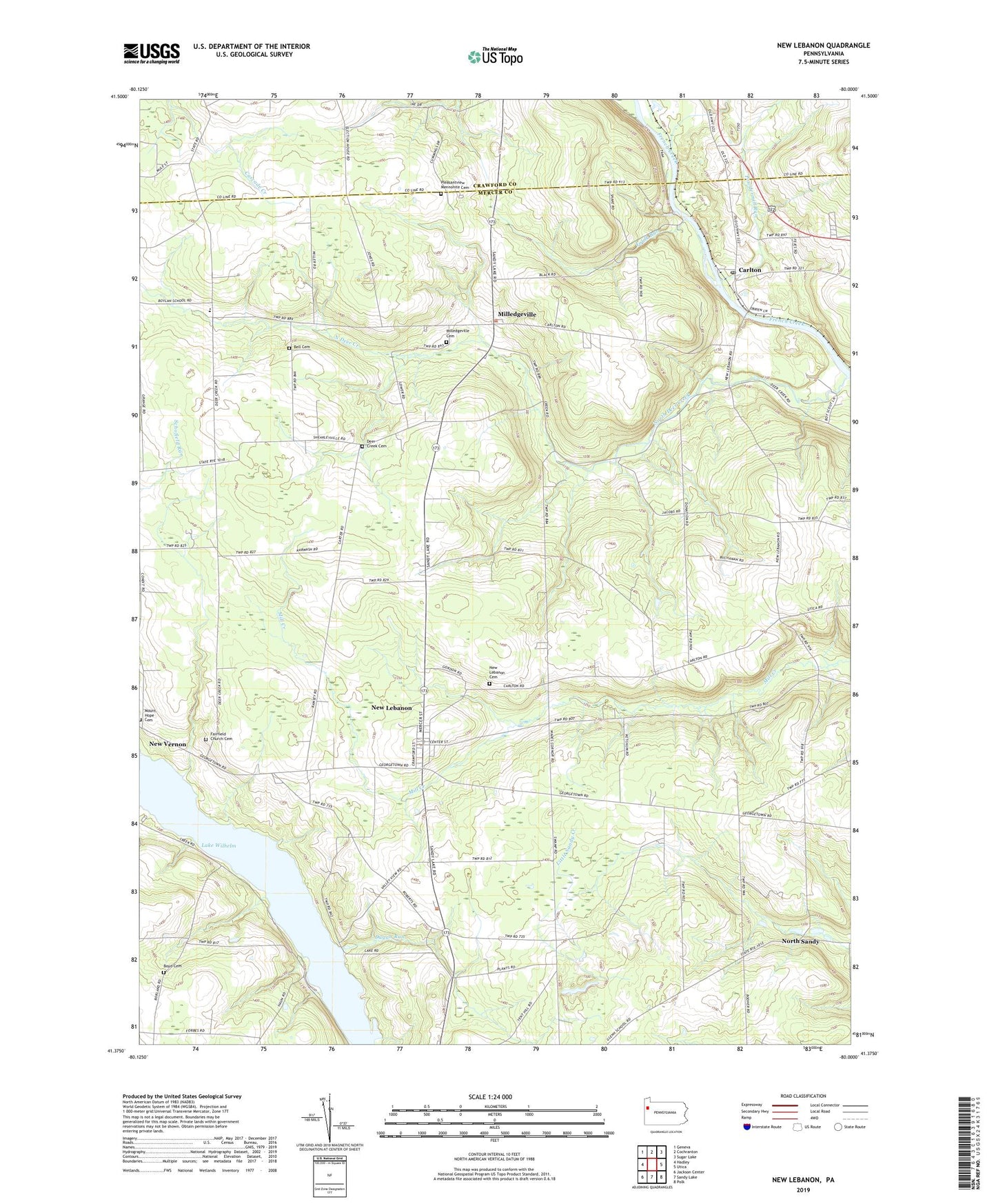
2023 topographic map quadrangle New Lebanon in the state of Pennsylvania. Scale: 1:24000. Based on the newly updated USGS 7.5' US Topo map series, this map is in the following counties: Mercer, Crawford. The map contains contour data, water features, and other items you are used to seeing on USGS maps, but also has updated roads and other features. This is the next generation of topographic maps. Printed on high-quality waterproof paper with UV fade-resistant inks.
Quads adjacent to this one:
West: Hadley
Northwest: Geneva
North: Cochranton
Northeast: Sugar Lake
East: Utica
Southeast: Polk
South: Sandy Lake
Southwest: Jackson Center
This map covers the same area as the classic USGS quad with code o41080d1.
Contains the following named places: Bell Cemetery, Blair School, Borough of New Lebanon, Boyd Cemetery, Boylan School, Calton Post Office, Carlton, Chatley School, Crouser School, Deer Creek Cemetery, Deer Creek Church, Dugan Run, Fairfield Church, Fairfield Church Cemetery, Five Points, Foulk Run, Glenn School, Indian Burial Ground, Kerrtown School, Klingensmith School, Mill Creek, Milledgeville, Milledgeville Cemetery, Montgomery School, Mount Hope Cemetery, Mount Hope Church, New Lebanon, New Lebanon Cemetery, New Lebanon Church, New Vernon, North Deer Creek, Pleasantview Mennonite Cemetery, Pontiac School, Powdermill Run, Ross School, Township of French Creek, Township of Mill Creek, Urey School, ZIP Codes: 16145, 16311