MyTopo
Sandy Lake Pennsylvania US Topo Map
Couldn't load pickup availability
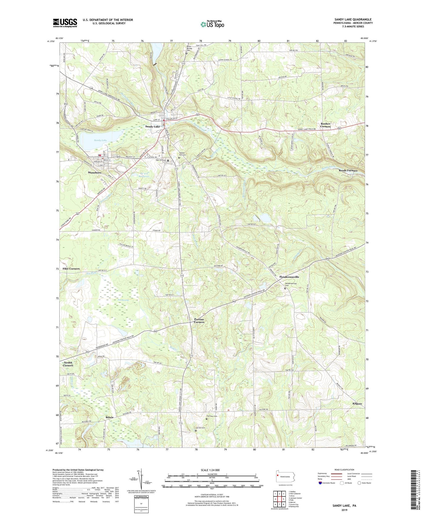
2023 topographic map quadrangle Sandy Lake in the state of Pennsylvania. Scale: 1:24000. Based on the newly updated USGS 7.5' US Topo map series, this map is in the following counties: Mercer. The map contains contour data, water features, and other items you are used to seeing on USGS maps, but also has updated roads and other features. This is the next generation of topographic maps. Printed on high-quality waterproof paper with UV fade-resistant inks.
Quads adjacent to this one:
West: Jackson Center
Northwest: Hadley
North: New Lebanon
Northeast: Utica
East: Polk
Southeast: Barkeyville
South: Grove City
Southwest: Mercer
This map covers the same area as the classic USGS quad with code o41080c1.
Contains the following named places: Arab School, Booher Corners, Borough of Sandy Lake, Borough of Stoneboro, Bowie, Butchery Creek, Carmichael School, Carroll Cemetery, Currier School, Fairview Cemetery, Fiddlers Green, Giebner School, Hendersonville, Hendersonville Cemetery, Hodge School, Kilgore, Lake Wilhelm Dam, Lakeview Consolidated High School, Lytle School, McConnell Run, McCutcheon Run, Oak Hill Cemetery, Pa-474 Dam, Pa-474 Reservoir, Perrine Corners, Pine Swamp, Porter School, Reeds Furnace, Rocky Springs Cemetery, Saint John School, Saint Paul School, Sandy Lake, Sandy Lake Borough Police Department, Sandy Lake Post Office, Sandy Lake Volunteer Fire Department Station 84, Sawmill Run, State Game Lands Number 130, Stoneboro, Stoneboro Police Department, Stoneboro Post Office, Stoneboro Volunteer Fire Department Station 76, Township of Sandy Lake, Township of Worth, Wades Corners, Wesleyan Campground, Yankee Hill Cemetery, Yankee Hill School, Zion Church, ZIP Codes: 16133, 16153