
MyTopo
Penfield Pennsylvania US Topo Map
Couldn't load pickup availability
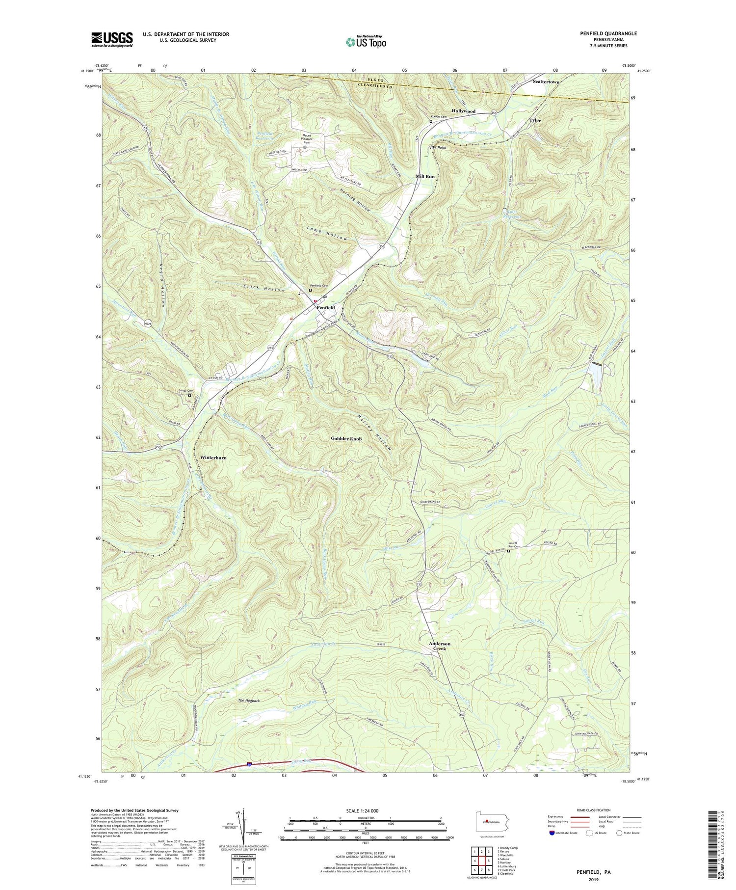
2019 topographic map quadrangle Penfield in the state of Pennsylvania. Scale: 1:24000. Based on the newly updated USGS 7.5' US Topo map series, this map is in the following counties: Clearfield, Elk. The map contains contour data, water features, and other items you are used to seeing on USGS maps, but also has updated roads and other features. This is the next generation of topographic maps. Printed on high-quality waterproof paper with UV fade-resistant inks.
Quads adjacent to this one:
West: Sabula
Northwest: Brandy Camp
North: Kersey
Northeast: Weedville
East: Huntley
Southeast: Clearfield
South: Elliott Park
Southwest: Luthersburg
Contains the following named places: Abbot Run, Anderson Creek, Bark Camp Run, Bennett's Valley Ambulance Service Station 41, Birch Run, Bundy Cemetery, Crystal Spring Camp, East Branch Wilson Run, Erick Hollow, Fox Run, Gobbler Knob, Grapevine Run, Heath Run, Hollywood, Hoovertown, Horning Hollow, Horning Run, Kooker Cemetery, Lamb Hollow, Laurel Bend Camp, Laurel Run Cemetery, Laurel School, Little Laurel Run, Matley Hollow, Matley Run, Middle Branch Wilson Run, Mill Run, Moose Run, Mount Pleasant, Mount Pleasant Cemetery, Mount Pleasant School, Mountain Run, Mud Run, Negro Hollow, Parker Dam, Parker Dam State Park, Penfield, Penfield Cemetery, Penfield Post Office, Penfield Reservoir, Penfield Volunteer Fire Department Station 41, Pine School, Pine Springs Trail, Pray Run, Scattertown, South Branch Bennett Branch, State Game Lands Number 93, Stony Run, The Hogback, Township of Huston, Tyler, Tyler Point, Tyler Reservoir, Tyler Run, Whitney Run, Wilson Run, Winterburn, Wise Run, Woodward Dam Camp, ZIP Code: 15849


