MyTopo
Brandy Camp Pennsylvania US Topo Map
Couldn't load pickup availability
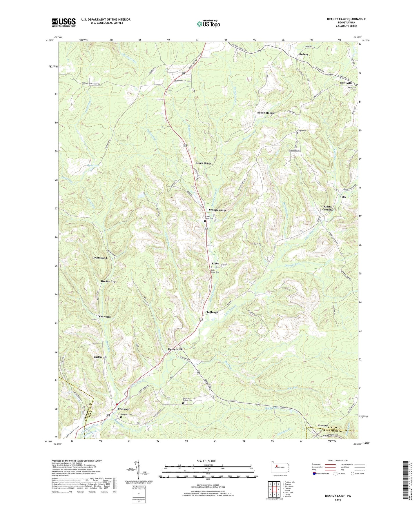
2023 topographic map quadrangle Brandy Camp in the state of Pennsylvania. Scale: 1:24000. Based on the newly updated USGS 7.5' US Topo map series, this map is in the following counties: Elk, Jefferson, Clearfield. The map contains contour data, water features, and other items you are used to seeing on USGS maps, but also has updated roads and other features. This is the next generation of topographic maps. Printed on high-quality waterproof paper with UV fade-resistant inks.
Quads adjacent to this one:
West: Carman
Northwest: Portland Mills
North: Ridgway
Northeast: Saint Marys
East: Kersey
Southeast: Penfield
South: Sabula
Southwest: Falls Creek
This map covers the same area as the classic USGS quad with code o41078c6.
Contains the following named places: Bear Run, Beech Grove, Benninger Creek, Boggy Run, Brandy Camp, Brandy Camp Cemetery, Brandy Camp Creek, Brockport, Brockport Cemetery, Brockport Post Office, Cartwright, Challenge, Drummond, Earleyville Cemetery, Elbon, Helen Mills, Holy Cross Cemetery, Horton City, Horton Township Volunteer Fire Department Company 7, Hyde Lake, Johnson Run, Karnes Run, Kyler Mine, Kyler Run, Kylers Corners, Limestone Run, McCauley Run, Mead Run, Mountain Church, Mountain Church Cemetery, Oyster Run, Phalen Run, Ridge Cemetery, Ridge School, Sawmill Run, Shawmut, Shawmut Reservoir, Shelvey, Squab Hollow, Toby, Township of Horton, ZIP Code: 15823