MyTopo
Weedville Pennsylvania US Topo Map
Couldn't load pickup availability
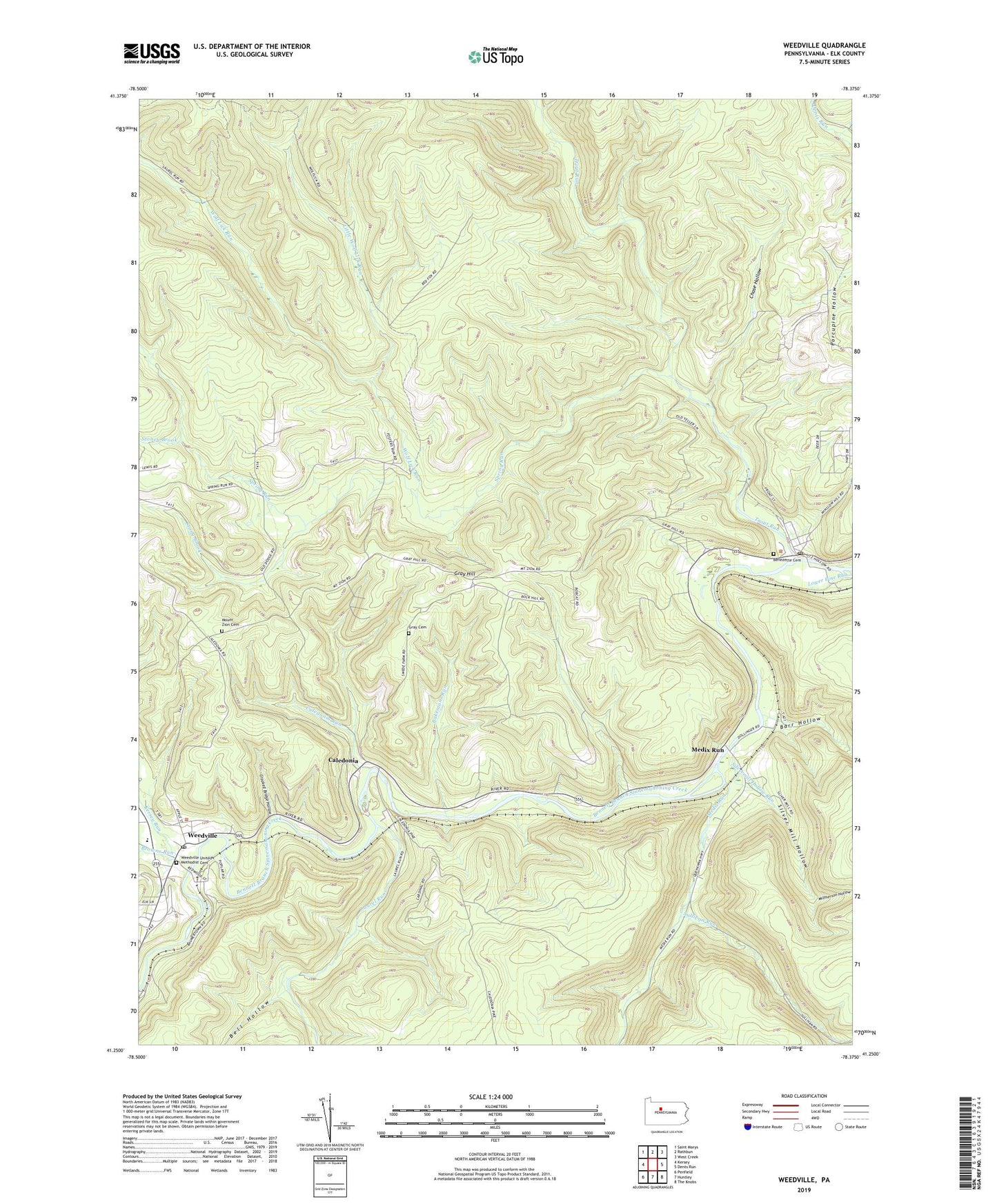
2023 topographic map quadrangle Weedville in the state of Pennsylvania. Scale: 1:24000. Based on the newly updated USGS 7.5' US Topo map series, this map is in the following counties: Elk. The map contains contour data, water features, and other items you are used to seeing on USGS maps, but also has updated roads and other features. This is the next generation of topographic maps. Printed on high-quality waterproof paper with UV fade-resistant inks.
Quads adjacent to this one:
West: Kersey
Northwest: Saint Marys
North: Rathbun
Northeast: West Creek
East: Dents Run
Southeast: The Knobs
South: Huntley
Southwest: Penfield
This map covers the same area as the classic USGS quad with code o41078c4.
Contains the following named places: Bakemans Run, Barr Hollow, Bear Run, Bell Hollow, Benezett Post Office, Benezette, Benezette Cemetery, Browns Run, Caledonia, Caledonia Run, Chase Hollow, Crooked Bridge Hollow, Gray Cemetery, Gray Hill, Kersey Run, Laurel Run, Little Dents Run, Little Wolf Lick Run, McPherson Hollow, McPherson Run, Medix Run, Mount Zion Cemetery, Mount Zion Church, Silver Mill Hollow, Silvermill Hollow Run, Spring Run, Stoney Brook, Stony Brook, Sullivan Run, Township of Jay, Trout Run, Weedville, Weedville Census Designated Place, Weedville Post Office, Weedville United Methodist Cemetery, Wolf Lick Run