MyTopo
Polk Pennsylvania US Topo Map
Couldn't load pickup availability
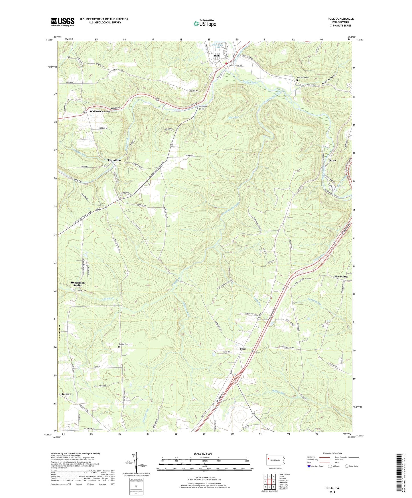
2019 topographic map quadrangle Polk in the state of Pennsylvania. Scale: 1:24000. Based on the newly updated USGS 7.5' US Topo map series, this map is in the following counties: Venango, Mercer. The map contains contour data, water features, and other items you are used to seeing on USGS maps, but also has updated roads and other features. This is the next generation of topographic maps. Printed on high-quality waterproof paper with UV fade-resistant inks.
Quads adjacent to this one:
West: Sandy Lake
Northwest: New Lebanon
North: Utica
Northeast: Franklin
East: Kennerdell
Southeast: Eau Claire
South: Barkeyville
Southwest: Grove City
Contains the following named places: Bear Run, Borough of Polk, Center Church, Five Points, Five Points School, Gadsby Cemetery, Haggerty Hollow, Hebron Church, Henderson Station, Hickory Grove Church, Irwin Church, Little Sandy Creek, Lyons Run, Morrison Run, Mount Pleasant, Mount Pleasant Church, Old Sandy Cemetery, Pearl, Pecan, Pennsylvania State Hospital and School, Polk, Polk Center Hospital, Polk Center School, Polk Dam Lake, Polk Fire - Rescue, Polk Junction, Polk Post Office, Polk State School, Raymilton, South Sandy Creek, State Game Lands Number 39, Sulphur Run, Summer Range Airport, Township of Mineral, Township of Victory, Twin Oaks, Wallace Corners, Waterloo Bridge, Williams Run, Woods Cemetery, Woods Corners, ZIP Code: 16342