MyTopo
Grove City Pennsylvania US Topo Map
Couldn't load pickup availability
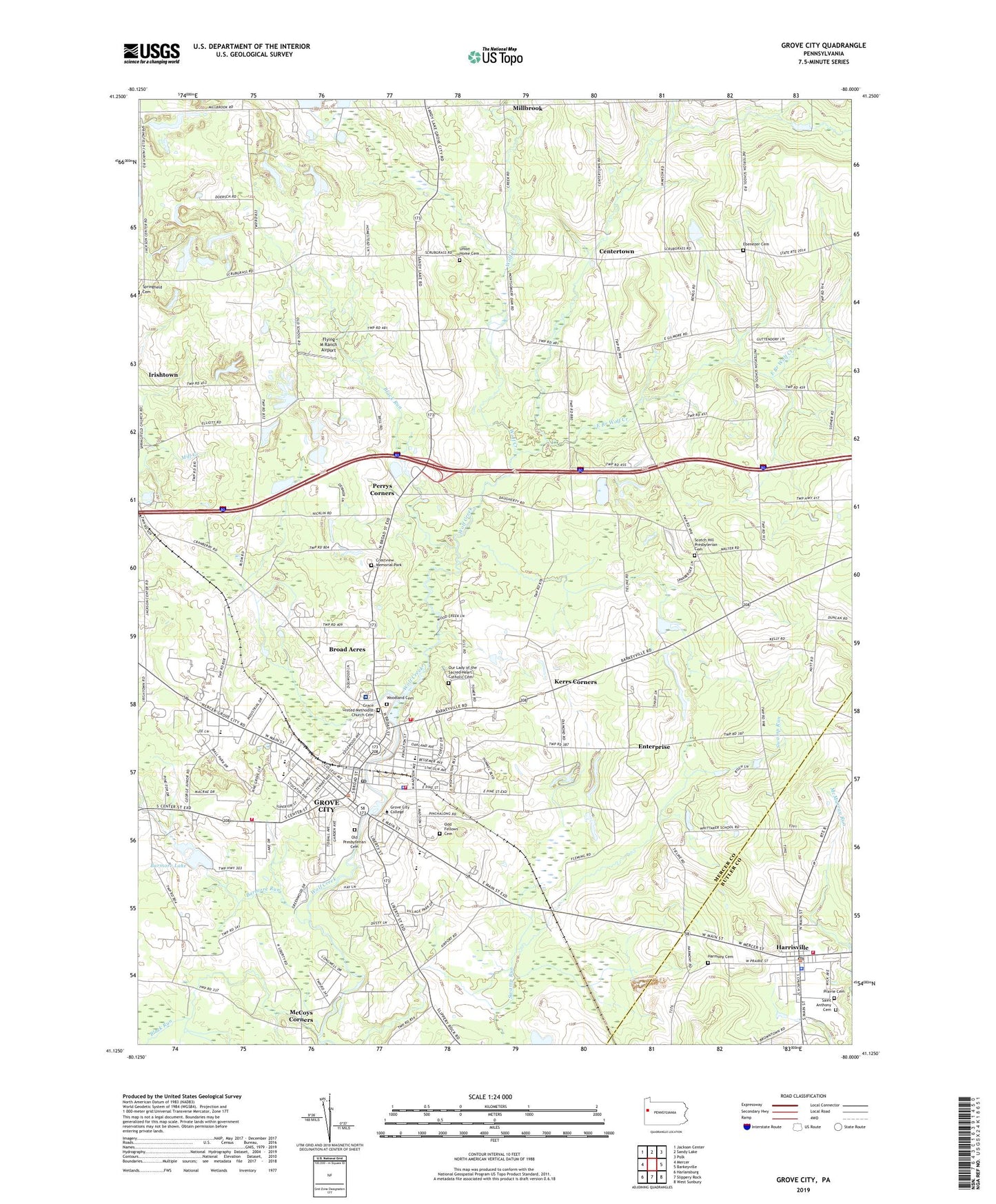
2023 topographic map quadrangle Grove City in the state of Pennsylvania. Scale: 1:24000. Based on the newly updated USGS 7.5' US Topo map series, this map is in the following counties: Mercer, Butler. The map contains contour data, water features, and other items you are used to seeing on USGS maps, but also has updated roads and other features. This is the next generation of topographic maps. Printed on high-quality waterproof paper with UV fade-resistant inks.
Quads adjacent to this one:
West: Mercer
Northwest: Jackson Center
North: Sandy Lake
Northeast: Polk
East: Barkeyville
Southeast: West Sunbury
South: Slippery Rock
Southwest: Harlansburg
This map covers the same area as the classic USGS quad with code o41080b1.
Contains the following named places: Allison Airport, August-Menzies-Monroe Airport, Barmore Lake, Barmore Lake Dam, Barmore Run, Black Run, Borough of Grove City, Borough of Harrisville, Bowie School, Broad Acres, Centertown, Central School, Chestnut Ridge School, Cranberry School, Crestview Memorial Park, East Branch Wolf Creek, Ebenezer Cemetery, Ebenezer Church, Enterprise, Flying M Ranch Airport, Gordon School, Grace United Methodist Church Cemetery, Grove City, Grove City Area High School, Grove City Area Junior High School, Grove City College, Grove City Country Club, Grove City Landing Area, Grove City Medical Center, Grove City Police Department, Grove City Post Office, Grove City Volunteer Fire Department Station 1 Headquarters, Grove City Volunteer Fire Department Station 95, Hall of Arts and Lecture, Harbison Chapel, Har-Mer Elementary School, Harmony Cemetery, Harrisville, Harrisville Post Office, Harrisville Volunteer Fire Company Station 34, Helen Harker Hall, Hemlock School, Henry Buhl Library, Highland Elementary School, Highland School, Hillview Elementary School, Hopeman Hall, Hoyt Hall of Engineering, Irishtown, Issac C Ketier Dormitory, J Howard Pew Fine Arts Center, Kerr School, Kerrs Corners, Klondike School, Lincoln School, Mary Anderson Pew Dormitory, Mary Ethel Pew Dormitory, McCoy School, McCoys Corners, McCoytown, McDowell Corners, Memorial Park, Millbrook, Montgomery School, Nutts Corners, Odd Fellows Cemetery, Old Presbyterian Cemetery, Our Lady of the Sacred Heart Catholic Cemetery, Park Elementary School, Patterson School, Perrys Corners, Phillips Field House, Physical Learning Center, Pinchalong School, Pine Grove Public Golf Course, Pine Township Engine Company Station 85, Pinetop School, Prairie Cemetery, President's Residence - Grove City College, Rockwell Hall of Science, Sagulla Airport, Saint Anthony Cemetery, School for Boys, Schoolfield Church, Scotch Hill Presbyterian Cemetery, Scott Hill Church, Spring Field Corners, Superior Ambulance Service, Swamproot, Township of Mercer, Township of Pine, Township of Wolf Creek, Union Home Cemetery, Washington Kindergarden Center, Washington School, WEDA-FM (Grove City), Weir C Ketler Technology Learning Center, Woodland Cemetery, WSAJ-FM (Grove City), Zerbe Health Center, ZIP Code: 16127