MyTopo
Roxbury Pennsylvania US Topo Map
Couldn't load pickup availability
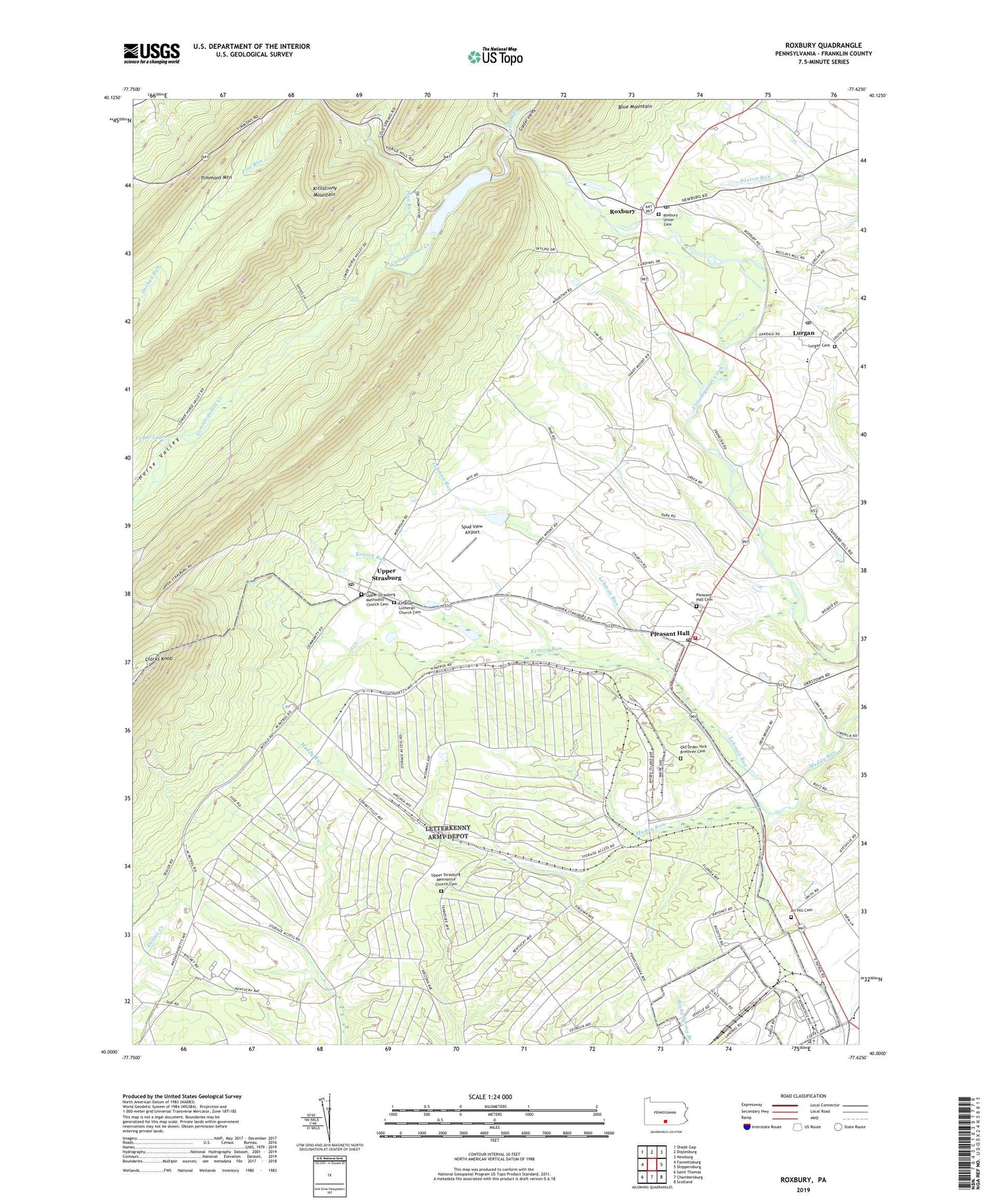
2019 topographic map quadrangle Roxbury in the state of Pennsylvania. Scale: 1:24000. Based on the newly updated USGS 7.5' US Topo map series, this map is in the following counties: Franklin. The map contains contour data, water features, and other items you are used to seeing on USGS maps, but also has updated roads and other features. This is the next generation of topographic maps. Printed on high-quality waterproof paper with UV fade-resistant inks.
Quads adjacent to this one:
West: Fannettsburg
Northwest: Shade Gap
North: Doylesburg
Northeast: Newburg
East: Shippensburg
Southeast: Scotland
South: Chambersburg
Southwest: Saint Thomas
Contains the following named places: Air Hill Cemetery, Air Hill Church, Benders Park, Blue Mountain, Camp Johnson, Cedar Lake, Clarks Knob, Dothan Run, Elm Grove School, Emanuel Lutheran Church Cemetery, Emmanuel Church, Fairview School, Gelvin School, Gunter Valley, Holiness Camp, Horse Valley, Keasey Run, Keefers, Lehman Run, Letterkenny Army Depot, Letterkenny Reservoir, Lurgan, Lurgan Cemetery, Lurgan Post Office, Maple Grove, Old Order York Brethren Cemetery, Pine Run, Pleasant Hall, Pleasant Hall Cemetery, Pleasant Hall Post Office, Pleasant Hall Volunteer Fire Department - Company 11, Pleasant Hill School, Roxbury, Roxbury Post Office, Roxbury Union Cemetery, Salem Church, Sandy Mount School, Shearer School, Spud View Airport, State Game Lands Number 76, Timmons Mountain, Township of Letterkenny, Township of Lurgan, Trout Run, Union School, Upper Strasburg, Upper Strasburg Mennonite Church Cemetery, Upper Strasburg Methodist Church Cemetery, Upper Strasburg Post Office, ZIP Codes: 17244, 17246