MyTopo
Newburg Pennsylvania US Topo Map
Couldn't load pickup availability
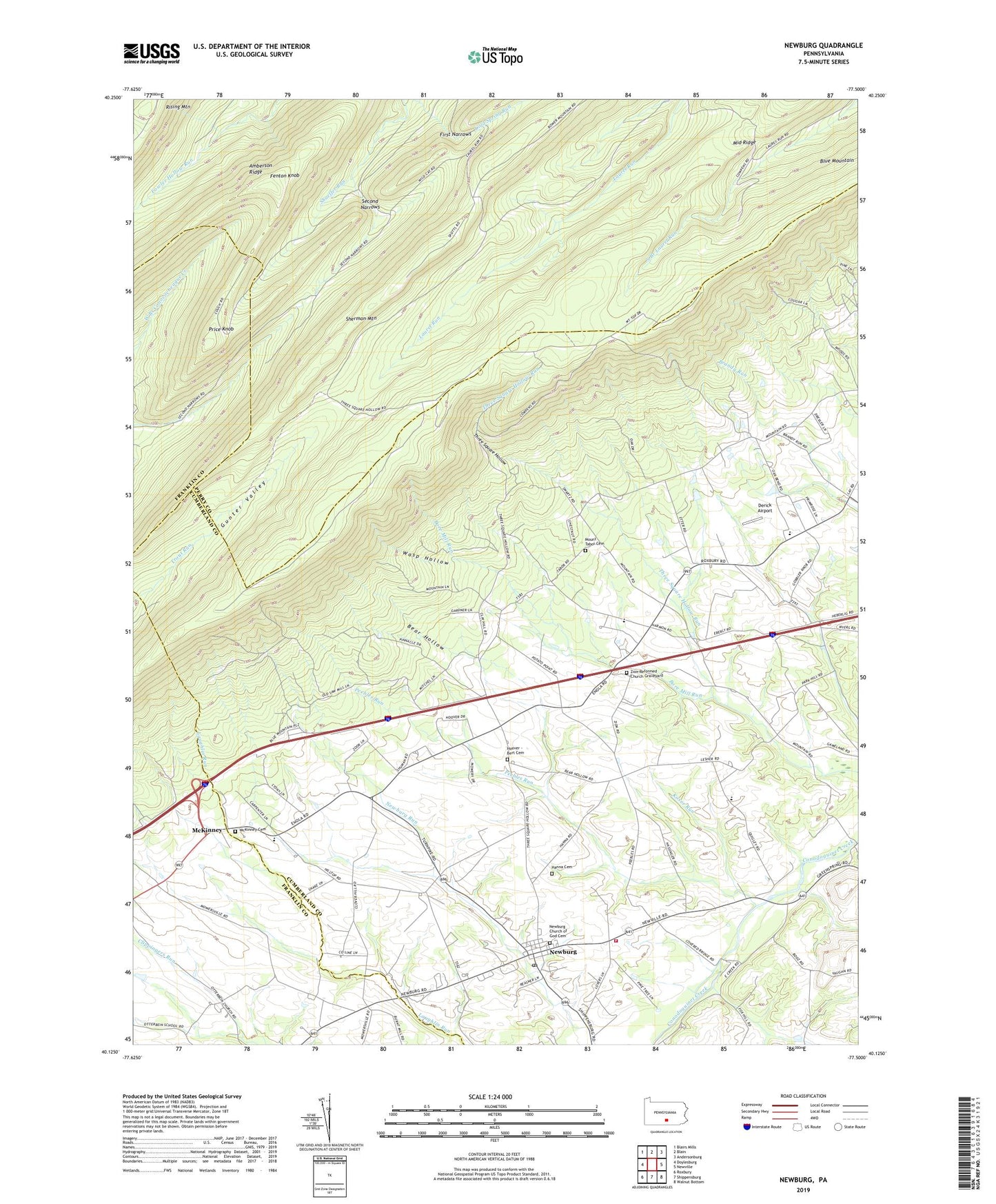
2023 topographic map quadrangle Newburg in the state of Pennsylvania. Scale: 1:24000. Based on the newly updated USGS 7.5' US Topo map series, this map is in the following counties: Cumberland, Perry, Franklin. The map contains contour data, water features, and other items you are used to seeing on USGS maps, but also has updated roads and other features. This is the next generation of topographic maps. Printed on high-quality waterproof paper with UV fade-resistant inks.
Quads adjacent to this one:
West: Doylesburg
Northwest: Blairs Mills
North: Blain
Northeast: Andersonburg
East: Newville
Southeast: Walnut Bottom
South: Shippensburg
Southwest: Roxbury
This map covers the same area as the classic USGS quad with code o40077b5.
Contains the following named places: Amberson Ridge, Amberson Trail, Bear Hollow, Bore Mill Run, Borough of Newburg, Chestnut Grove School, Clover Hill School, Cumberland County Landfill, Deer Hollow Trail, Derick Airport, Dividing Waters Trail, Fenton Knob, First Narrows, Frank E Masland Natural Area, Hanna Cemetery, Hoover - Bert Cemetery, Hopewell Church, Hopewell Newburg Elementary School, Jackson School, Koser Run, McKinney, McKinney Cemetery, Middle Ridge Trail, Moretown Landfill, Mount Tabor Cemetery, Mount Tabor Church, Newburg, Newburg - Hopewell Volunteer Fire Company Station 51, Newburg Church of God Cemetery, Newburg Post Office, North Fork Trail, Old Ramp Trail, Peebles Run, Perry Lumber Company Trail, Phoenix Trail, Price Knob, Second Narrows, Shadyside School, Sherman Mountain, Shermans Tower, Shermans Trail, Three Square Hollow, Torbett Hollow Trail, Township of Hopewell, Township of Upper Mifflin, Twig Trail, Wasp Hollow, Westfield School, Zion Church, Zion Reformed Church Graveyard, ZIP Code: 17240