MyTopo
Saint Marys Pennsylvania US Topo Map
Couldn't load pickup availability
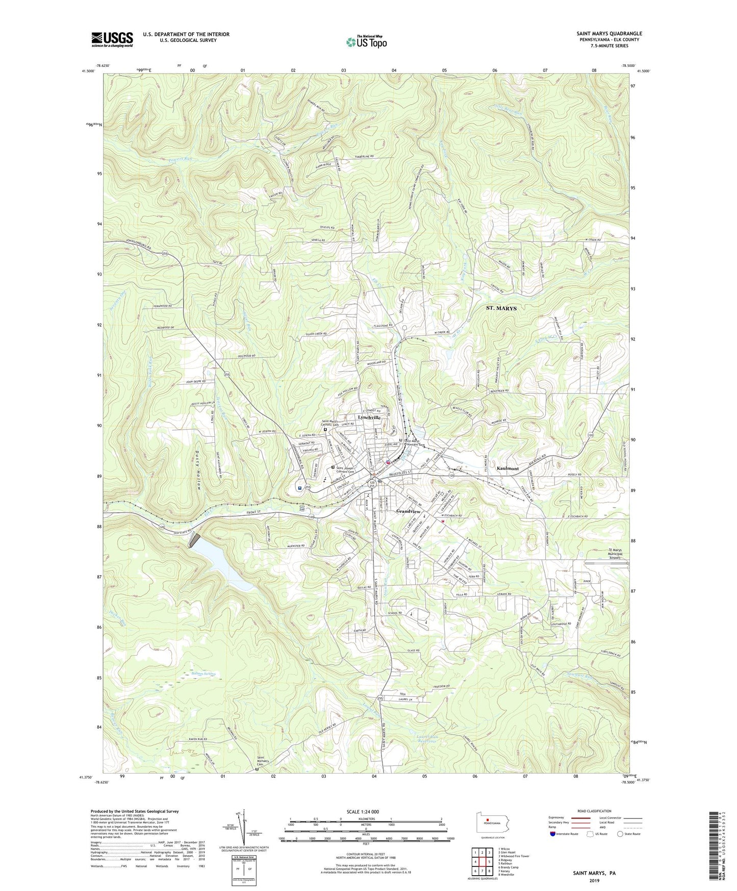
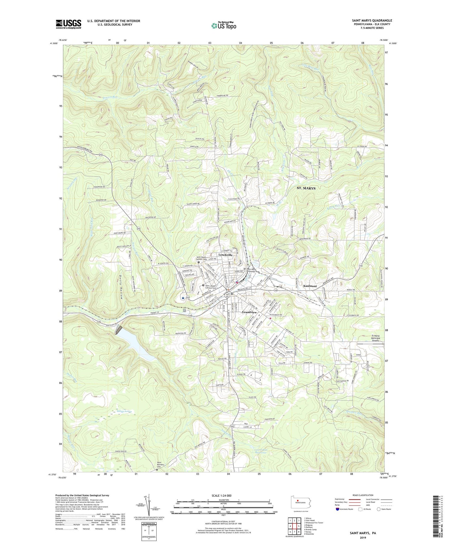
2019 topographic map quadrangle Saint Marys in the state of Pennsylvania. Scale: 1:24000. Based on the newly updated USGS 7.5' US Topo map series, this map is in the following counties: Elk. The map contains contour data, water features, and other items you are used to seeing on USGS maps, but also has updated roads and other features. This is the next generation of topographic maps. Printed on high-quality waterproof paper with UV fade-resistant inks.
Quads adjacent to this one:
West: Ridgway
Northwest: Wilcox
North: Glen Hazel
Northeast: Wildwood Fire Tower
East: Rathbun
Southeast: Weedville
South: Kersey
Southwest: Brandy Camp
Contains the following named places: Balsam Swamp, Benzinger, Bucktail Trail, City of Saint Marys, Crystal Fire Department Company 1 Station 11, Crystal Fire Department Company 1 Station 13, Decker Chapel, Dusty Hollow, Elk Haven County Home, Grandview, Iron Run, Kaulmont, Kay Fork, Laural Run Reservoir, Laurel Run, Laurel Run Reservoir, Lynchville, Penn Highland Elk Hospital, Queen of the World School, Sacred Heart School, Saint Joseph Convent Cemetery, Saint Marys, Saint Marys Area Ambulance Service, Saint Marys Area High School, Saint Mary's Catholic Cemetery, Saint Marys Police Department, Saint Marys Post Office, Saint Marys Protestant Cemetery, Saint Marys School, Saint Michael's Cemetery, Scahonda, Silver Run, Spruce Street School, St Marys Municipal Airport, Tencent Run, Township of Benzinger, Water Tank Run, WKBI-AM (Saint Marys), WTMX-FM (St Marys), ZIP Code: 15857