MyTopo
Saxton Pennsylvania US Topo Map
Couldn't load pickup availability
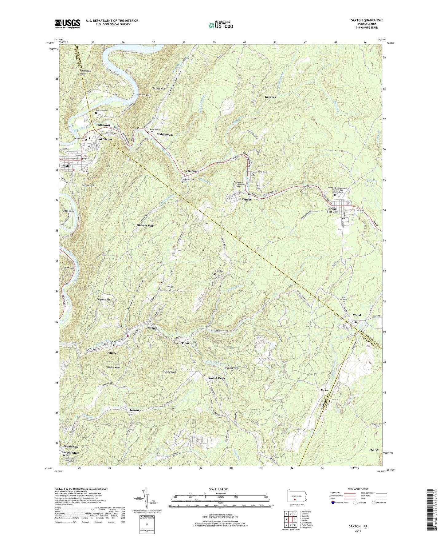
2019 topographic map quadrangle Saxton in the state of Pennsylvania. Scale: 1:24000. Based on the newly updated USGS 7.5' US Topo map series, this map is in the following counties: Bedford, Huntingdon, Fulton. The map contains contour data, water features, and other items you are used to seeing on USGS maps, but also has updated roads and other features. This is the next generation of topographic maps. Printed on high-quality waterproof paper with UV fade-resistant inks.
Quads adjacent to this one:
West: Hopewell
Northwest: Martinsburg
North: Entriken
Northeast: Cassville
East: Saltillo
Southeast: Hustontown
South: Wells Tannery
Southwest: Everett East
Contains the following named places: Alvan, Ave Maria Cemetery, Barnettstown, Borough of Broad Top City, Borough of Coaldale, Borough of Coalmont, Borough of Dudley, Borough of Saxton, Brewster Hollow, Broad Top City, Broad Top Independent Order of Odd Fellows Cemetery, Broad Top Post Office, Coal Bank Run, Coaldale, Coalmont, Colmont Cemetery, Cookstown, Defiance, Defiance Census Designated Place, Defiance Elementary School, Defiance Post Office, Diehl Spring, Dudley, Dudley Methodist Cemetery, Dudley Post Office, Duvalls Cemetery, East Saxton, Evans Cemetery, Finleyville, Fockler Cemetery, Granview Cemetery, Greenwood School, Hartman Run, Hickory Hill, Hill School, Hopewell Landfill, House Run, Kearney, Kennedy Run, Kenrock, Langdondale Community Cemetery, Melrose, Middletown, Miller Run, Minersville, Nagley Knob, North Point, Oak Grove School, Powelton, Puttstown, Raven Run, Rhoat Family Cemetery, Rogers Knob, Round Knob, Round Knob School, Saint Michaels Cemetery, Saxton, Saxton Borough Police Department, Saxton Dam, Saxton Mountain, Saxton Pond, Saxton Post Office, Saxton Volunteer Fire Company - Station 35, Shoup Run, Shreves Run, Six Mile Run Area Volunteer Fire Company - Station 36, Six Mile Run Post Office, State Game Lands Number 67, Stone Row, Sugarcamp Run, Township of Broad Top, Township of Carbon, Tussey Mountain Junior-Senior High School, Union Church, Weaver Bridge, Weaver Falls Access Area, White Church School, Whited School, Wisdom Hollow, Wood, Wood Post Office, Wooduale Dam, ZIP Codes: 16621, 16633, 16634, 16672, 16678, 16679, 16689, 16694