MyTopo
Hustontown Pennsylvania US Topo Map
Couldn't load pickup availability
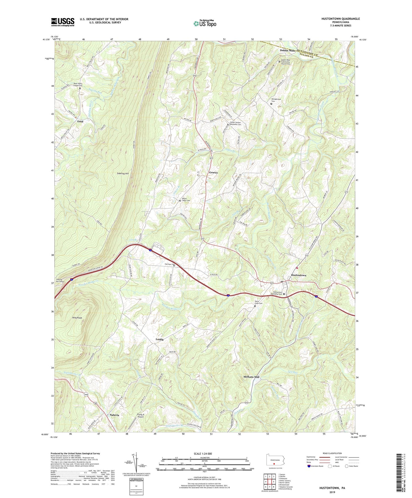
2023 topographic map quadrangle Hustontown in the state of Pennsylvania. Scale: 1:24000. Based on the newly updated USGS 7.5' US Topo map series, this map is in the following counties: Fulton, Huntingdon. The map contains contour data, water features, and other items you are used to seeing on USGS maps, but also has updated roads and other features. This is the next generation of topographic maps. Printed on high-quality waterproof paper with UV fade-resistant inks.
Quads adjacent to this one:
West: Wells Tannery
Northwest: Saxton
North: Saltillo
Northeast: Orbisonia
East: Burnt Cabins
Southeast: McConnellsburg
South: Meadow Grounds
Southwest: Breezewood
This map covers the same area as the classic USGS quad with code o40078a1.
Contains the following named places: Anderson Trail, Appalachian Mountains, Cabin Trail, Center Church, Center United Methodist Cemetery, Cherry Lane Church, Davis Lane Cemetery, Dublin Mills, Dublin Mills Community Church Cemetery, Elders Branch, Enid, Enid School, Ensley Trail, Fairview Cemetery, Fairview Church, Flying R Airport, Forbes Road Elementary School, Forbes Road Junior-Senior High School, Fortune Teller Creek, Gracey, Gracey School, Green Trail, Hiram, Hustontown, Hustontown Area Volunteer Fire Company - Station 57, Hustontown Methodist Cemetery, Hustontown Post Office, Keith Trail, King Knob, Kings Trail, Laidig, Lamberson Branch, Lick Branch, Mellotts Mill, Mellotts Run, Mitchell Trail, Mount Tabor Cemetery, Mount Tabor Church, Roaring Run, Rocky Face Trail, Saluvia, School Number 3, Sciotha Trail, Sideling Hill Plaza, Sipes Branch, Township of Taylor, Vallance School, Waterfall School, Wells Valley Chapel Cemetery, Wells Valley Church, Winegardner Cemetery, Winegardner School, Wintergreen School, Winters Trail, Woodcock Trail, Wooden Bridge Creek, ZIP Code: 17229