MyTopo
Slatedale Pennsylvania US Topo Map
Couldn't load pickup availability
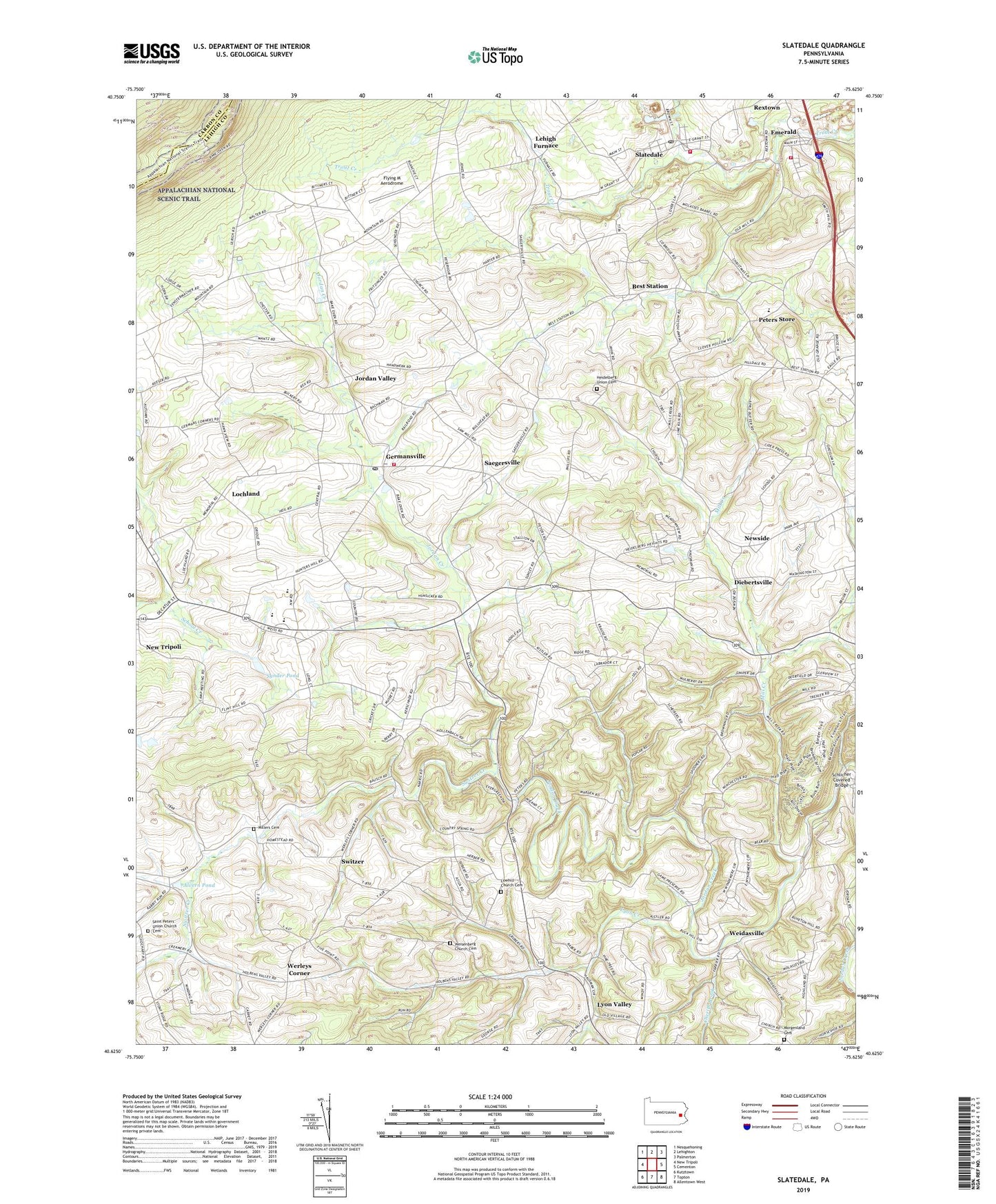
2019 topographic map quadrangle Slatedale in the state of Pennsylvania. Scale: 1:24000. Based on the newly updated USGS 7.5' US Topo map series, this map is in the following counties: Lehigh, Carbon. The map contains contour data, water features, and other items you are used to seeing on USGS maps, but also has updated roads and other features. This is the next generation of topographic maps. Printed on high-quality waterproof paper with UV fade-resistant inks.
Quads adjacent to this one:
West: New Tripoli
Northwest: Nesquehoning
North: Lehighton
Northeast: Palmerton
East: Cementon
Southeast: Allentown West
South: Topton
Southwest: Kutztown
Contains the following named places: Alvern Pond, Bake Oven Knob, Bausch School, Best Station, Bittners Corner, Bull Head, Bullfly Ultralight Flightpark, Cherith Brook, Citizens Fire Company 1 Station 23, Custer, Diebertsville, Emerald, Flint Hill, Flying M Aerodrome, Franklin School, Germans Corners, Germansville, Germansville Post Office, Goodwill Fire Company Station 10, Heidelberg Church, Heidelberg School, Heidelberg Union Cemetery, Hoffman School, Jordan Valley, Kemmener School, Lehigh Furnace, Lehigh Gap School, Lochland, Lowhill, Lowhill Church, Lowhill Church Cemetery, Lowhill School, Lynnville Church, Lyon Creek, Lyon Valley, Lyon Valley School, Mantz School, Mill Creek, Mill Hill, Millers Cemetery, Morganland Church, Morgenland Cemetery, New Tripoli Census Designated Place, Newside, Northwestern Elementary School, Northwestern Lehigh Junior-Senior High School, Peters Elementary School, Peters Store, Pleasant Corners, Saegersville, Saint Peters Union Church Cemetery, Sand Spring Lake, Sand Spring Run Dam, Scherers School, Schlicher Covered Bridge, Schortz School, Slatedale, Slatedale Census Designated Place, Slatedale Post Office, Snyder School, Star Hose Company Station 6, State Game Lands Number 205, Switzer, Switzer Creek, Synder Pond, Township of Heidelberg, Township of Lowhill, Township of Washington, Trexler Nature Preserve, Water Pond School, Weidasville, Weisenberg Church, Weisenberg Church Cemetery, Werleys Corner, ZIP Codes: 18053, 18066, 18079, 18080