MyTopo
New Tripoli Pennsylvania US Topo Map
Couldn't load pickup availability
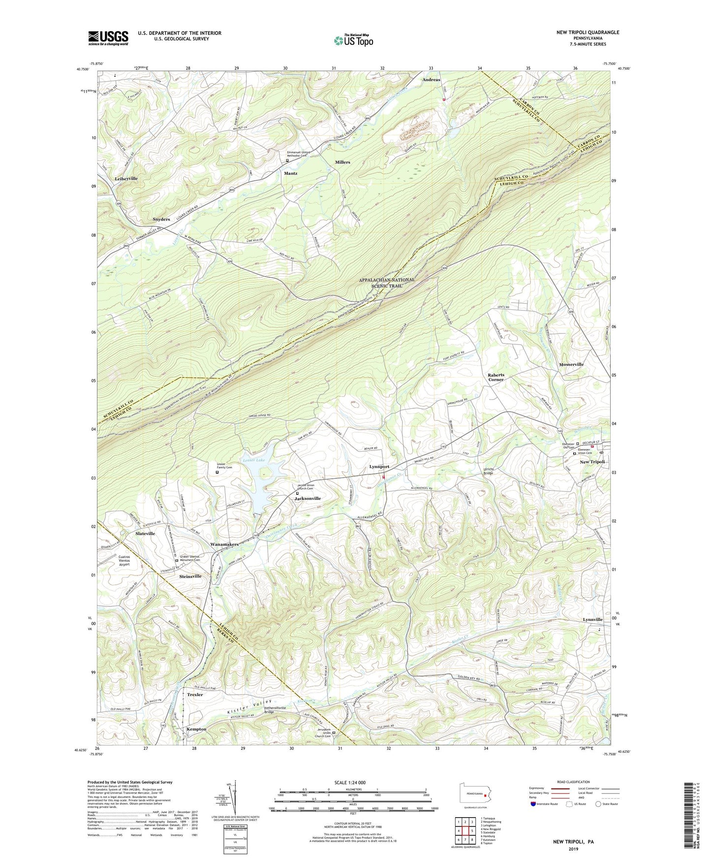
2023 topographic map quadrangle New Tripoli in the state of Pennsylvania. Scale: 1:24000. Based on the newly updated USGS 7.5' US Topo map series, this map is in the following counties: Lehigh, Schuylkill, Berks, Carbon. The map contains contour data, water features, and other items you are used to seeing on USGS maps, but also has updated roads and other features. This is the next generation of topographic maps. Printed on high-quality waterproof paper with UV fade-resistant inks.
Quads adjacent to this one:
West: New Ringgold
Northwest: Tamaqua
North: Nesquehoning
Northeast: Lehighton
East: Slatedale
Southeast: Topton
South: Kutztown
Southwest: Hamburg
This map covers the same area as the classic USGS quad with code o40075f7.
Contains the following named places: Bears Rocks, Blue Mountain House of Hope, Bolich School, Cuatros Vientos Airport, Ebenezer Old Cemetery, Ebenezer Union Cemetery, Emmanuel United Methodist Cemetery, Fetherolfsville, Fetherolfsville Bridge, Furnace School, Graber Obelisk Monument Cemetery, Jacksonville, Jacobs Union Church Cemetery, Jerusalem Union Church Cemetery, Kempton, Kempton Census Designated Place, Kistler Creek, Kistler Valley, Kistler-Longacre School, Leaser Family Cemetery, Leaser Lake, Leaser Lake Dam, Leibeyville, Lynnport, Lynnport Community Fire Company Station 14, Lynnville, Mantz, Millers, Mosserville, New Jerusalem Church, New Tripoli, New Tripoli Post Office, New Tripoli Volunteer Fire Company Station 17, Ontelaunee Creek, Ontelaunee Park, Orchard View Airport, Raberts Corner, Schneidersville, School Creek, Shochary Ridge, Slateville, Snyders, Spitzberg Hill, Steinsville, Township of Lynn, Trexler, Ulrichs Bridge, Wanamakers, ZIP Codes: 18211, 19529