MyTopo
Topton Pennsylvania US Topo Map
Couldn't load pickup availability
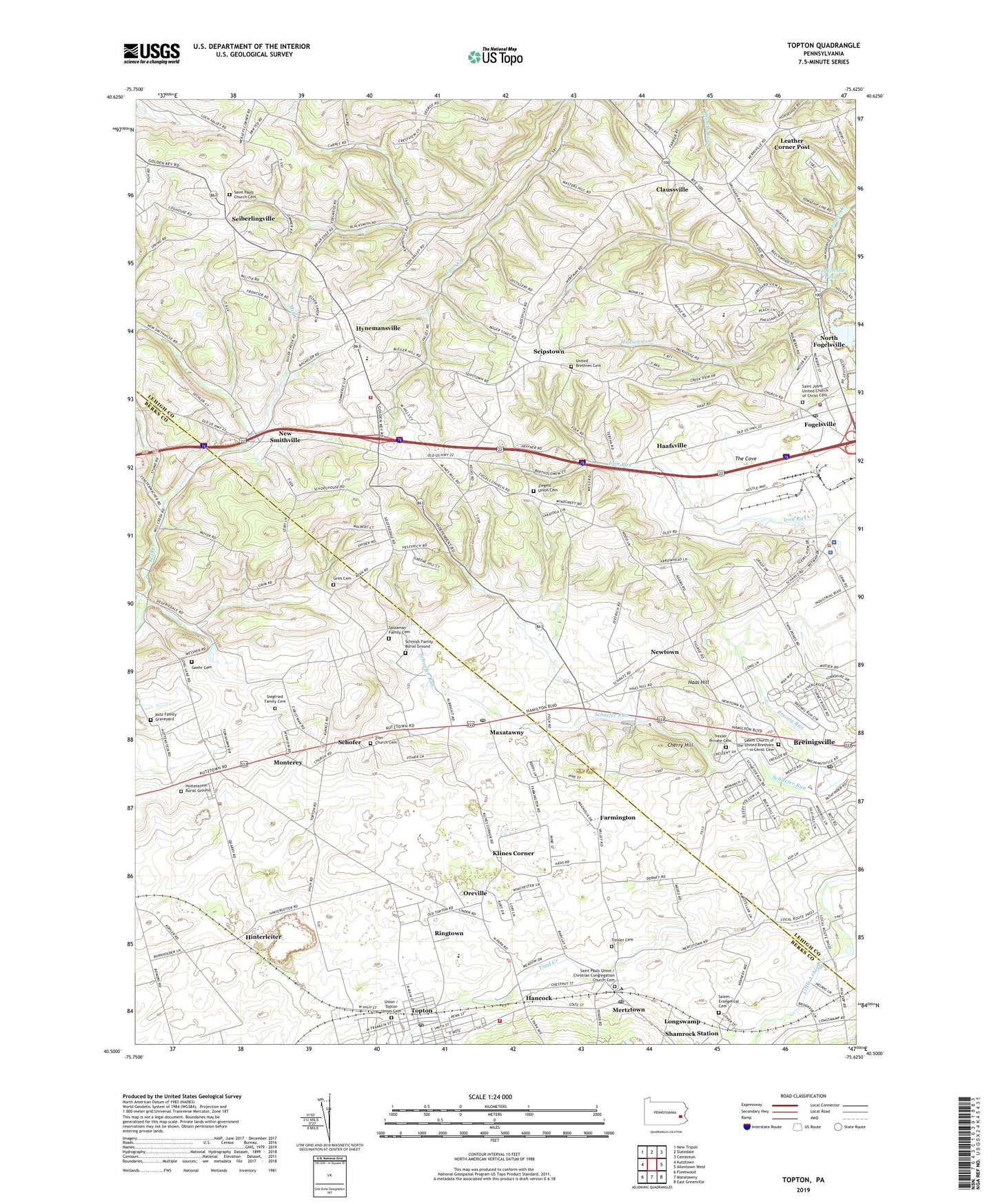
2023 topographic map quadrangle Topton in the state of Pennsylvania. Scale: 1:24000. Based on the newly updated USGS 7.5' US Topo map series, this map is in the following counties: Lehigh, Berks. The map contains contour data, water features, and other items you are used to seeing on USGS maps, but also has updated roads and other features. This is the next generation of topographic maps. Printed on high-quality waterproof paper with UV fade-resistant inks.
Quads adjacent to this one:
West: Kutztown
Northwest: New Tripoli
North: Slatedale
Northeast: Cementon
East: Allentown West
Southeast: East Greenville
South: Manatawny
Southwest: Fleetwood
This map covers the same area as the classic USGS quad with code o40075e6.
Contains the following named places: Apple School, Berks-Lehigh Regional Police Department, Borough of Topton, Brandywine Heights High School, Breinig Run, Breinigsville, Breinigsville Census Designated Place, Breinigsville Post Office, Bucks School, Cherry Hill, Claussville, Country View Mobile Home Park, East Penn School, Evangel Assembly of God, Farmington, Farmington School, Five Points, Fogelsville, Fogelsville Pond, Fogelsville Post Office, Fogelsville Volunteer Fire Company Station 8, Gackenbachs School, Geehr Cemetery, Grim Cemetery, Grim Independent School, Haafsville, Haas Hill, Hancock, Hartzell, Helfrichsville, Hinterleiter, Hinterleiter School, Hottenstein Burial Ground, Hottenstein School, Hynemansville, Hynemansville School, Klines Corner, Kutz Family Graveyard, Laros, Leather Corner Post, Longswamp Community Park, Longswamp Elementary School, Longswamp Township Office, Maxatawney Elementary School, Maxatawny, Maxatawny Census Designated Place, Maxatawny Post Office, Maxatawny Township Offices, Mertztown, Mertztown Census Designated Place, Mertztown Post Office, Mill Creek Corner, Mill Creek School, Monterey, New Smithville, Newtown, North Fogelsville, Oreville, Pennsylvania State Police Troop M Fogelsville Station, Pennsylvania State University - Allentown Campus, Ringtown, Rodale Institute Experimental Farm, Rupp School, Saint Johns United Church of Christ Cemetery, Saint Pauls Church, Saint Pauls Church Cemetery, Saint Paul's Evangelical Lutheran Church, Saint Pauls Union Cemetery, Saint Pauls United Church of Christ, Salem Church of the United Brethren in Christ Cemetery, Salem Evangelical Cemetery, Sassaman Family Cemetery, Schmidt Family Burial Ground, Schofer, Seiberlingville, Seipstown, Shamrock Station, Siegfried Family Cemetery, Siegfriedsdale School, Stone Quarry School, The Cove, Toad Creek, Topton, Topton American Legion Community Ambulance, Topton Community Park, Topton Industrial Park, Topton Post Office, Topton Union Cemetery, Topton Volunteer Fire Company 1 Station 21, Township of Maxatawny, Township of Weisenberg, Trexler Cemetery, Trexler Private Cemetery, United Brethren Cemetery, Wallner, Weisenberg, Weisenberg Elementary School, Zeigels School, Zettlemoyer Airport, Ziegels Union Cemetery, Ziegels Union Church, Zion Church, Zion Church Cemetery, ZIP Codes: 18031, 18051, 19538, 19562