MyTopo
Sunbury Pennsylvania US Topo Map
Couldn't load pickup availability
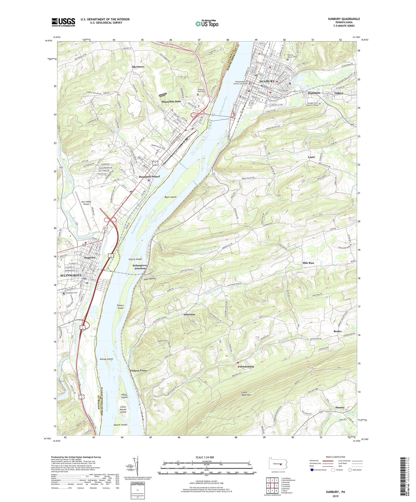
2019 topographic map quadrangle Sunbury in the state of Pennsylvania. Scale: 1:24000. Based on the newly updated USGS 7.5' US Topo map series, this map is in the following counties: Northumberland, Snyder. The map contains contour data, water features, and other items you are used to seeing on USGS maps, but also has updated roads and other features. This is the next generation of topographic maps. Printed on high-quality waterproof paper with UV fade-resistant inks.
Quads adjacent to this one:
West: Freeburg
Northwest: Lewisburg
North: Northumberland
Northeast: Riverside
East: Trevorton
Southeast: Klingerstown
South: Pillow
Southwest: Dalmatia
Contains the following named places: Americus Hose Company Fire Station 5 - 4, Apfelbaum Hall, Ash Pond Number Three, Ash Pond Number Two, Asherton, Augusta Church, Black Mill Chapel, Blough-Weis Library, Bogar Hall, Boile Run, Borough of Selinsgrove, Borough of Shamokin Dam, Byers Island, Caketown, Center for Music and Art, Cherry Island, City of Sunbury, Clement Station, Dauntless Hook and Ladder Fire Company Station 80, Dogtown, Douglas E Arthur Practice Football Field, Drumheller School, East Sunbury Hose Company Fire Station 5 - 6, Edison Elementary School, Elias Church, Emmanuel Church, EMTS Ambulance Service, Evergreen Cemetery, Fisher School, Fishers Ferry, Fishers Island, Fort Augusta Elementary School, Friendship Hose Company Fire Station 5 - 5, Good Will Hose Company Fire Station 5 - 7, Grace S Beck Elementary School, Hallowing Run, Hamilton, Hassinger Hall, Hill School, Hummels Warf Post Office, Hummels Wharf, Hummels Wharf Census Designated Place, Hummels Wharf Fire Company Station 70, Hunter, Jackson Penn School, Jacobs Fitness Center, James W Garrett Sports Complex, Jews Hollow, Kinney Island, Lake Augusta, Lantz, Little Hoover Island, Little Shamokin Creek, Lower Augusta Volunteer Fire Company Station 7 - 1, McClay School, Middle Creek, Mile Run, Monroe Township Elementary School, Mountain Church, Mussers Dam, Nicholas A Lopardo Football and Track Stadium, Northumberland County Sheriff's Office, Oaklyn, Oaklyn Elementary School, Orchard Hills Cemetery, Orchard Hills Shopping Center, Patricksburg, Penn Valley Airport, Penns Creek, Plum Creek, Pomfret Manor Cemetery, Purdytown, Renns School, Rescue Hose Company Fire Station 5 - 3, Resler, Resler School, Ritz School, Rohrbach School, Rolling Green Amusement Park, Rolling Green Run, Saint Peters Church, Sealholtz Run, Selins Grove, Selinsgrove, Selinsgrove Area Middle School, Selinsgrove Borough Police Department, Selinsgrove Creek, Selinsgrove Elementary School, Selinsgrove Junction, Selinsgrove Post Office, Shamokin Creek, Shamokin Dam, Shamokin Dam Borough Police Department, Shamokin Dam Fire Company Station 90, Shamokin Dam Post Office, Shikellamy High School, Shikellamy Junior High School, Shreiners, State Game Lands Number 233, Stelle Hall, Sunbury, Sunbury Almshouse, Sunbury Community Hospital, Sunbury Fabridam, Sunbury Police Department, Sunbury Post Office, Sunbury Steam Fire Engine Company Station 5 - 2, Susquehanna University, Susquehanna Valley Country Club, Susquehanna Valley Mall, Tomson Station, Township of Little Mahanoy, Township of Lower Augusta, Township of Monroe, Township of Upper Augusta, Wallace Station, Wayside Mission Church, Wises Island, WQBQ-AM (Selinsgrove), Zerbe Run, ZIP Codes: 17801, 17876