MyTopo
Dalmatia Pennsylvania US Topo Map
Couldn't load pickup availability
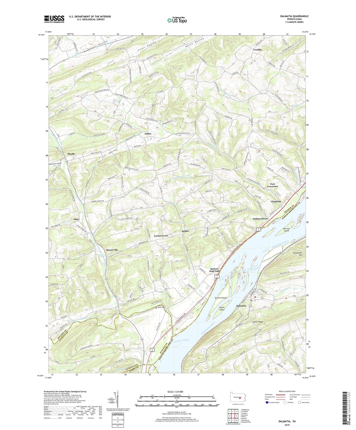
2023 topographic map quadrangle Dalmatia in the state of Pennsylvania. Scale: 1:24000. Based on the newly updated USGS 7.5' US Topo map series, this map is in the following counties: Snyder, Northumberland, Juniata, Perry, Dauphin. The map contains contour data, water features, and other items you are used to seeing on USGS maps, but also has updated roads and other features. This is the next generation of topographic maps. Printed on high-quality waterproof paper with UV fade-resistant inks.
Quads adjacent to this one:
West: Richfield
Northwest: Middleburg
North: Freeburg
Northeast: Sunbury
East: Pillow
Southeast: Elizabethville
South: Millersburg
Southwest: Reward
This map covers the same area as the classic USGS quad with code o40076f8.
Contains the following named places: Aline, Aline Creek, Arnold School, Bethel Church, Browns Island, Buckwheat Valley, Ceejay Airport, Chapman, Chapman Church, Chapman Creek, Dalmatia, Dalmatia Census Designated Place, Dalmatia Creek, Dalmatia Post Office, Dobson Run, Ebenezer Church, Grubbs Church, Hall Church, Herrold Island, Hoffer, Hoffer Creek, Houtz School, Independence, Independence Run, Locust Grove, Lower Mahanoy Fire Company Station 62, Mahantango, McKees Half Falls, Meiserville, North Branch Mahantango Creek, Pallas, Paradise Church, Port Trevorton Census Designated Place, Saint Johns Church, Saint Paul's Cemetery, Saint Pauls Church, Shadle, State Game Lands Number 194, Stauffer Church, Susquehanna Church, The Bible Church, Township of Chapman, Township of Lower Mahanoy, Township of Union, Trout Valley, Troutwell, Verdilla, West Branch Mahantango Creek, Zeigler Island, ZIP Codes: 17017, 17864