
MyTopo
Weatherly Pennsylvania US Topo Map
Couldn't load pickup availability
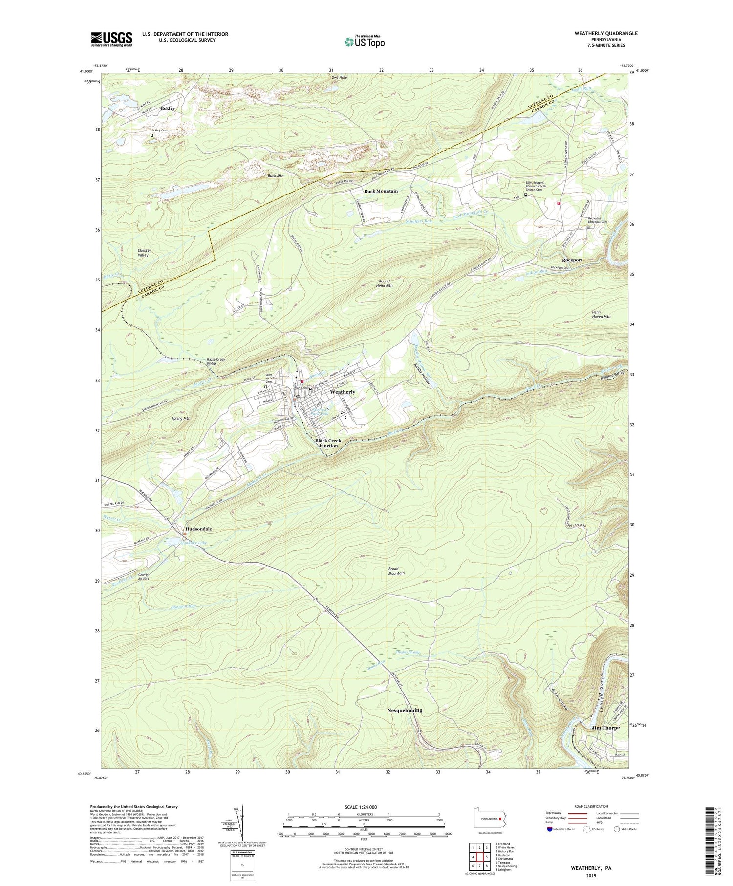
2023 topographic map quadrangle Weatherly in the state of Pennsylvania. Scale: 1:24000. Based on the newly updated USGS 7.5' US Topo map series, this map is in the following counties: Carbon, Luzerne. The map contains contour data, water features, and other items you are used to seeing on USGS maps, but also has updated roads and other features. This is the next generation of topographic maps. Printed on high-quality waterproof paper with UV fade-resistant inks.
Quads adjacent to this one:
West: Hazleton
Northwest: Freeland
North: White Haven
Northeast: Hickory Run
East: Christmans
Southeast: Lehighton
South: Nesquehoning
Southwest: Tamaqua
This map covers the same area as the classic USGS quad with code o40075h7.
Contains the following named places: Beaver Creek, Beisel Run Dam, Black Creek Junction, Borough of Weatherly, Broad Mountain, Broad Mountain Tower, Brushy Hollow, Brushy Hollow Run, Buck Mountain, Buck Mountain Colliery, Buck Mountain Creek, Buckley Colliery Station, Citizens Fire Company District 20, Eckley, Eckley Cemetery, Eckley Station, Eurana Park Pool, Glen Onoko, Glen Onoko Station, Greater Weatherly Ambulance, Grover Airport, Hazle Creek, Hazle Creek Bridge, Hazle Creek Junction Station, Hudsondale, Hughes Swamp, Indian Run, Indian Run Dam, Koons Creek, Larrytown School, Lehigh and Lausanne Rural Volunteer Fire Company District 19, Methodist Episcopal Cemetery, Nesquehoning Creek, Oberson Run, Penn Haven Mountain, Quakake Creek, Quakake Dam, Quakake Lake, Rockport, Round Head Mountain, Saint Joseph Church, Saint Josephs' Roman Catholic Church Cemetery, Saint Nicholas Cemetery, Schaffers Run, Township of Lausanne, Township of Lehigh, Union Cemetery, Upper Buck Mountain Dam, Valley Hospital Medevac Station 4, Weatherly, Weatherly Police Department, Weatherly Post Office, Wetzel Creek, ZIP Code: 18255


