MyTopo
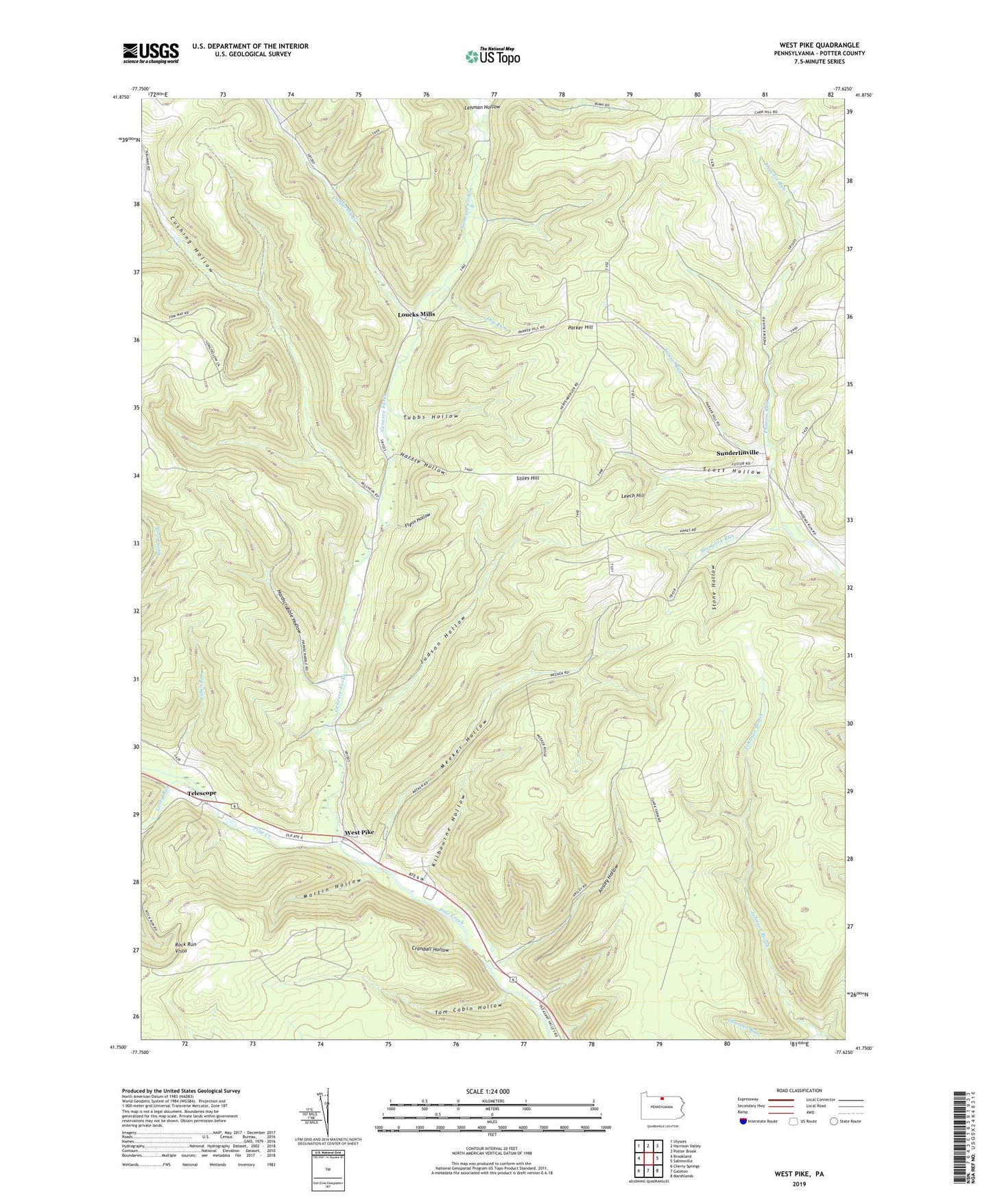
West Pike Pennsylvania US Topo Map
Couldn't load pickup availability
2019 topographic map quadrangle West Pike in the state of Pennsylvania. Scale: 1:24000. Based on the newly updated USGS 7.5' US Topo map series, this map is in the following counties: Potter. The map contains contour data, water features, and other items you are used to seeing on USGS maps, but also has updated roads and other features. This is the next generation of topographic maps. Printed on high-quality waterproof paper with UV fade-resistant inks.
Quads adjacent to this one:
West: Brookland
Northwest: Ulysses
North: Harrison Valley
Northeast: Potter Brook
East: Sabinsville
Southeast: Marshlands
South: Galeton
Southwest: Cherry Springs
Contains the following named places: Ansley Hollow, Baldwin Hollow, Cabin Run, California Creek, Crandall Hollow, Cushing Hollow, Dry Bottom Trail, Dry Run, Flynn Hollow, Genesee Forks, Hardscrabble Hollow, Hartle Hollow, Hemlock Trail, Judson Hollow, Kilbourne Hollow, Laurel Run, Leech Hill, Lehman Hollow, Lehman Run, Losey Run, Loucks Mills, Martin Hollow, Meeker Hollow, Parker Hill, Phoenix Trail, Rock Run Vista, Scott Hollow, State Game Lands Number 64, Stiles Hill, Stone Hollow, Stonylick Run, Sunderlinville, Telescope, Thunder Run, Tom Cabin Hollow, Tom Cabin Trail, Township of Hector, Township of Pike, Tubbs Hollow, Ulysses Airport, West Pike