MyTopo
West Sunbury Pennsylvania US Topo Map
Couldn't load pickup availability
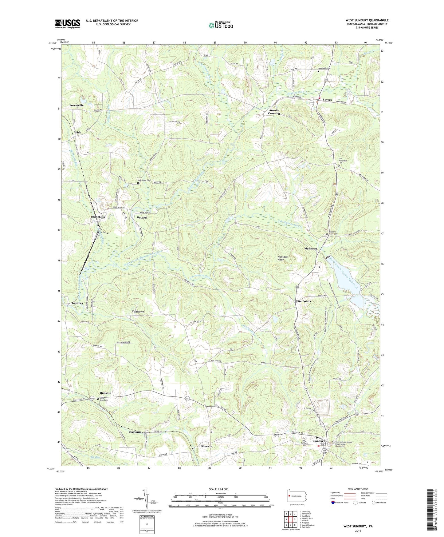
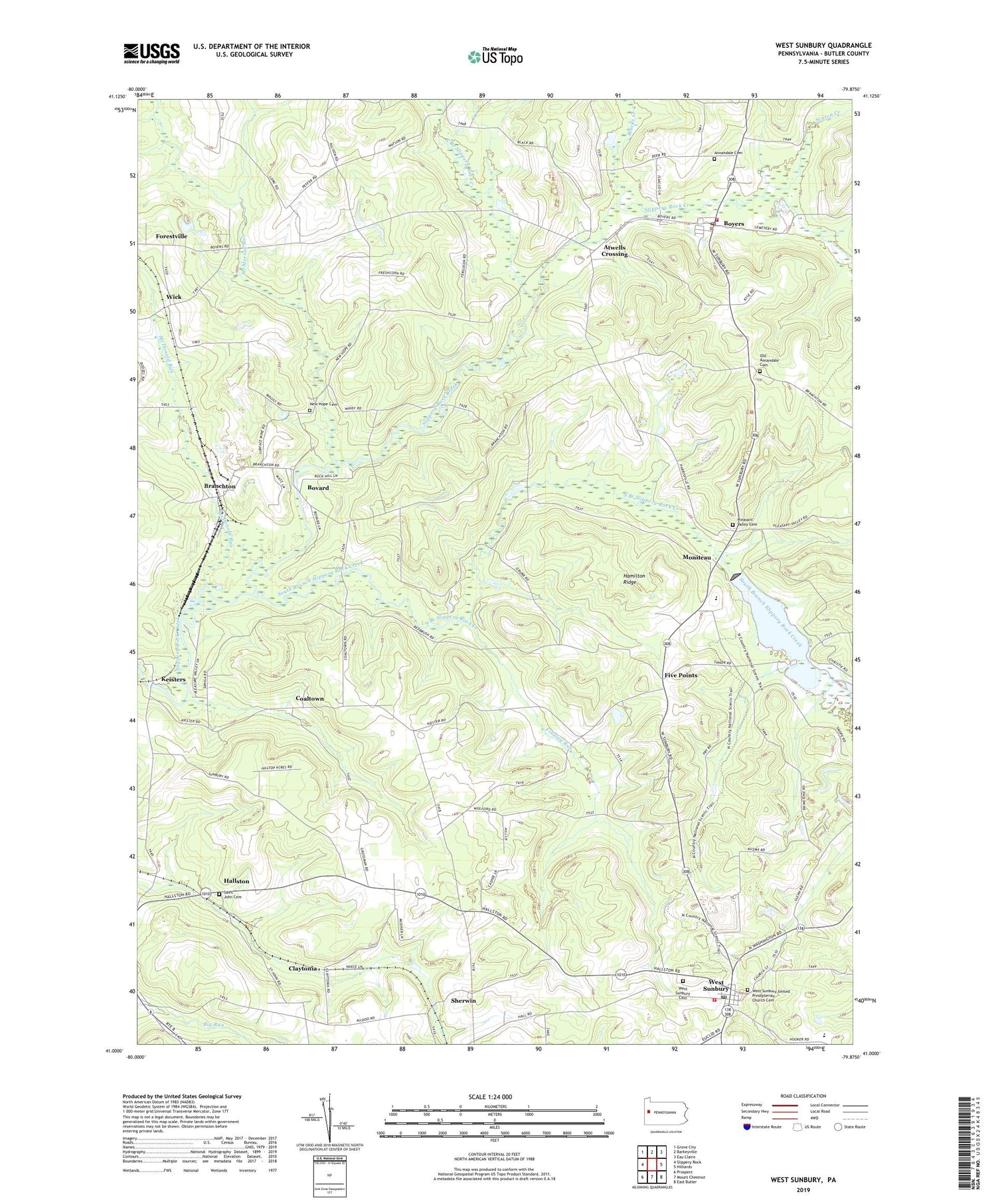
2019 topographic map quadrangle West Sunbury in the state of Pennsylvania. Scale: 1:24000. Based on the newly updated USGS 7.5' US Topo map series, this map is in the following counties: Butler. The map contains contour data, water features, and other items you are used to seeing on USGS maps, but also has updated roads and other features. This is the next generation of topographic maps. Printed on high-quality waterproof paper with UV fade-resistant inks.
Quads adjacent to this one:
West: Slippery Rock
Northwest: Grove City
North: Barkeyville
Northeast: Eau Claire
East: Hilliards
Southeast: East Butler
South: Mount Chestnut
Southwest: Prospect
Contains the following named places: Annandale, Annandale Cemetery, Atwells Crossing, Blacks Creek, Borough of West Sunbury, Bovard, Boyers, Boyers Post Office, Branchton, Camp Davis, Claytonia, Coaltown, Dugan School, Findlay Run, Five Points, Flat Rock School, Glade Dam Lake, Glades Dam, Greer Mitchell School, Hallston, Hamilton Ridge, Loque School, Marion Township Volunteer Fire Company Station 31, McDermott School, McDonald Run, McMurray Run, Moniteau, Moniteau High School, New Hope Cemetery, New Hope Church, North Branch Slippery Rock Creek, Northwest Sanitary Landfill, Old Annandale Cemetery, Pipestem School, Pleasant Valley Cemetery, Pleasant Valley Church, Rock Hill Camp, Rye Bread School, Saint John Cemetery, Seaton Creek, Sherwin, South Branch Slippery Rock Creek, State Game Lands Number 95, Township of Cherry, West Community Church, West Sunbury, West Sunbury Cemetery, West Sunbury Post Office, West Sunbury United Presbyterian Church Cemetery, West Sunbury Volunteer Fire Department Station 25, Wick, ZIP Codes: 16020, 16061