MyTopo
Wildwood Fire Tower Pennsylvania US Topo Map
Couldn't load pickup availability
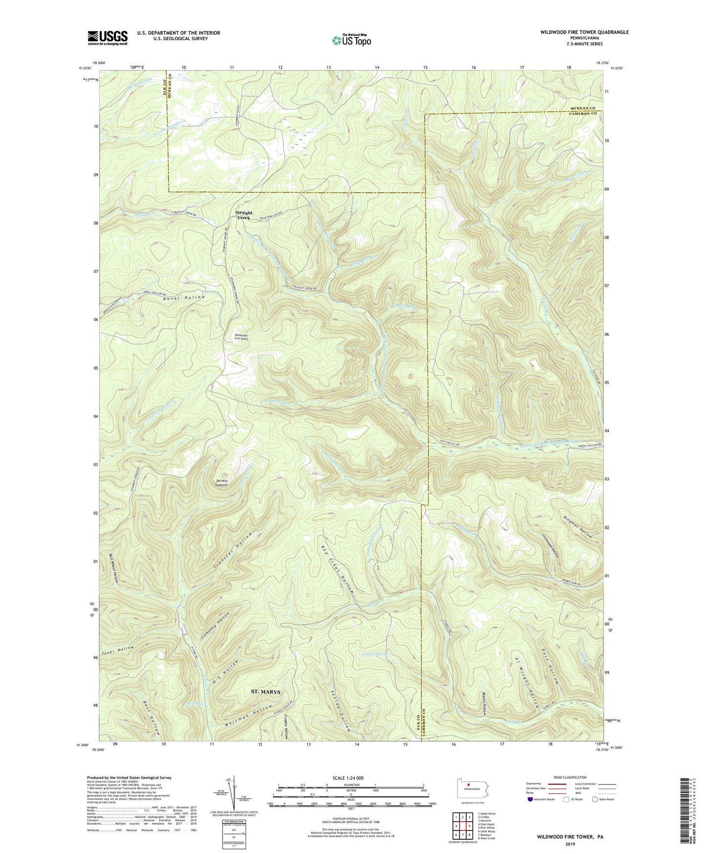
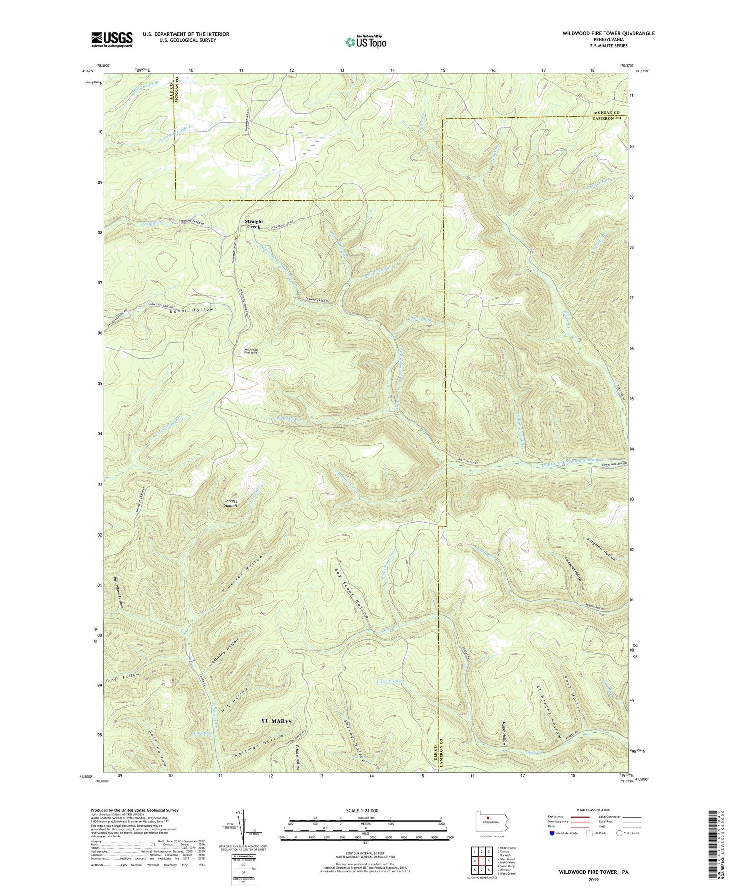
2019 topographic map quadrangle Wildwood Fire Tower in the state of Pennsylvania. Scale: 1:24000. Based on the newly updated USGS 7.5' US Topo map series, this map is in the following counties: Elk, Cameron, McKean. The map contains contour data, water features, and other items you are used to seeing on USGS maps, but also has updated roads and other features. This is the next generation of topographic maps. Printed on high-quality waterproof paper with UV fade-resistant inks.
Quads adjacent to this one:
West: Glen Hazel
Northwest: Hazel Hurst
North: Crosby
Northeast: Norwich
East: Rich Valley
Southeast: West Creek
South: Rathbun
Southwest: Saint Marys
Contains the following named places: Al Wright Hollow, Billy Buck Run, Boy Scout Hollow, Brewer Fork, Bull Wheel Hollow, Cherry Run, Company Hollow, Dead Mans Lick, Elk River, H C Hollow, Indian Camp Run, Jarrets Summit, Little Clear Creek, Lockwood Hollow, Mason Hollow, Nichols Run, Oviatt Branch, Post Hollow, Right Hand Fork, Robinson Run, Straight Creek, Toner Hollow, Transfer Hollow, Wellendorf Branch, Wellendorf Station, Whitman Hollow, Wildwood Fire Tower, Windfall Run