MyTopo
Norwich Pennsylvania US Topo Map
Couldn't load pickup availability
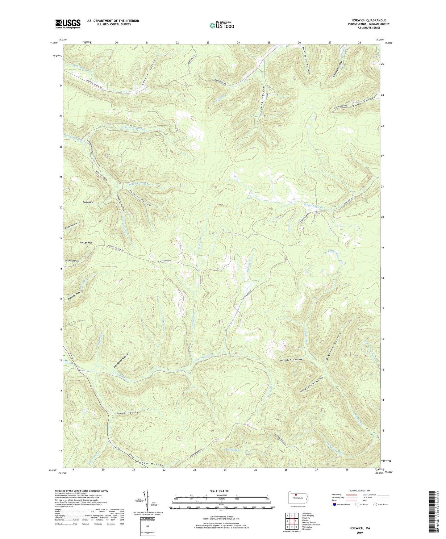
2023 topographic map quadrangle Norwich in the state of Pennsylvania. Scale: 1:24000. Based on the newly updated USGS 7.5' US Topo map series, this map is in the following counties: McKean. The map contains contour data, water features, and other items you are used to seeing on USGS maps, but also has updated roads and other features. This is the next generation of topographic maps. Printed on high-quality waterproof paper with UV fade-resistant inks.
Quads adjacent to this one:
West: Crosby
Northwest: Smethport
North: Port Allegany
Northeast: Roulette
East: Keating Summit
Southeast: Emporium
South: Rich Valley
Southwest: Wildwood Fire Tower
This map covers the same area as the classic USGS quad with code o41078f3.
Contains the following named places: Doubler Hollow, East Branch Potato Creek, Evans Hill, Hamlin Run, Hand Brook, Havens Run, Jay Cox Hill, Keesler Hollow, Larson Hollow, Little Parker Run, Lyman Run, North Branch Colegrove Brook, Norwich, O'Brien Hollow, Panther Run, Pigeon Hollow, Porcupine Hollow, Railroad Run, Saltlog Hollow, Squab Hollow, State Game Lands Number 30, Stone Chimney Hollow, Strang Hollow, Susquehanna State Forest, Taylor Field Branch, Township of Norwich, ZIP Code: 16724