MyTopo
West Creek Pennsylvania US Topo Map
Couldn't load pickup availability
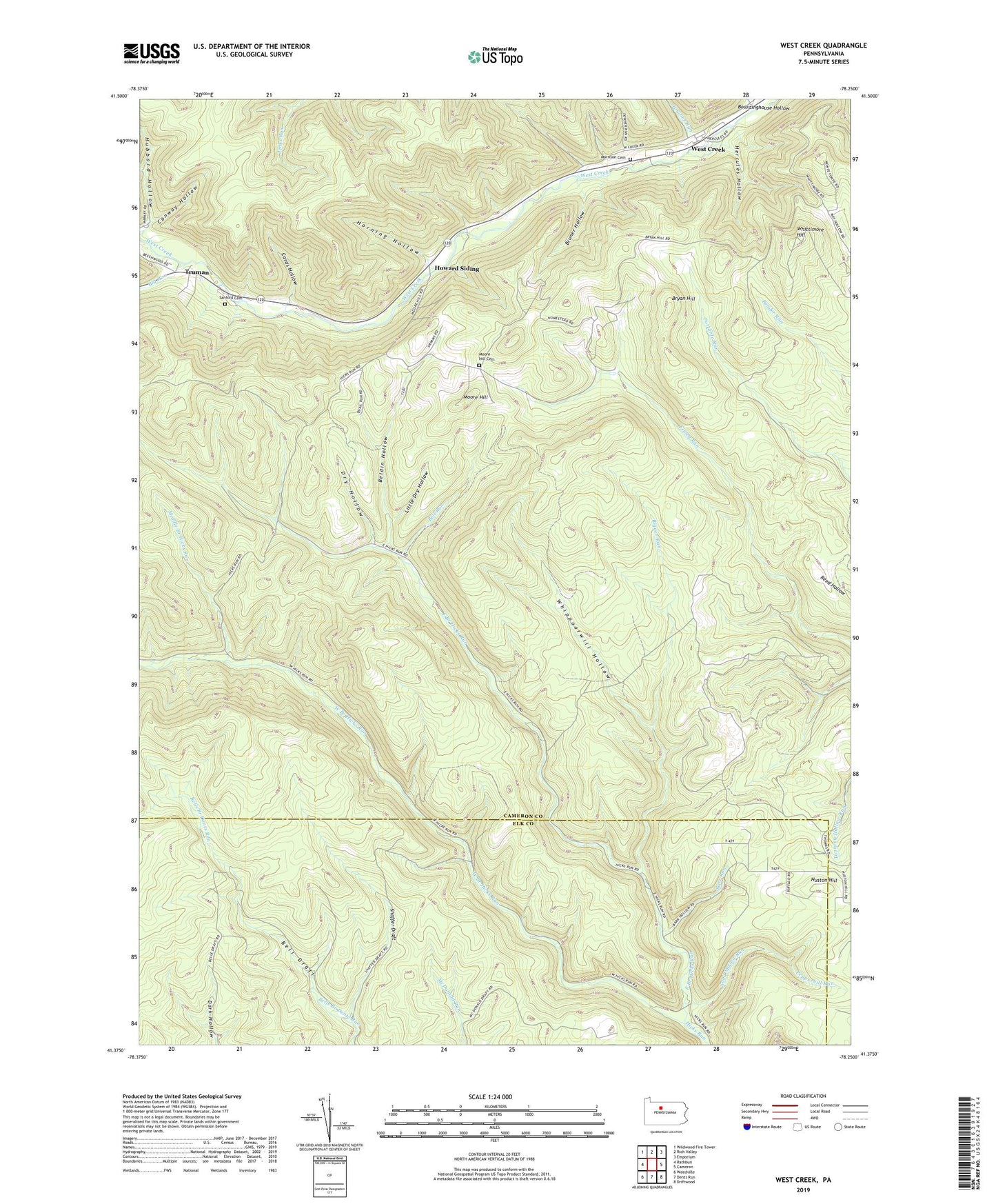
2023 topographic map quadrangle West Creek in the state of Pennsylvania. Scale: 1:24000. Based on the newly updated USGS 7.5' US Topo map series, this map is in the following counties: Cameron, Elk. The map contains contour data, water features, and other items you are used to seeing on USGS maps, but also has updated roads and other features. This is the next generation of topographic maps. Printed on high-quality waterproof paper with UV fade-resistant inks.
Quads adjacent to this one:
West: Rathbun
Northwest: Wildwood Fire Tower
North: Rich Valley
Northeast: Emporium
East: Cameron
Southeast: Driftwood
South: Dents Run
Southwest: Weedville
This map covers the same area as the classic USGS quad with code o41078d3.
Contains the following named places: Barr Run, Beldin Hollow, Bell Run, Big Run, Bigger Run, Boardinghouse Hollow, Bruner Hollow, Bryan Hill, Bryan Hill School, Cards Hollow, Conway Hollow, Dry Hollow, East Branch Hicks Run, Emporium Cable TV Mast, Gillis Bliss Run, Hart Run, Hercules Hollow, Hicks Run Camping Area, Horning Hollow, Howard Siding, Hubbard Hollow, Little Dry Hollow, Middle Branch Hicks Run, Moore Hill, Moore Hill Cemetery, Moore Hill School, Morrison Cemetery, Mud Run, Pine Tree Trail Natural Area, Sand Spring Run, Sanford Cemetery, Shaffer Draft, State Game Lands Number 14, Towner Run, Truman, West Branch Hicks Run, West Creek, Whippoorwill Camp, Whippoorwill Hollow, Whittimore Hill, Whittimore School