MyTopo
Rich Valley Pennsylvania US Topo Map
Couldn't load pickup availability
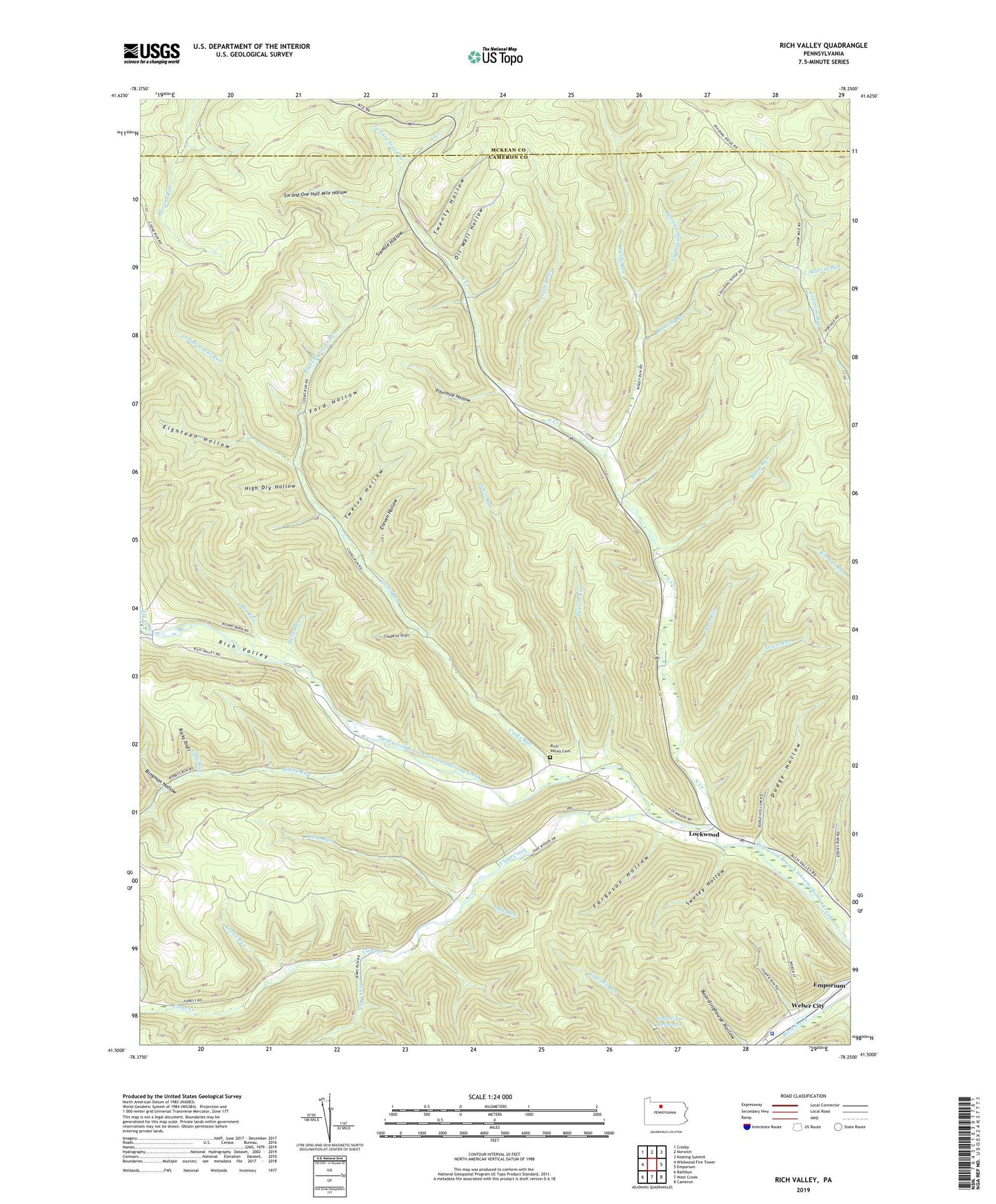
2023 topographic map quadrangle Rich Valley in the state of Pennsylvania. Scale: 1:24000. Based on the newly updated USGS 7.5' US Topo map series, this map is in the following counties: Cameron, McKean. The map contains contour data, water features, and other items you are used to seeing on USGS maps, but also has updated roads and other features. This is the next generation of topographic maps. Printed on high-quality waterproof paper with UV fade-resistant inks.
Quads adjacent to this one:
West: Wildwood Fire Tower
Northwest: Crosby
North: Norwich
Northeast: Keating Summit
East: Emporium
Southeast: Cameron
South: West Creek
Southwest: Rathbun
This map covers the same area as the classic USGS quad with code o41078e3.
Contains the following named places: Barr Run, Big Run, Bingman Hollow, Bobby Run, Britton Run, Chadwick Draft, Chop Run, Clear Creek, Cooks Run, Day Run, Dells Run, Dodge Hollow, Eddy Run, Eighteen Hollow, Eleven Hollow, Elk Fork, Emporium Reservoir, Emporium Reservoir Dam, Ferguson Hollow, Fivemile Run, Ford Hollow, Fourmile Hollow, Franks Run, High Dry Hollow, Hunting Shanty Run, Jenks Run, Johns Run, Lawn View, Left Branch Cooks Run, Lewis Run, Lockwood, Moon Run, Mud Run, North Creek, North Creek Chapel, Oil Well Hollow, Pennsylvania State Police Troop F Emporium Station, Pepper Run, Rich Valley, Rich Valley Cemetery, Right Branch Cooks Run, Roaring Branch, Rocky Draft, Rocky Run, Six and One Half Mile Hollow, Sixmile Hollow, Swesey Hollow, Swesey School, Thayer Run, Township of Shippen, Twelve Hollow, Twenty Hollow, Twenty Seven Branch, Waldy Run, Weber City, ZIP Code: 15834