MyTopo
Cabo Rojo Puerto Rico US Topo Map
Couldn't load pickup availability
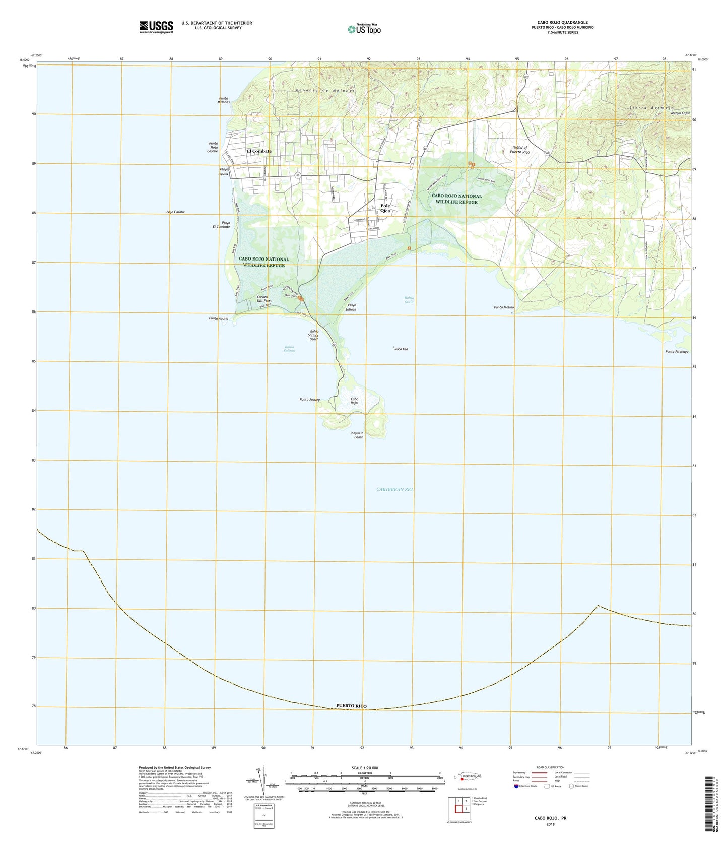
2024 topographic map quadrangle Cabo Rojo in the state of Puerto Rico. Scale: 1:20000. Based on the newly updated USGS 7.5' US Topo map series, this map is in the following counties: Cabo Rojo. The map contains contour data, water features, and other items you are used to seeing on USGS maps, but also has updated roads and other features. This is the next generation of topographic maps. Printed on high-quality waterproof paper with UV fade-resistant inks.
Quads adjacent to this one:
North: Puerto Real
Northeast: San German
East: Parguera
Contains the following named places: Arroyo Cajul, Bahia Salinas, Bahia Salinas Beach, Bahia Sucia, Bajo Casabe, Boqueron Barrio, Bosque Estatal de Boqueron, Bosque Estatal Los Morillos, Cabo Rojo, Cabo Rojo National Wildlife Refuge, Caribbean Bureau of Foreign Broadcast Service, Centro de la Industria de la Sal, Corozo, Corozo Salt Flats, Cullingford Field Airport, El Combate, El Combate Comunidad, El Faro de Cabo Rojo, Escuela Sebastian Pabon Alyes, Las Palmas, Llanos Costa Barrio, Municipio de Cabo Rojo, Penones de Melones, Playa Aguila, Playa El Combate, Playa Salinas, Playuela Beach, Pole Ojea, Pole Ojea Comunidad, Punta Aguila, Punta Jaguey, Punta Melones, Punta Moja Casabe, Punta Molino, Roca Ola, WMIO-FM (Cabo Rojo), ZIP Code: 00622