MyTopo
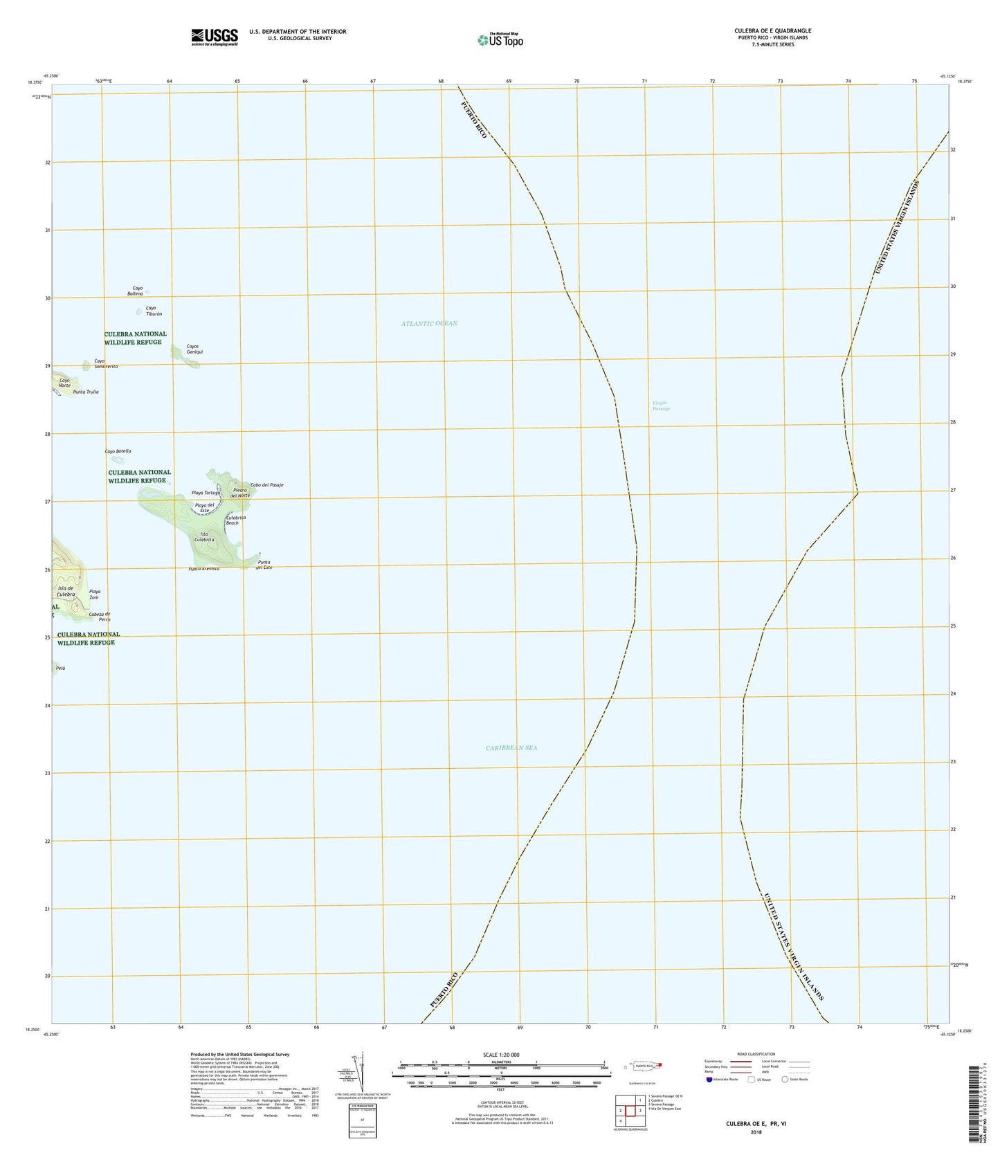
Culebra OE E Puerto Rico US Topo Map
Couldn't load pickup availability
2024 topographic map quadrangle Culebra OE E in the state of Puerto Rico. Scale: 1:20000. Based on the newly updated USGS 7.5' US Topo map series, this map is in the following counties: Humacao, Culebra, St. Thomas. The map contains contour data, water features, and other items you are used to seeing on USGS maps, but also has updated roads and other features. This is the next generation of topographic maps. Printed on high-quality waterproof paper with UV fade-resistant inks.
Quads adjacent to this one:
West: Culebra
Southwest: Isla De Vieques East
Contains the following named places: Bajo Grouper, Cabeza de Perro, Cabo del Pasaje, Canal de Culebrita, Canal Del Sur, Canal Tiempo, Cayo Ballena, Cayo Botella, Cayo Sombrerito, Cayo Tiburon, Cayos Geniqui, Culebrita Beach, Fraile Barrio, Isla Culebrita, Laguna de Molino, Laguna Garay, Marc Point, Piedra del Norte, Playa del Este, Playa Tortuga, Playa Zoni, Punta Arenisca, Punta del Este, Punta Trulla, San Ildefonso, San Isidro Barrio, Tlerra a Medio, Vinet, Virgin Passage