MyTopo
Playa De Ponce Puerto Rico US Topo Map
Couldn't load pickup availability
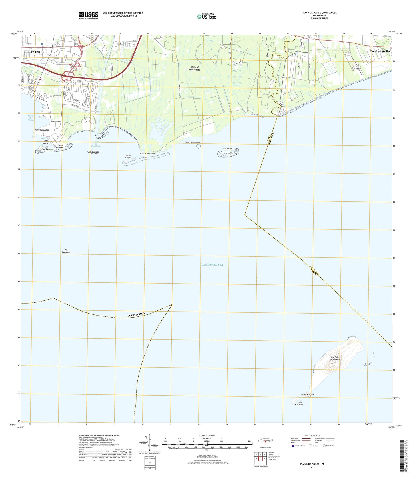
2024 topographic map quadrangle Playa De Ponce in the state of Puerto Rico. Scale: 1:20000. Based on the newly updated USGS 7.5' US Topo map series, this map is in the following counties: Ponce, Juana D��az. The map contains contour data, water features, and other items you are used to seeing on USGS maps, but also has updated roads and other features. This is the next generation of topographic maps. Printed on high-quality waterproof paper with UV fade-resistant inks.
Quads adjacent to this one:
West: Punta Cucharas
Northwest: Penuelas
North: Ponce
Northeast: Rio Descalabrado
East: Santa Isabel
Contains the following named places: Bajo Tasmanian, Barriada El Caribe, Boca Chica, Bucana Barrio, Buyones, Caleta de Cabullones, Camino del Sur, Capitanejo Barrio, Caribbean School, Cayo Desgraciado, Centro Comercial Valle Real Shopping Center, Centro de Estudios Puertorriquenos, Centro Judicial, Cerro Morrillo, Cintrona Segunda, Coffin Island Ferry Terminal, El Faro Caja de Muerto, Escuela Juan Cuevas, Escuela Lopez Nussa, Esperanza, Fondo del Seguro de Estado, Fortuna, Galicias, Gata Islets, Hospital de Damas, Hospital de Doctor Pila, Isla Caja de Muerto Nature Reserve, Isla Caja de Muertos, Isla de Gata, Isla de Jueyes, Isla del Frio, Isla Morrillito, La Guancha Paseo Tablado, La Hamaca, Manzanillo, Muelle de Ponce, Playa Barrio, Playa de Ponce, Plaza del Caribe Shopping Center, Poly Deportivo Frankie Colon, Ponce Mall Shopping Center, Ponce Yacht Club, Punta Cabullones, Punta Carenero, Punta Penoncillo, Quinta Esperanza, Rio Bucana, Rio Inabon, Rio Jacaguas, Rio Portugues, Roca Ahogado, Santa Cruz, Tiburones, Union, Universidad de Puerto Rico en Ponce, Vayas Barrio, Villa Del Carmen, WEUC-AM (Ponce), WIOC-FM (Ponce), WISO-AM (Ponce), WLEO-AM (Ponce), WPRP-AM (Ponce), ZIP Code: 00716