MyTopo
Santa Isabel Puerto Rico US Topo Map
Couldn't load pickup availability
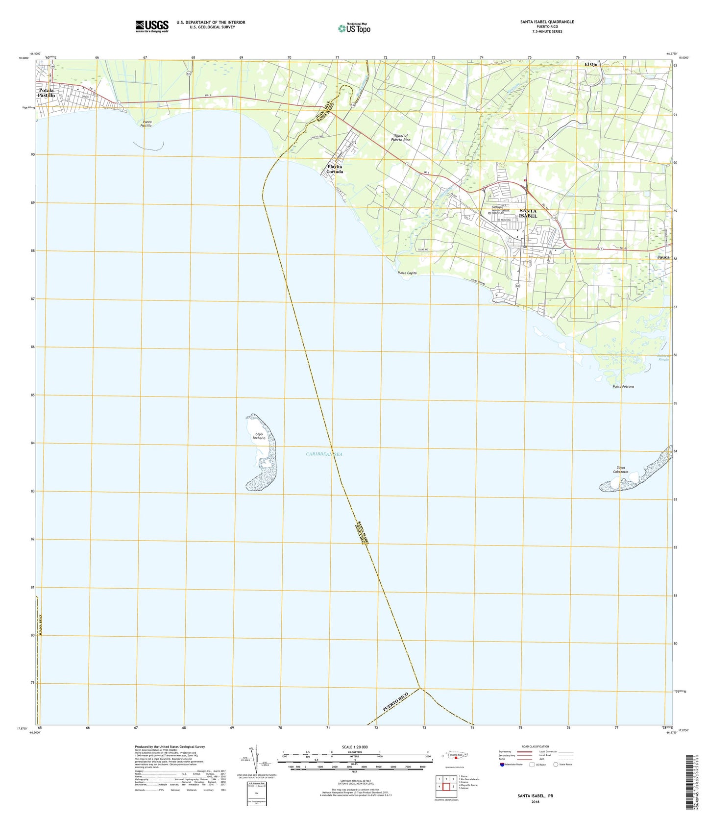
2024 topographic map quadrangle Santa Isabel in the state of Puerto Rico. Scale: 1:20000. Based on the newly updated USGS 7.5' US Topo map series, this map is in the following counties: Santa Isabel, Juana D��az, Ponce. The map contains contour data, water features, and other items you are used to seeing on USGS maps, but also has updated roads and other features. This is the next generation of topographic maps. Printed on high-quality waterproof paper with UV fade-resistant inks.
Quads adjacent to this one:
West: Playa De Ponce
Northwest: Ponce
North: Rio Descalabrado
Northeast: Coamo
East: Salinas
Contains the following named places: Aeropuerto Santa Isabel, Barriada Monserrate, Bizarreta, Boca Velazquez Barrio, Buenos Aires, Camp Caribe, Canal de Florida, Capitanejo, Cayo Berberia, Cayos Cabezazos, Central Cortada, Chardon, Colonia Indios, Comunidad Playa, Comunidad Villa Brabe, Comunidad Villa Pulga, Descalabrado Barrio, Estacion Santa Isabel, Estadio Municipal Luis Guillermo Moreno, Extension Jardines de Santa Isabel, Felicia 1 Barrio, Felicia 2 Barrio, Felicia I, Hacienda Alomar, Hacienda Altura, Hacienda Florida, Hacienda Santa Isabel, Juana Diaz Municipio, Llanso de Santa Isabel, Municipio de Santa Isabel, Parque Luis Cruz, Pastillo, Playa Barrio, Playa Cortada, Playa de Santa Isabel, Playita Cortada, Playita Cortada Comunidad, Potala Pastillo, Potala Pastillo Comunidad, Punta Cayito, Punta Pastillo, Punta Petrona, Reparto Flamboyan, Rio Canas, Rio Canas Abajo Barrio, Rio Coamo, Rio Descalabrado, San Miguel, Santa Isabel, Santa Isabel Barrio-Pueblo, Santa Isabel Municipio, Santa Isabel Nautic Club, Santa Isabel Post Office, Santa Isabel Zona Urbana, Santiago Apostol - Santa Isabel Cemetery, Serrano, Velazquez, Villa de Caribe, Villa Retiro, WCGB-AM (Juana Diaz), ZIP Code: 00757