MyTopo
Bayboro South Carolina US Topo Map
Couldn't load pickup availability
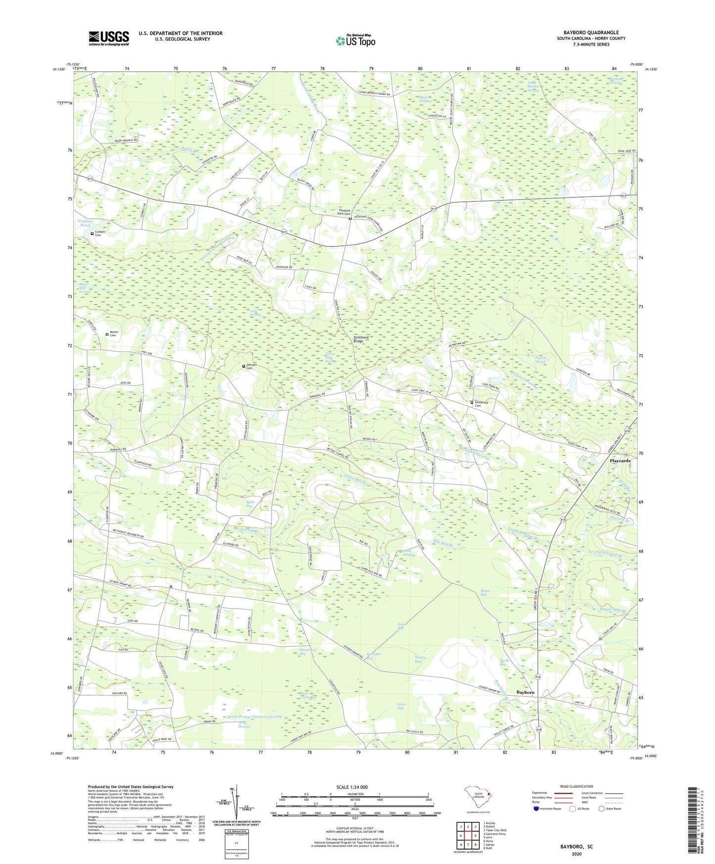
2020 topographic map quadrangle Bayboro in the state of South Carolina. Scale: 1:24000. Based on the newly updated USGS 7.5' US Topo map series, this map is in the following counties: Horry. The map contains contour data, water features, and other items you are used to seeing on USGS maps, but also has updated roads and other features. This is the next generation of topographic maps. Printed on high-quality waterproof paper with UV fade-resistant inks.
Quads adjacent to this one:
West: Galivants Ferry
Northwest: Nichols
North: Duford
Northeast: Tabor City West
East: Loris
Southeast: Shell
South: Adrian
Southwest: Horry
Contains the following named places: Athens Church, Athens School, Bayboro, Bayboro Church, Bayboro School, Berea Church, Bethel Chapel, Big Mill Branch, Boat Lake, Bogue Bay, Breakfast Swamp, Bullit Bay, Calvary Church, Cannons Mill, Chickencoop Branch, Craham Cemetery, Daniel Hole Branch, Gineretts Mill, Graham Pond Dam D-3613, Grass Bay, High Hill Bay, High Hill Church, High Hill School, Honey Camp Branch, Horry County Fire Department Station 28, Horsepen Bay, Horseskull Bay, Johnson Cemetery, Joiner Bay, Joiner Swamp School, Lake Swamp, Lake Swamp Church, Leather String Branch, Lewis School Number 1, Lewis School Number 2, Lewisville, Limbrick Branch, Little Mill Branch, Martin Cemetery, Mitchell Swamp, Mose Swamp, Mount Olive Church, Mount Pisgah Church, New Hope Church, Pasture Branch, Pine Grove School, Playcard Swamp, Playcards, Pleasant Meadow Swamp, Pleasant View, Pleasant View Cemetery, Pleasant View Church, Prince Mill Swamp, Princes Mill, Reedy Bay, Sand Hill Bay, Sarvis Pond, Sarvis Pond Dam D-3614, Small Pond, Strickland Bridge, Strickland Cemetery, Turf Camp Bay, Watery Bay, Zeeks Branch, Zoan Church, Zoan School