MyTopo
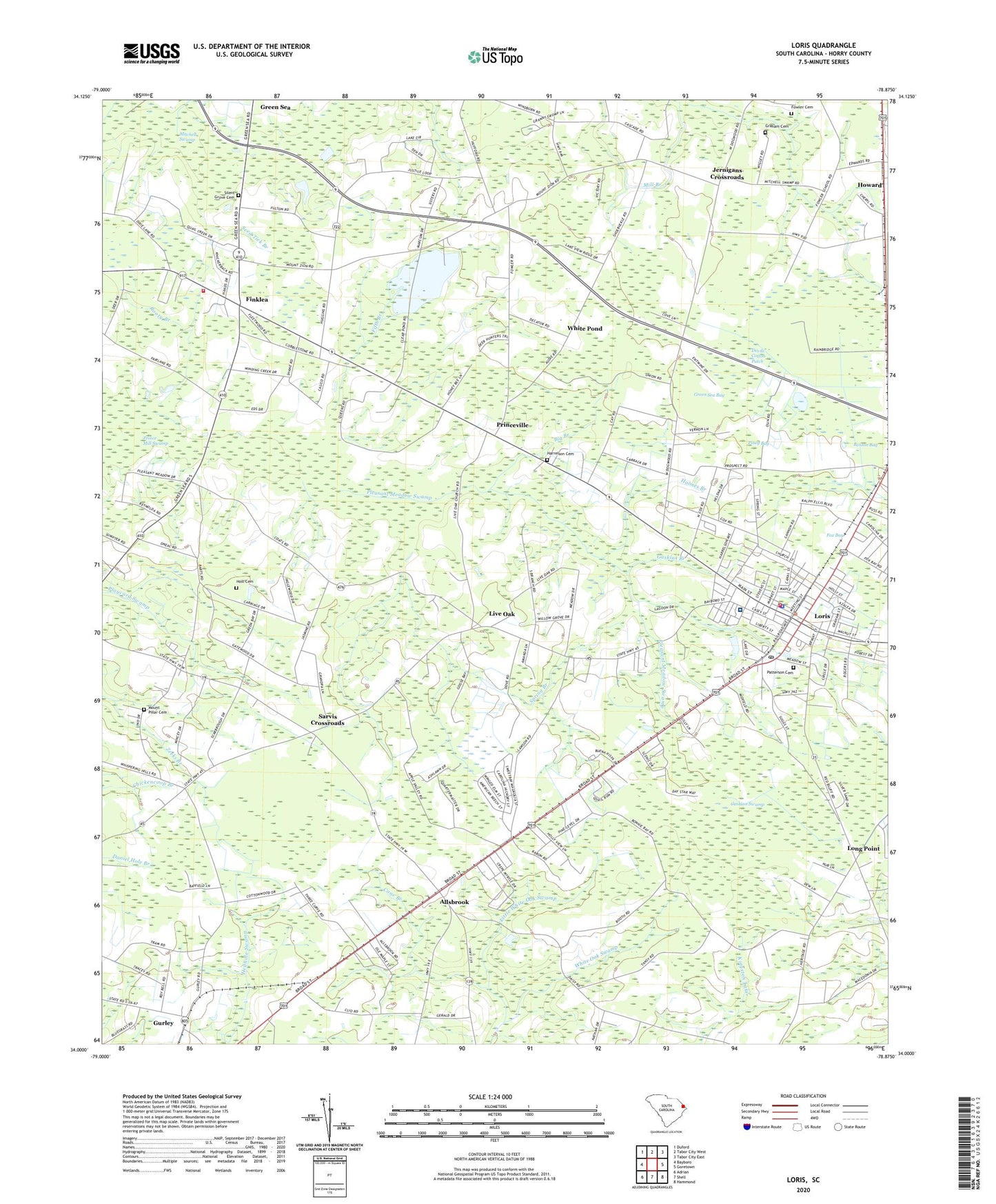
Loris South Carolina US Topo Map
Couldn't load pickup availability
2024 topographic map quadrangle Loris in the state of South Carolina. Scale: 1:24000. Based on the newly updated USGS 7.5' US Topo map series, this map is in the following counties: Horry. The map contains contour data, water features, and other items you are used to seeing on USGS maps, but also has updated roads and other features. This is the next generation of topographic maps. Printed on high-quality waterproof paper with UV fade-resistant inks.
Quads adjacent to this one:
West: Bayboro
Northwest: Duford
North: Tabor City West
Northeast: Tabor City East
East: Goretown
Southeast: Hammond
South: Shell
Southwest: Adrian
This map covers the same area as the classic USGS quad with code o34078a8.
Contains the following named places: Allsbrook, Allsbrook Pond, Allsbrook Pond Dam D-3619, Allsbrook School, Benton Bay, Berean Assembly of God Church, Bethany Church, Big Branch, Cane Branch, Cane Branch Church, Cherry Hill Baptist Church, City of Loris, Clio School, Cushion Swamp, Devils Cotton Patch, Dogwood Hill Church, Durham School, Fifth Branch, Finklea, Finklea Career Center, Finklea Census Designated Place, Finklea High School, Finklea School, Fowler Cemetery, Fox Bay, Gaskins Branch, Glenn, Graham Cemetery, Green Sea Bay, Gurley, Gurley Church, Harrelson Cemetery, Hickory Hill School, Hickory Hill School Number 2, Holmes Branch, Holt Cemetery, Horry County Fire Department Loris, Horry County Fire Department Station 6, Horry County Memorial Library Loris Branch Library, Howard, Iona Church, Iron Springs Swamp, Jernigans Crossroads, Little White Oak Swamp, Live Oak, Live Oak Census Designated Place, Live Oak Church, Long Point, Loris, Loris City Hall, Loris Commerce Center, Loris Community Hospital Heliport, Loris Division, Loris Fire Department, Loris First Baptist Church, Loris Oxidation Pond, Loris Oxidation Pond Dam D-3615, Loris Police Department, Loris Post Office, McLeod Loris Hospital, Mitchell Sea Church, Mount Beulah Church, Mount Pillar Cemetery, Mount Rona Church, Mount Zion Church, Northern Horry Rescue Squad, Patterson Cemetery, Piney Bay, Pleasant Meadow Church, Powell School, Princeville, Princeville Church, Rooty Branch, Sarvis Crossroads, Savannah Branch, Seed Tick Branch, Silent Grove Cemetery, Silent Grove Church, Silent Grove School, Spring Branch, Suggs Mill, Trinity Baptist Church, Watson School, White Pond, WLSC-AM (Loris), ZIP Code: 29569