MyTopo
Bradley South Carolina US Topo Map
Couldn't load pickup availability
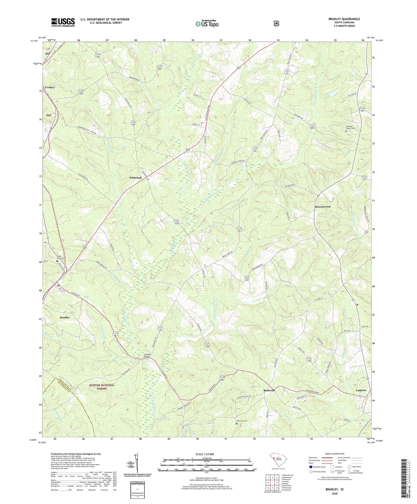
2020 topographic map quadrangle Bradley in the state of South Carolina. Scale: 1:24000. Based on the newly updated USGS 7.5' US Topo map series, this map is in the following counties: Greenwood, McCormick. The map contains contour data, water features, and other items you are used to seeing on USGS maps, but also has updated roads and other features. This is the next generation of topographic maps. Printed on high-quality waterproof paper with UV fade-resistant inks.
Quads adjacent to this one:
West: Verdery
Northwest: Abbeville East
North: Greenwood
Northeast: Ninety Six
East: Kirksey
Southeast: Limestone
South: Winterseat
Southwest: McCormick
Contains the following named places: Aix, Beaverdam Branch, Bethel Church, Bethel School, Big Cowhead Creek, Bold Spring Church, Bold Spring School, Bradley, Bradley Census Designated Place, Breezewood, Callison, Callison Fire Department - Greenwood County Station 90, Calvary Church, Cedar Grove Cemetery, Cedar Grove Church, Cedar Grove School, Chiles Branch, Church Branch, Civilian Conservation Corps Camp F-7, Coleman Branch, Cothran Bridge, Cunning Ford Creek, Laco, Laniers Store, Little Cowhead Creek, Old Pine Grove Cemetery, Old Rock House, Pine Grove Church, Pine Grove School, Powder Spring, Promised Land School, Rehoboth Church, Rushville, Rushville Cemetery, South Carolina Noname 24011 D-1266 Dam, South Carolina Noname 24017 D-1271 Dam, Stillhouse Branch, Troy Division, Union School, United States Forest Service Bradley Work Center, Verdery, Whitehall, Whitehall Church, Whitehall School, ZIP Code: 29819