MyTopo
Winterseat South Carolina US Topo Map
Couldn't load pickup availability
Also explore the Winterseat Forest Service Topo of this same quad for updated USFS data
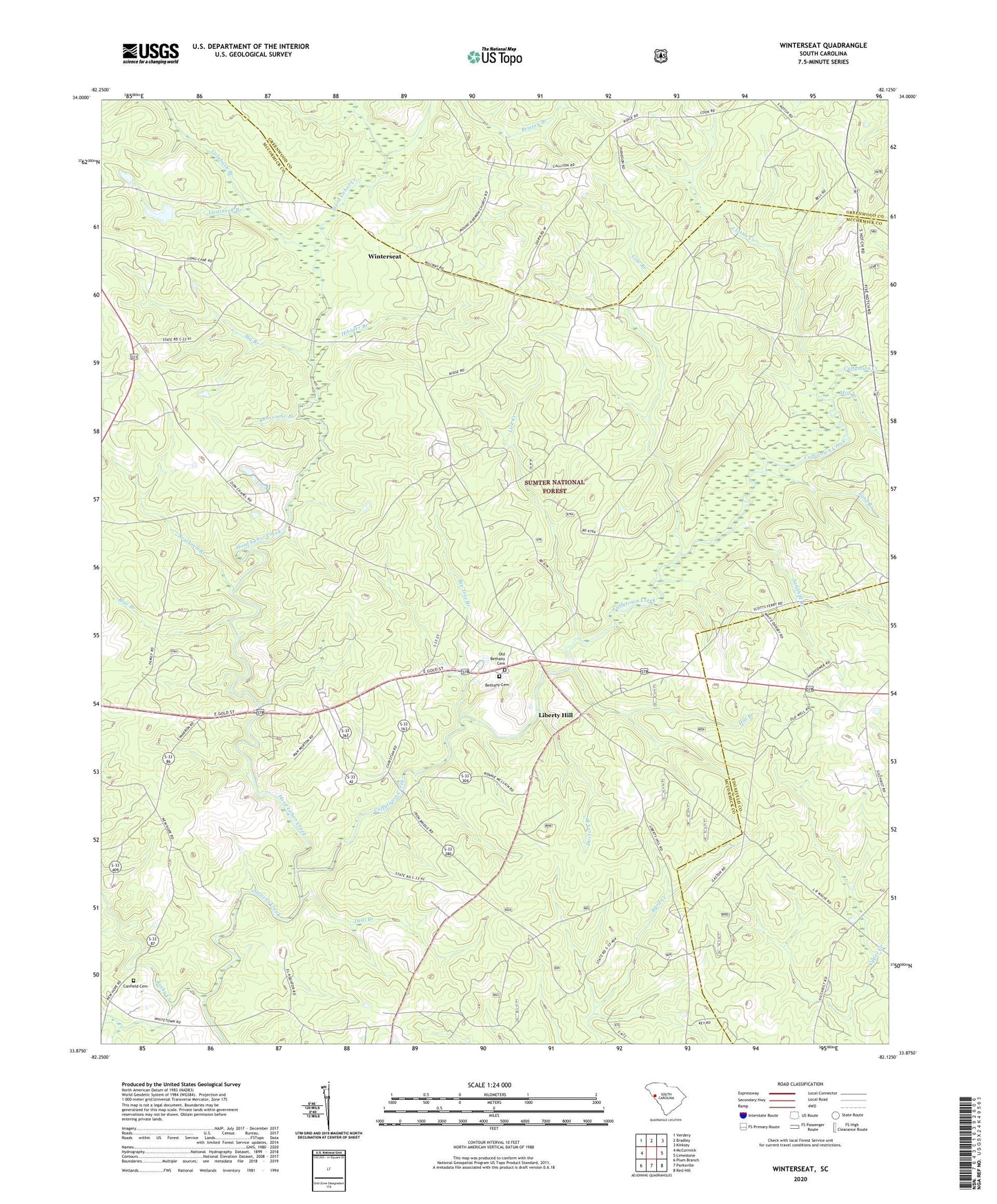
2024 topographic map quadrangle Winterseat in the state of South Carolina. Scale: 1:24000. Based on the newly updated USGS 7.5' US Topo map series, this map is in the following counties: McCormick, Greenwood, Edgefield. The map contains contour data, water features, and other items you are used to seeing on USGS maps, but also has updated roads and other features. This is the next generation of topographic maps. Printed on high-quality waterproof paper with UV fade-resistant inks.
Quads adjacent to this one:
West: McCormick
Northwest: Verdery
North: Bradley
Northeast: Kirksey
East: Limestone
Southeast: Red Hill
South: Parksville
Southwest: Plum Branch
This map covers the same area as the classic USGS quad with code o33082h2.
Contains the following named places: Bee Tree Branch, Bethany Cemetery, Bethany Church, Bethany School, Big Branch, Blue Branch, Blue Branch School, Bracknell Branch, Brissey Branch, Buncombe Branch, Calabash Branch, Canfield Cemetery, Cow Branch, Cuffytown Creek, Deal Branch, Doctors Branch, Dornville, Flat Rock School, Goatneck Branch, Hard Labor Creek, Hibbler Branch, Hibler School, Highway Holy Church, Hill Branch, Liberty Hill, Liberty Hill Lookout Tower, Lick Creek, Little Creek, Lyon School, McCormick Correctional Institution Infirmary, McCormick Division, Mill Branch, Mount Harmony Church, Oak Grove Church, Old Bethany Cemetery, Old Whitetown Church, Piney Grove School, Robinson Church, Robinson School, Rock Grove School, Rocky Creek, Sand Branch, Sand Hill School, Sandhill Branch, Shinburg Mill, South Carolina Noname 35008 D-0637 Dam, Tranquil Church, West Pond School, Whites Cross Roads, Winn Store, Winterseat, Zion Chapel, Zion Chapel School