MyTopo
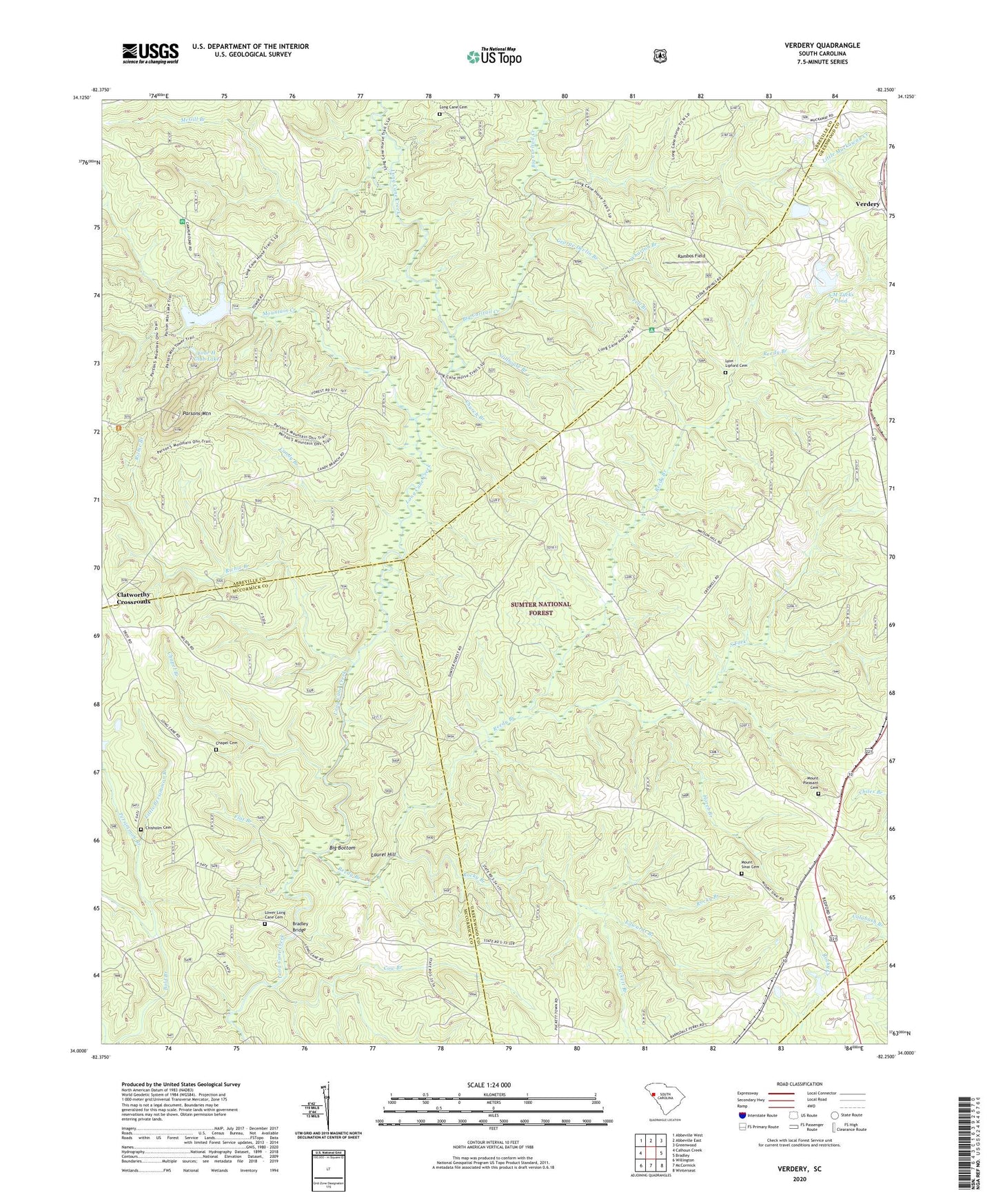
Verdery South Carolina US Topo Map
Couldn't load pickup availability
Also explore the Verdery Forest Service Topo of this same quad for updated USFS data
2024 topographic map quadrangle Verdery in the state of South Carolina. Scale: 1:24000. Based on the newly updated USGS 7.5' US Topo map series, this map is in the following counties: Abbeville, Greenwood, McCormick. The map contains contour data, water features, and other items you are used to seeing on USGS maps, but also has updated roads and other features. This is the next generation of topographic maps. Printed on high-quality waterproof paper with UV fade-resistant inks.
Quads adjacent to this one:
West: Calhoun Creek
Northwest: Abbeville West
North: Abbeville East
Northeast: Greenwood
East: Bradley
Southeast: Winterseat
South: McCormick
Southwest: Willington
This map covers the same area as the classic USGS quad with code o34082a3.
Contains the following named places: A M Tucks Pond, Bethiah School, Big Bottom, Big Curltail Creek, Bradley Bridge, Bradley Corner, Candy Branch, Cedar Spring Associate Reformed Presbyterian Church, Cedar Springs, Cedar Springs Historic District, Cedar Springs Rifle Range, Chapel Branch, Chapel Cemetery, Chapel School, Chisholm Cemetery, Church Branch, Clatworthy Crossroads, Cow Branch, Edney Chapel, Edwards Branch, Fell Branch, Fell Hunt Campground, Flat Branch, Four H Club Dam D-3040, Four H Club Lake, George Devlin Branch, Glover Chapel, Horeb Branch, Horeb Church, Laurel Hill, Little Muckaway Creek, Little Persimmon Branch, Long Cane Cemetery, Long Cane Church, Long Cane Scenic Area, Long Cane School, Lower Long Cane Cemetery, Lyon - Lipford Cemetery, McGill Branch, Millway Church, Mount Bethlehem School, Mount Pleasant Cemetery, Mount Sinai Cemetery, Mount Sinai Church, Mountain Creek, Parsons Mountain, Parsons Mountain Lake, Parsons Mountain Lake Campground, Parsons Mountain Lookout Tower, Persimmon Branch, Poplar Grove Chapel, Poplar Grove School, Puckett Branch, Rambos Field, Reedy Branch, Richie Branch, Rock Buffalo School, Rocky Branch, Sinai Church, South Carolina Noname 01001 D-3039 Dam, South Carolina Noname 24006 D-1262 Dam, South Fork, Stillhouse Branch, Wharton Branch


