MyTopo
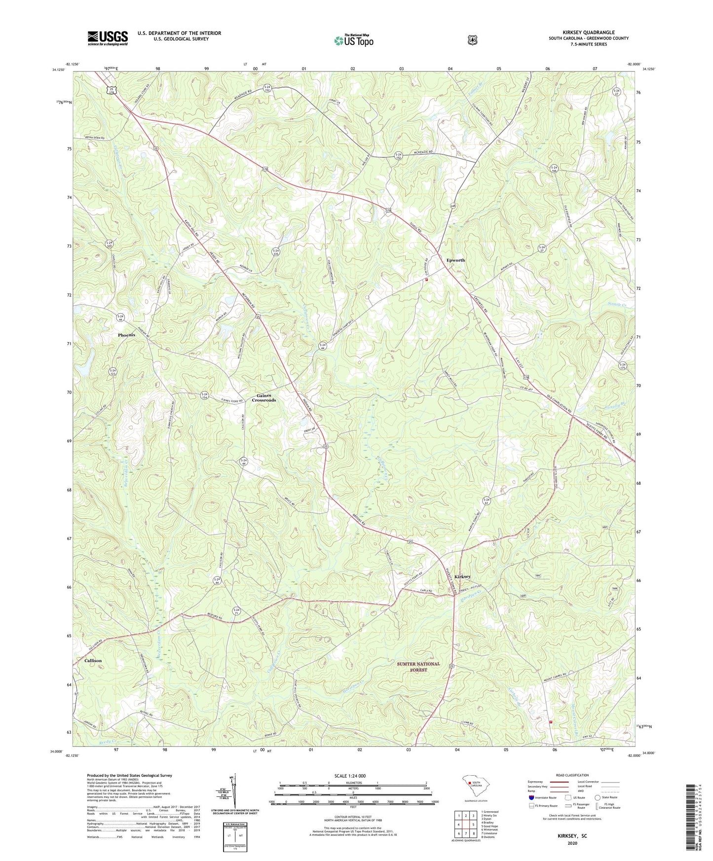
Kirksey South Carolina US Topo Map
Couldn't load pickup availability
Also explore the Kirksey Forest Service Topo of this same quad for updated USFS data
2024 topographic map quadrangle Kirksey in the state of South Carolina. Scale: 1:24000. Based on the newly updated USGS 7.5' US Topo map series, this map is in the following counties: Greenwood. The map contains contour data, water features, and other items you are used to seeing on USGS maps, but also has updated roads and other features. This is the next generation of topographic maps. Printed on high-quality waterproof paper with UV fade-resistant inks.
Quads adjacent to this one:
West: Bradley
Northwest: Greenwood
North: Ninety Six
Northeast: Dyson
East: Good Hope
Southeast: Owdoms
South: Limestone
Southwest: Winterseat
This map covers the same area as the classic USGS quad with code o34082a1.
Contains the following named places: Beaverdam Creek, Bethel Church, Brick House School, Burns Spring School, Damascus Church, Damascus School, Dominicks, Epworth, Epworth / Phoenix Fire Department - Greenwood County Station 70, Epworth Camp, Epworth Lookout Tower, Epworth Station, Fellowship Church, Flint Hill Church, Flint Hill School, Gaines Crossroads, Horsepen Creek, Horsepen School, Kinard Chapel, Kinard Chapel Cemetery, Kirksey, Kirksey Division, Kirksey School, Metts Pond Dam D-1672, Mount Carmel Church, Mount Pisgah Church, Mount Pisgah School, Mount Zion Church, Mount Zion School, Old Mount Zion Church, Old Mount Zion Church Cemetery, Phoenix, Phoenix School, Pittsburg School, Rosa, Sand Ridge, Sand Ridge Church, Sand Ridge School, South Carolina Noname 24019 D-1273 Dam, Tri County Fire Department - Greenwood County Station 95