MyTopo
Cordesville South Carolina US Topo Map
Couldn't load pickup availability
Also explore the Cordesville Forest Service Topo of this same quad for updated USFS data
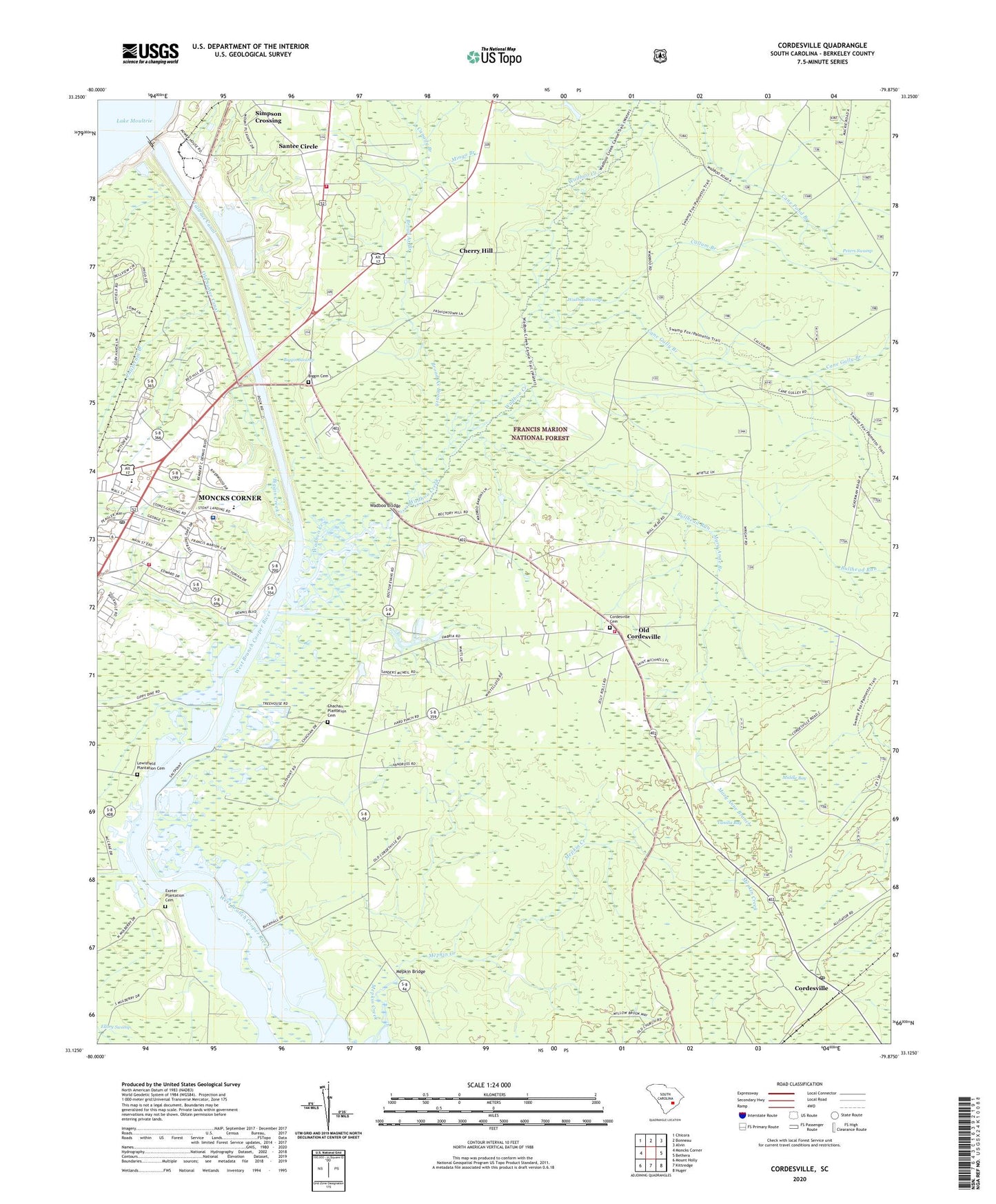
2024 topographic map quadrangle Cordesville in the state of South Carolina. Scale: 1:24000. Based on the newly updated USGS 7.5' US Topo map series, this map is in the following counties: Berkeley. The map contains contour data, water features, and other items you are used to seeing on USGS maps, but also has updated roads and other features. This is the next generation of topographic maps. Printed on high-quality waterproof paper with UV fade-resistant inks.
Quads adjacent to this one:
West: Moncks Corner
Northwest: Chicora
North: Bonneau
Northeast: Alvin
East: Bethera
Southeast: Huger
South: Kittredge
Southwest: Mount Holly
This map covers the same area as the classic USGS quad with code o33079b8.
Contains the following named places: Anderson School, Berkeley County, Berkeley Intermediate School, Berkeley Middle School, Berkeley Museum, Berkeley Training School, Biggin Cemetery, Biggin Creek, Biggin Swamp, Biggins Church, Broad Ax Branch, Buck Hall, Bullhead Run, California Branch, Callum Branch, Canady Branch, Cane Gully Branch, Chachan Plantation, Chachan Plantation Cemetery, Cherry Hill, Cherry Hill Church, Cherry Hill School, Cordesville, Cordesville Cemetery, Cordesville Fire Department Station 1, Cordesville First Baptist Church, Cordesville Post Office, Cordesville School, Emmanuel Church, Exeter Plantation, Exeter Plantation Cemetery, Grace Church, Holiness Church, Holy Comforter Church, Kitfield, Lewisfield Plantation, Lewisfield Plantation Cemetery, Mary Anne Branch, Mepkin Bridge, Middle Bay, Mingo Branch, Minton Plantation, Mittenlane, Moncks Corner Bi-Lo Plaza Shopping Center, Moncks Corner Fire Department Station 1, Moncks Corner Post Office, Moncks Corner Wastewater Treatment Facility, Monks Corner Plaza, Mount Carmel Church, Old Cordesville, Old Santee Canal, Old Santee Canal State Park, Pinopolis Dam, Roper Saint Francis Berkeley Hospital, Saint Lukes Church, Santee Circle, Santee Circle Fire Department Company 21, Simpson Crossing, South Carolina Department of Social Services, South Carolina Highway Patrol, South Pinckney Plantation, Stony Landing, Stony Landing Plantation, Tailrace Canal, Vanilla Bay, Wadboo, Wadboo Bridge, Wadboo Creek, Wadboo Swamp