MyTopo
Moncks Corner South Carolina US Topo Map
Couldn't load pickup availability
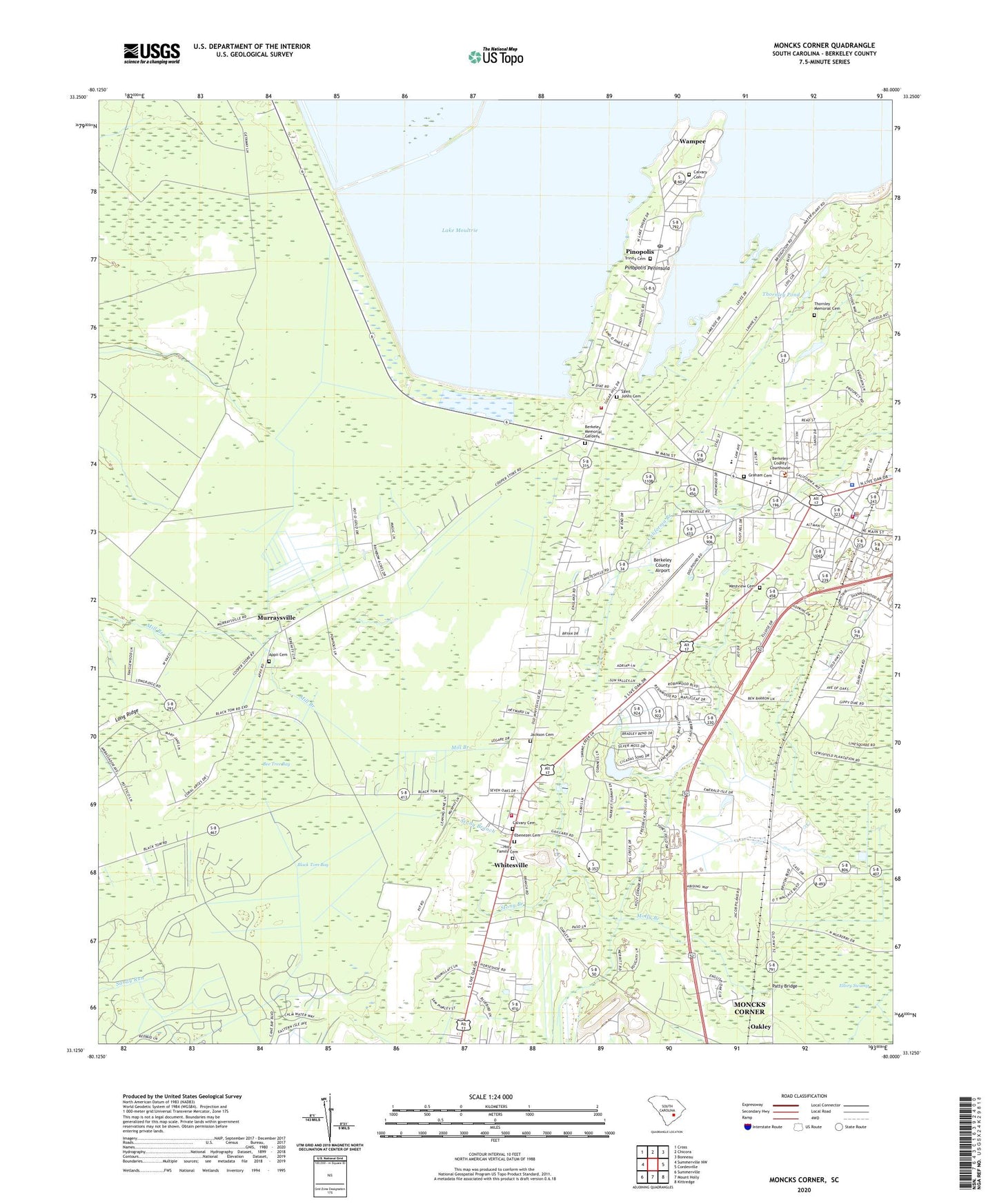
2024 topographic map quadrangle Moncks Corner in the state of South Carolina. Scale: 1:24000. Based on the newly updated USGS 7.5' US Topo map series, this map is in the following counties: Berkeley. The map contains contour data, water features, and other items you are used to seeing on USGS maps, but also has updated roads and other features. This is the next generation of topographic maps. Printed on high-quality waterproof paper with UV fade-resistant inks.
Quads adjacent to this one:
West: Summerville NW
Northwest: Cross
North: Chicora
Northeast: Bonneau
East: Cordesville
Southeast: Kittredge
South: Mount Holly
Southwest: Summerville
This map covers the same area as the classic USGS quad with code o33080b1.
Contains the following named places: Appii Cemetery, Appii Church, Barrow School, Bee Tree Bay, Berkeley Alternative School, Berkeley County Airport, Berkeley County Courthouse, Berkeley County Disaster Preparedness Office, Berkeley County Emergency Medical Services, Berkeley County Library, Berkeley County Library Monks Corner Branch, Berkeley County Rescue Squad, Berkeley County Sheriff's Office, Berkeley Elementary School, Berkeley High School, Berkeley Manor, Berkeley Memorial Gardens, Bethlehem Church, Black Tom Bay, Bombaretta, Calvary Baptist Church, Calvary Cemetery, Centenary Church, Church of God, Ebenezer Cemetery, Ebenezer Church, Ebenezer School, First Baptist Church, First Christian Church, Frazier Hill, Gippy Plantation, Graham Cemetery, Graham Church, Green Hill, Holiness Church, Holy Family Cemetery, Holy Family Episcopal Church, Jackson Cemetery, Locklair, Lord Berkeley Academy, Molly Branch, Moncks Corner, Moncks Corner Division, Moncks Corner Fire Department, Moncks Corner Fire Department Station 2, Moncks Corner Police Department, Moncks Corner Town Hall, Moncks Corner United Methodist Church, Moss Grove Plantation, Mulberry Plantation, Murraysville, Murrysville School, Nazareth Church, Oak Hill, Oak Park, Patty Bridge, Pinopolis, Pinopolis Census Designated Place, Pinopolis Historic District, Pinopolis Peninsula, Pinopolis Post Office, Pinopolis School, Pinopolis United Methodist Church, Saint Johns Baptist Church, Saint Johns Cemetery, Saint Pauls Church, Saint Thomas Church, South Carolina Noname 08016 D-3466 Dam, Stony Branch, Sugar Hill, Sun Down School, The Barrows, The Cottage, The Oak Chapel, Thornley Memorial Cemetery, Thornley Pond, Town of Moncks Corner, Trident Technical College, Trident Technical College Berkeley Campus Library Learning Resources Center, Trinity Cemetery, Trinity Episcopal Church, Tuckertown, Wampee, Westview Cemetery, Whitesville, Whitesville Elementary School, Whitesville Fire Department Station 1, Whitesville School, WMCJ-AM (Moncks Corner), ZIP Code: 29461