MyTopo
Darlington West South Carolina US Topo Map
Couldn't load pickup availability
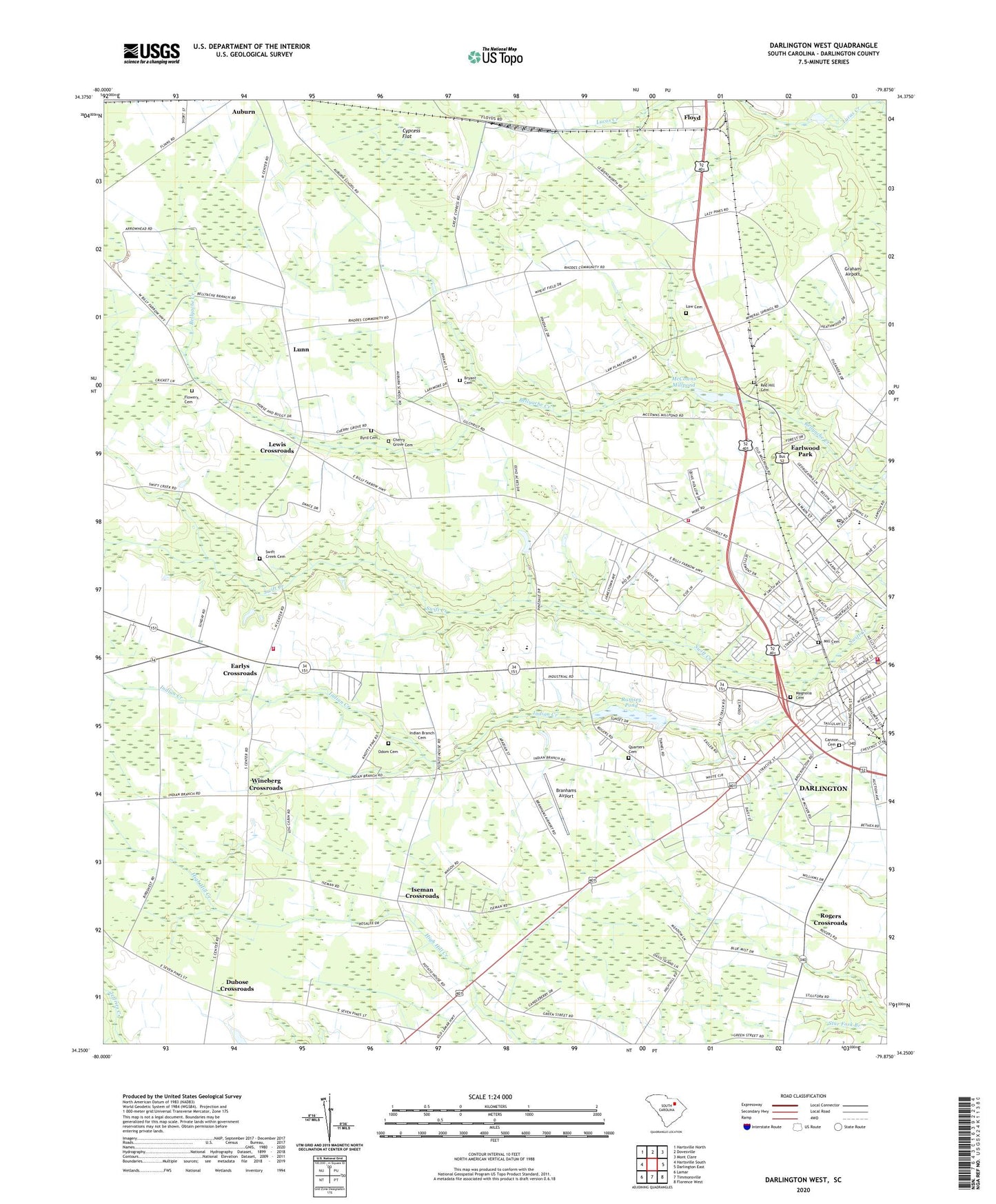
2024 topographic map quadrangle Darlington West in the state of South Carolina. Scale: 1:24000. Based on the newly updated USGS 7.5' US Topo map series, this map is in the following counties: Darlington. The map contains contour data, water features, and other items you are used to seeing on USGS maps, but also has updated roads and other features. This is the next generation of topographic maps. Printed on high-quality waterproof paper with UV fade-resistant inks.
Quads adjacent to this one:
West: Hartsville South
Northwest: Hartsville North
North: Dovesville
Northeast: Mont Clare
East: Darlington East
Southeast: Florence West
South: Timmonsville
Southwest: Lamar
This map covers the same area as the classic USGS quad with code o34079c8.
Contains the following named places: Auburn School, Bell Acres, Bethel African Methodist Episcopal Churh, Branhams Airport, Brockington Heights, Brockington School, Brunson Dargan Junior High School, Bryant Cemetery, Byrd Cemetery, Cannon Cemetery, Cherry Grove Cemetery, Cherry Grove Church, Cherry Grove School, Church of God, Country Oak, Cypress Flat, Darlington, Darlington Career Center, Darlington City Fire Department, Darlington City Hall, Darlington County, Darlington County Emergency Medical Services, Darlington County Fire Department Headquarters, Darlington County Fire Department Station 3, Darlington County Fire Department Swift Creek, Darlington Plaza Shopping Center, Darlington Police Department, Darlington Post Office, Darlington Raceway, Dubose Crossroads, Earlwood Park, Earlys Crossroads, Epworth United Methodist Church, First Church of God, First Pentecostal Holiness Church, Flowers Cemetery, Floyd, Graham Airport, Hunters Ridge, Indian Branch Cemetery, Indian Branch Church, Indian Branch School, Indian Creek, Iseman Crossroads, Law Cemetery, Lewis Crossroads, Lucas Creek, Lunn, Magnolia Cemetery, McCowans Mill, McCowns Millpond, McCowns Millpond Dam D-3535, Medsouth Transportation, Mill Cemetery, Mineral Spring, Mineral Springs Park, Oak Grove Church, Oak Grove School, Odom Cemetery, Parrotts Mill, Pate School, Quail Hollow, Quarters Cemetery, Ramsey Pond, Red Hill Cemetery, Rogers Crossroads, Royal Oaks, Saint John Historic District, Saint Johns High School, Saint Johns School, Saint Josephs Church, Second Baptist Church, South Carolina Highway Patrol Troop 5 Post A, South Carolina Noname 16022 D-3537 Dam, Spring Acres, Spring School, Swan Lake, Swift Creek Cemetery, Swift Creek Church, Swift Creek School, Temple Church, Union Baptist Church, WDAR-AM (Darlington), WDAR-FM (Darlington), Wesley Memorial Methodist Church, Williams Estates, Wineberg Crossroads