MyTopo
Mont Clare South Carolina US Topo Map
Couldn't load pickup availability
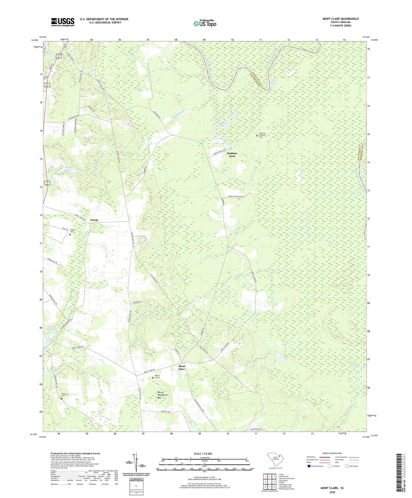
2024 topographic map quadrangle Mont Clare in the state of South Carolina. Scale: 1:24000. Based on the newly updated USGS 7.5' US Topo map series, this map is in the following counties: Darlington, Marlboro, Chesterfield. The map contains contour data, water features, and other items you are used to seeing on USGS maps, but also has updated roads and other features. This is the next generation of topographic maps. Printed on high-quality waterproof paper with UV fade-resistant inks.
Quads adjacent to this one:
West: Dovesville
Northwest: Cash
North: Society Hill
Northeast: Bennettsville South
East: Drake
Southeast: Witherspoon Island
South: Darlington East
Southwest: Darlington West
This map covers the same area as the classic USGS quad with code o34079d7.
Contains the following named places: Barn Plantation, Buckholtz Creek, Charles Mill, Cockers Falls, Coker Pond, Devils Woodyard Bay, Flat Creek Church, Gandy, Gandy Cemetery, Georgetown School, Governor Williams Cemetery, Jeffords Millpond, Jeffords Pond Dam D-3541, Lumber, Mont Clare, Mont Clare Lookout Tower, Montclare School, Mount Clare Baptist Church, Mount Rona Church, Parnell Cemetery, Red Hill Church, Red Hill School, Robbins Neck, Robbins Neck Station, Rosewald Consolidated School, Round O Cemetery, Round O Church, Round O School, Smiths Mill, Society Hill Division, South Carolina Noname 16008 D-3540 Dam, South Carolina Noname 16024 D-3539 Dam, Spring Lake, Wilbur Flowers Pond, Williams Lake, ZIP Codes: 29540, 29593