MyTopo
Edisto Beach South Carolina US Topo Map
Couldn't load pickup availability
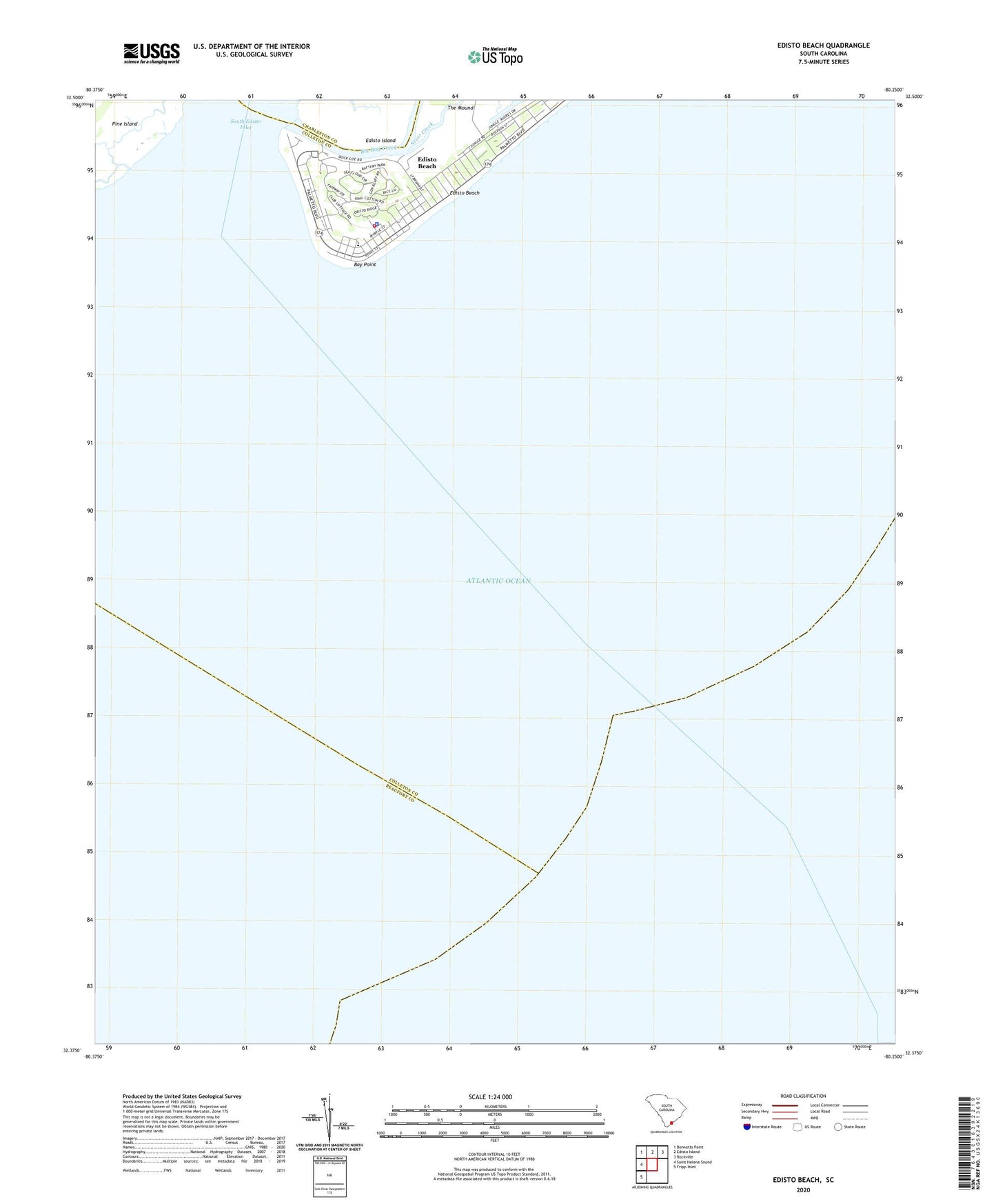
2020 topographic map quadrangle Edisto Beach in the state of South Carolina. Scale: 1:24000. Based on the newly updated USGS 7.5' US Topo map series, this map is in the following counties: Charleston, Colleton, Beaufort. The map contains contour data, water features, and other items you are used to seeing on USGS maps, but also has updated roads and other features. This is the next generation of topographic maps. Printed on high-quality waterproof paper with UV fade-resistant inks.
Quads adjacent to this one:
West: Saint Helena Sound
Northwest: Bennetts Point
North: Edisto Island
Northeast: Rockville
Southwest: Fripp Inlet
Contains the following named places: Bay Point, Big Bay Creek, Colleton County Fire - Rescue Edisto Beach, Edisto Beach, Edisto Beach Police Department, Scott Creek, South Edisto Inlet, South Edisto River, Town of Edisto Beach