MyTopo
Saint Helena Sound South Carolina US Topo Map
Couldn't load pickup availability
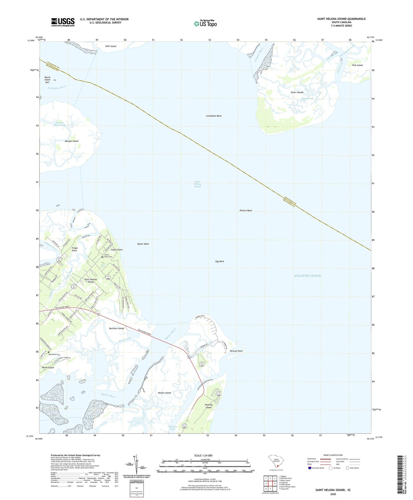
2024 topographic map quadrangle Saint Helena Sound in the state of South Carolina. Scale: 1:24000. Based on the newly updated USGS 7.5' US Topo map series, this map is in the following counties: Beaufort, Colleton. The map contains contour data, water features, and other items you are used to seeing on USGS maps, but also has updated roads and other features. This is the next generation of topographic maps. Printed on high-quality waterproof paper with UV fade-resistant inks.
Quads adjacent to this one:
West: Frogmore
Northwest: Wiggins
North: Bennetts Point
Northeast: Edisto Island
East: Edisto Beach
South: Fripp Inlet
Southwest: Saint Phillips Island
This map covers the same area as the classic USGS quad with code o32080d4.
Contains the following named places: Ashepoo River, Big House Cemetery, Butchers Island, Cedar Reef Villas, Coffin Creek, Coffin Point, Coffin Point Cemetery, Coffin Point Plantation, Combahee Bank, Coosaw River, Egg Bank, Fish Creek, Fripps Point, Harbor Island, Harbor Island Census Designated Place, Horse Island, Hunting Island Lighthouse, Jefford Creek, Johnson Creek, Lee Rosenwald School, Marsh Island Spit, Morgan River, Nautical Watch Villas, Otter Creek, Otter Islands, Oyster Bank, Pelican Bank, Pelican Point, Pine Island, Pine Island Creek, Saint Helena Sound, Ward Creek, WHTK-FM (Port Royal)