MyTopo
Fenwick South Carolina US Topo Map
Couldn't load pickup availability
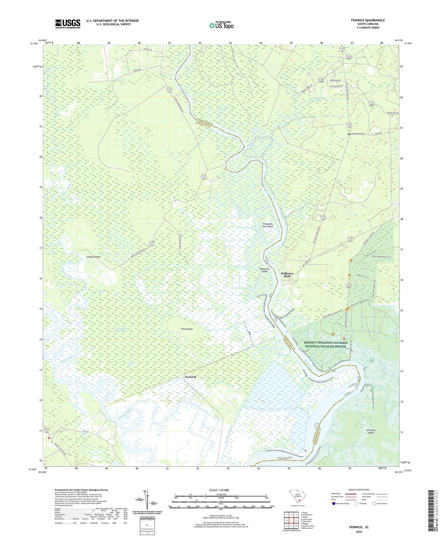
2020 topographic map quadrangle Fenwick in the state of South Carolina. Scale: 1:24000. Based on the newly updated USGS 7.5' US Topo map series, this map is in the following counties: Colleton, Charleston. The map contains contour data, water features, and other items you are used to seeing on USGS maps, but also has updated roads and other features. This is the next generation of topographic maps. Printed on high-quality waterproof paper with UV fade-resistant inks.
Quads adjacent to this one:
West: Green Pond
Northwest: Neyles
North: Jacksonboro
Northeast: Osborn
East: Adams Run
Southeast: Edisto Island
South: Bennetts Point
Southwest: Wiggins
Contains the following named places: Adams Run, Airy Hall, Airy Hall Plantation, Ashe Creek, Bethlehem Cemetery, Bethlehem Church, Calvary Church, Cattle Island, Colleton Fire Department Station 28, Deer Creek, Edisto River, Fenwick, Grove Plantation, Hope Creek, Hope Plantation, Hutton Plantation, Manuel Church, Matthews Canal, Oakhurst Island, Penny Creek, Pine Island, Prospect Hill Island, Prospect Plantation, Shiloh, Shiloh Church, Snuggedy Swamp, Willtown Bluff, ZIP Code: 29452