MyTopo
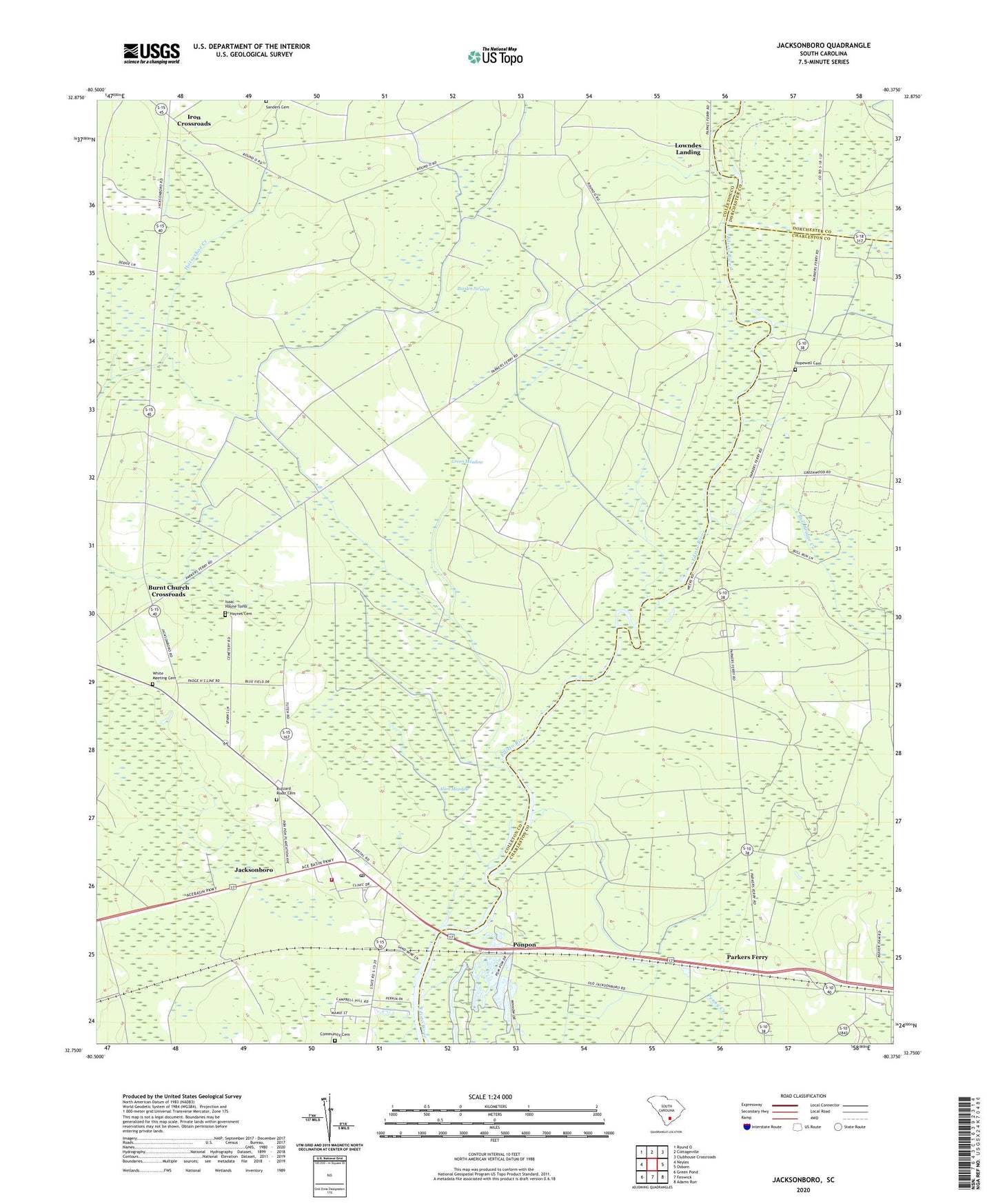
Jacksonboro South Carolina US Topo Map
Couldn't load pickup availability
2024 topographic map quadrangle Jacksonboro in the state of South Carolina. Scale: 1:24000. Based on the newly updated USGS 7.5' US Topo map series, this map is in the following counties: Colleton, Charleston, Dorchester. The map contains contour data, water features, and other items you are used to seeing on USGS maps, but also has updated roads and other features. This is the next generation of topographic maps. Printed on high-quality waterproof paper with UV fade-resistant inks.
Quads adjacent to this one:
West: Neyles
Northwest: Round O
North: Cottageville
Northeast: Clubhouse Crossroads
East: Osborn
Southeast: Adams Run
South: Fenwick
Southwest: Green Pond
This map covers the same area as the classic USGS quad with code o32080g4.
Contains the following named places: Allen Meadow, Baptist Church Branch, Beck Landing, Bluefield Hunting Club, Bull Bridge Creek, Burden Swamp, Burnt Church Crossroads, Buzzard Roost Cemetery, Canady Landing, Cedar Grove School, Church of God, Colleton Fire Department Station 2, Community Cemetery, Edisto Sand Pit, Elliot Swamp, Eureka School, Fishburn Landing, Green Meadow, Haynes Cemetery, Henry James Swamp, Hopewell Cemetery, Hopewell Church, Iron Crossroads, Irons Cross Roads School, Isaac Hayne Tomb, Jacksonboro, Jacksonboro Census Designated Place, Jacksonboro Church, Jacksonboro Post Office, Jacksonboro School, Jenkins Swamp, Lowndes Landing, Martins Landing, Oak Grove School, Padgett Landing, Parkers Ferry, Parkers Ferry Landing, Parkers Ferry School, Pine Hill Landing, Pine Hill School, Ponpon, Saint Johns Swamp, Saint Marks Church, Sanders Cemetery, Trinity Church, Trinity School, White Meeting Cemetery