MyTopo
Wiggins South Carolina US Topo Map
Couldn't load pickup availability
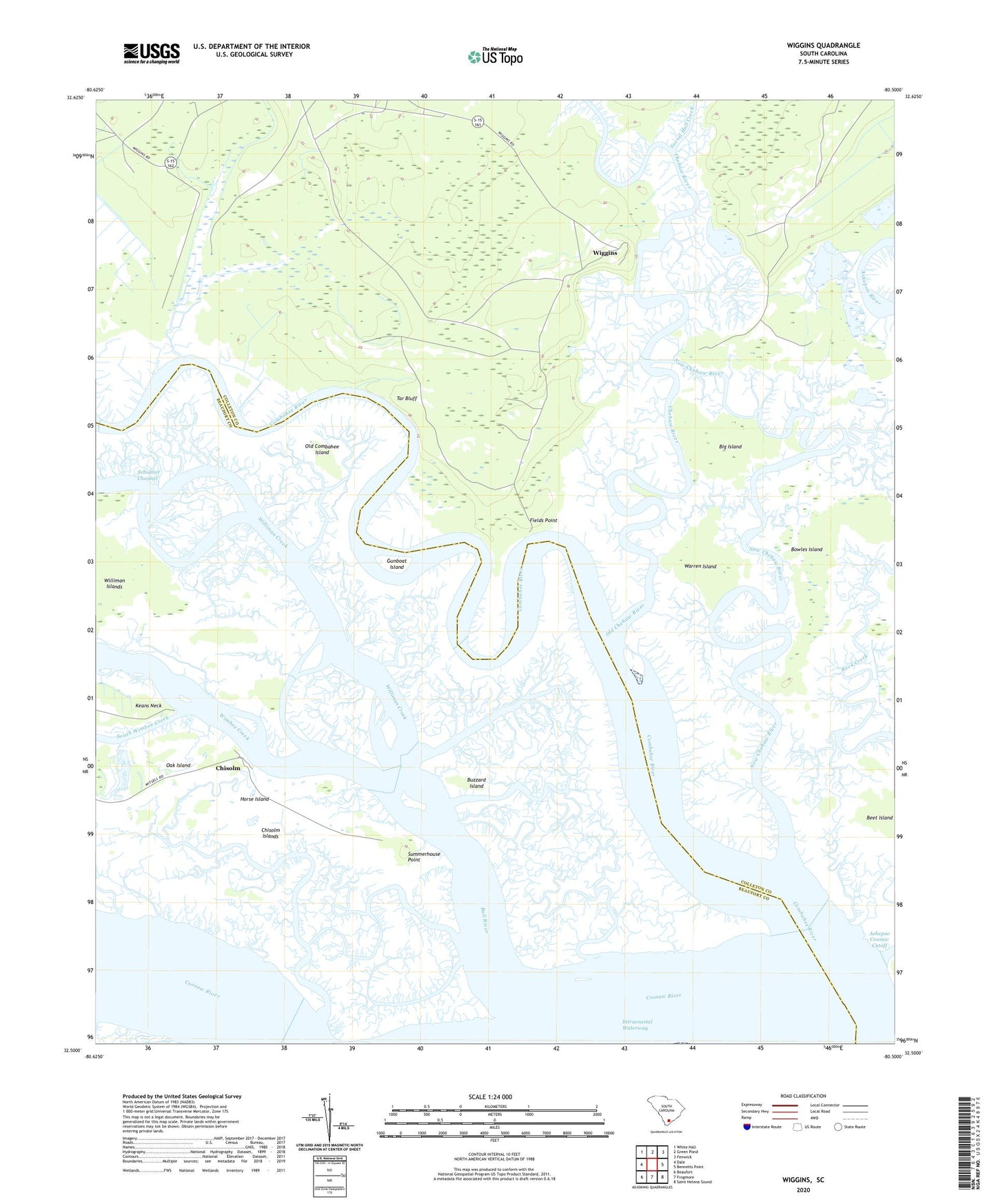
2024 topographic map quadrangle Wiggins in the state of South Carolina. Scale: 1:24000. Based on the newly updated USGS 7.5' US Topo map series, this map is in the following counties: Colleton, Beaufort. The map contains contour data, water features, and other items you are used to seeing on USGS maps, but also has updated roads and other features. This is the next generation of topographic maps. Printed on high-quality waterproof paper with UV fade-resistant inks.
Quads adjacent to this one:
West: Dale
Northwest: White Hall
North: Green Pond
Northeast: Fenwick
East: Bennetts Point
Southeast: Saint Helena Sound
South: Frogmore
Southwest: Beaufort
This map covers the same area as the classic USGS quad with code o32080e5.
Contains the following named places: Ashepoo Plantation Pond Dam D-2387, Big Island, Bowles Island, Bull River, Buzzard Island, Chehaw River, Chisolm, Chisolm Islands, Chisolm Plantation, Combahee River, Fields Point, Fields Point School, Gunboat Island, Horse Island, New Chehaw River, Oak Island, Old Chehaw River, Old Combahee Island, Social Hall Creek, South Wimbee Creek, Summerhouse Point, Tar Bluff, Warren Island, Whitsell Landing, Wiggins, Wiggins School, Williman Creek, Wimbee Creek