MyTopo
Osborn South Carolina US Topo Map
Couldn't load pickup availability
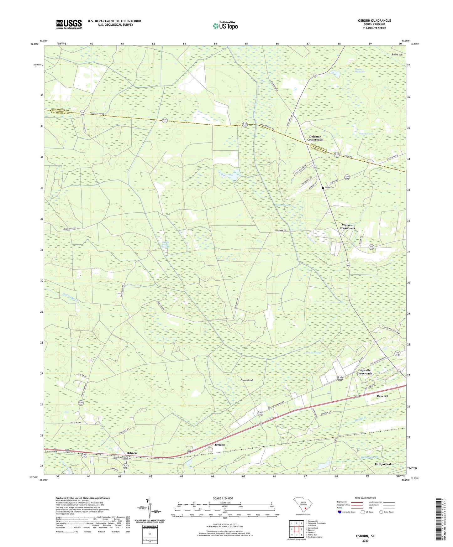
2024 topographic map quadrangle Osborn in the state of South Carolina. Scale: 1:24000. Based on the newly updated USGS 7.5' US Topo map series, this map is in the following counties: Charleston, Dorchester. The map contains contour data, water features, and other items you are used to seeing on USGS maps, but also has updated roads and other features. This is the next generation of topographic maps. Printed on high-quality waterproof paper with UV fade-resistant inks.
Quads adjacent to this one:
West: Jacksonboro
Northwest: Cottageville
North: Clubhouse Crossroads
Northeast: Stallsville
East: Ravenel
Southeast: Wadmalaw Island
South: Adams Run
Southwest: Fenwick
This map covers the same area as the classic USGS quad with code o32080g3.
Contains the following named places: Boyle School, Caddin Bridge Swamp, Calvary Church, Capwells Crossroads, Coon Island, Delemar Crossroads, Delemars School, Drayton Swamp, Dwight School, Jericho, Judge Smith School, Mount Nebo Church, Osborn, Osborn Church, Ravenel, Ravenel-Hollywood Division, Rivens Backwater, Saint Pauls Church, Spring Grove Church, Spring Grove School, Stono Church, Warren Crossroads, White Cemetery, ZIP Codes: 29426, 29470