MyTopo
Flint Hill South Carolina US Topo Map
Couldn't load pickup availability
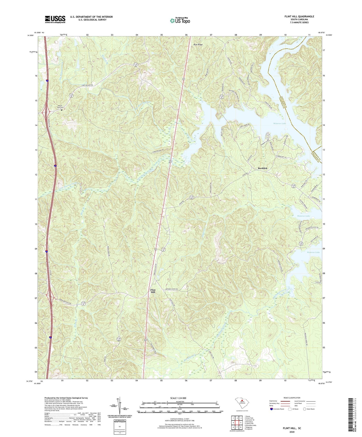
2020 topographic map quadrangle Flint Hill in the state of South Carolina. Scale: 1:24000. Based on the newly updated USGS 7.5' US Topo map series, this map is in the following counties: Fairfield, Lancaster, Kershaw. The map contains contour data, water features, and other items you are used to seeing on USGS maps, but also has updated roads and other features. This is the next generation of topographic maps. Printed on high-quality waterproof paper with UV fade-resistant inks.
Quads adjacent to this one:
West: Winnsboro
Northwest: Stover
North: Great Falls
Northeast: Lancaster SE
East: Liberty Hill
Southeast: Longtown
South: Ridgeway
Southwest: Winnsboro Mills
Contains the following named places: Aldrichs Shoal, Biddle, Big Wateree Creek, Bucklick, Camp Welfare, Catawba River, Caughmans Duck Pond D-1572 Dam, Crooked Creek, Dukes Ford, Dutchman Creek, Flint Hill, Hogfork Branch, Horse Branch, Little Wateree Creek, Montgomerys Island, Mount Zion Cemetery, Mount Zion Church, New Zion Church, New Zion School, Pickels Mill, Piney Grove School, Rock Hill Church, Scabbler Branch, Taylors Creek, White Oak Church, White Oak School, Zion Church