MyTopo
Liberty Hill South Carolina US Topo Map
Couldn't load pickup availability
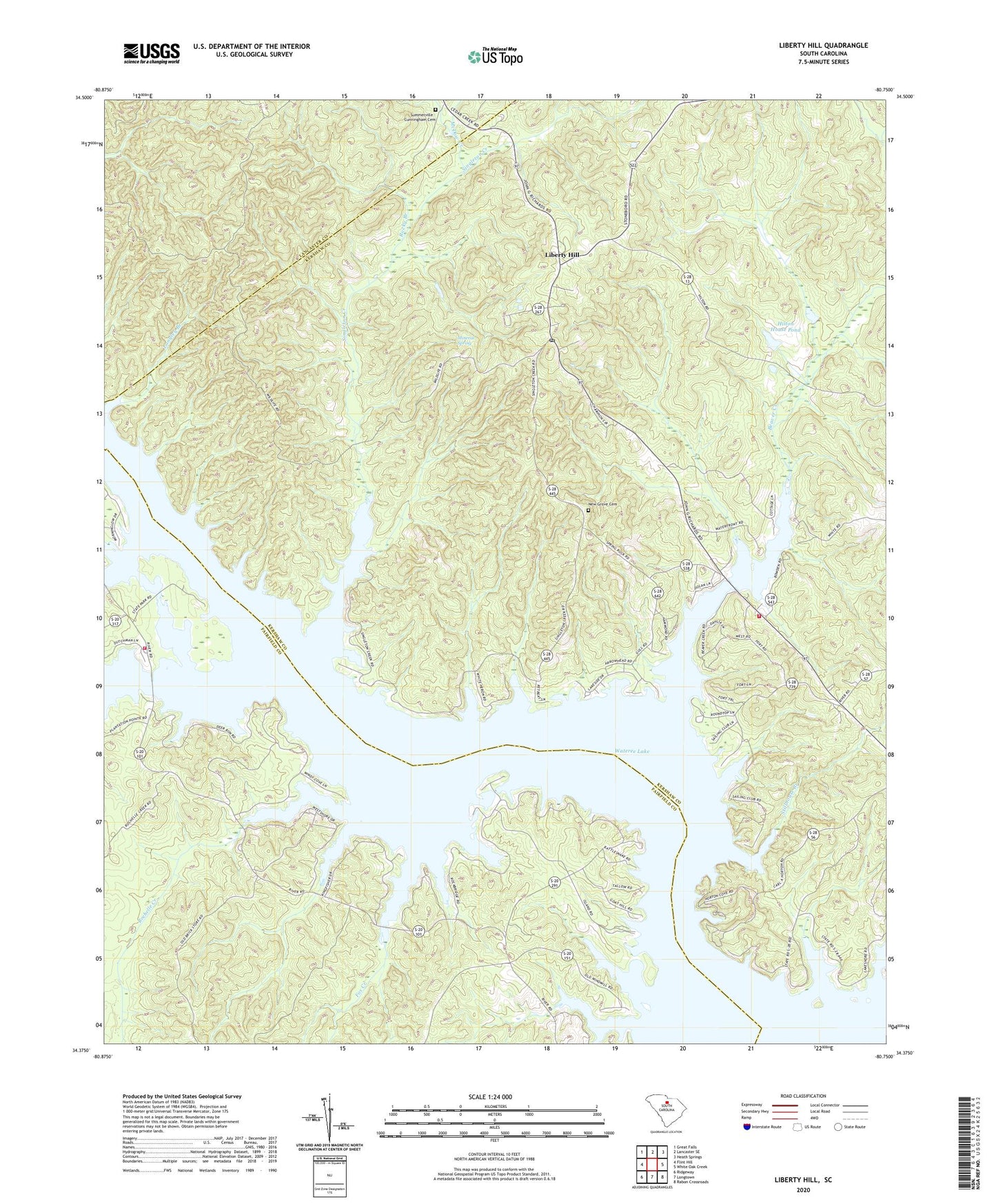
2024 topographic map quadrangle Liberty Hill in the state of South Carolina. Scale: 1:24000. Based on the newly updated USGS 7.5' US Topo map series, this map is in the following counties: Kershaw, Fairfield, Lancaster. The map contains contour data, water features, and other items you are used to seeing on USGS maps, but also has updated roads and other features. This is the next generation of topographic maps. Printed on high-quality waterproof paper with UV fade-resistant inks.
Quads adjacent to this one:
West: Flint Hill
Northwest: Great Falls
North: Lancaster SE
Northeast: Heath Springs
East: White Oak Creek
Southeast: Rabon Crossroads
South: Longtown
Southwest: Ridgeway
This map covers the same area as the classic USGS quad with code o34080d7.
Contains the following named places: Beaver Creek, Beaver Creek Church, Dutchmans Creek, Fairfield County Fire Department Number 8 Dutchman Creek, Fox Creek, Gitsinger Church, Hilton House Pond, Hilton House Pond Dam D-1139, Hoods Mill, Kershaw County Fire Station 12, Lake Wateree State Park, Langley Branch, Liberty Hill, Liberty Hill Church, Liberty Hill Historic District, Liberty Hill Lookout Tower, Liberty Hill Presbyterian Church, Liberty Hill School, McDow Creek, Mickles Ferry, Mineral Spring, Mount Moriah Church, New Grove Cemetery, New Grove Church, Oak Spring Church, Peays Ferry, Rochelle Creek, Rocky Branch, Saint Johns Church, Singleton Creek, Stillhouse Branch, Summerville - Cunningham Cemetery, Taylor Creek, Thorn School, Wateree Lake, ZIP Code: 29074