MyTopo
Longtown South Carolina US Topo Map
Couldn't load pickup availability
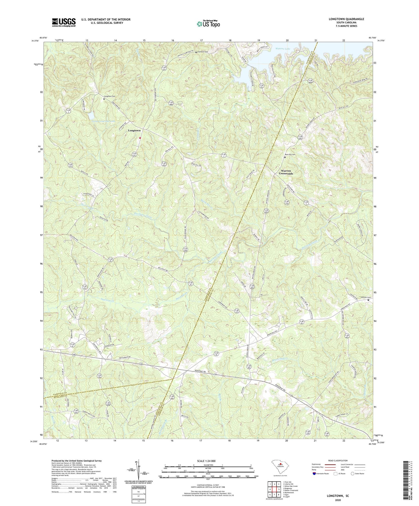
2024 topographic map quadrangle Longtown in the state of South Carolina. Scale: 1:24000. Based on the newly updated USGS 7.5' US Topo map series, this map is in the following counties: Fairfield, Kershaw, Richland. The map contains contour data, water features, and other items you are used to seeing on USGS maps, but also has updated roads and other features. This is the next generation of topographic maps. Printed on high-quality waterproof paper with UV fade-resistant inks.
Quads adjacent to this one:
West: Ridgeway
Northwest: Flint Hill
North: Liberty Hill
Northeast: White Oak Creek
East: Rabon Crossroads
Southeast: Lugoff
South: Elgin
Southwest: Blythewood
This map covers the same area as the classic USGS quad with code o34080c7.
Contains the following named places: Antioch Cemetery, Antioch Church, Bellfield, Camp Longridge, Camp Longridge Lake, Camp Longridge Lake Dam D-0534, Centerville School, Church of God, Colonel Creek, Colonel Creek Landing, Crims Mill, Fairfield County Fire Department Southeastern, Hopewell School, Horse Pen Creek, Jackson Cemetery, James Chapel, Longtown, Longtown Cemetery, Longtown Church, Mittenwald Creek, Mount Joshua Church, Mount Joshua School, Mount Olive Church, Rock Hill Cemetery, Rock Hill Church, Smyrna Camp Ground, Smyrna Church, Sutton Branch Baptist Church, Suttons Branch, Thorntree Creek, Thorntree School, Turner School, Warren Crossroads, White Oak Church, Woods School