MyTopo
Fountain Inn South Carolina US Topo Map
Couldn't load pickup availability
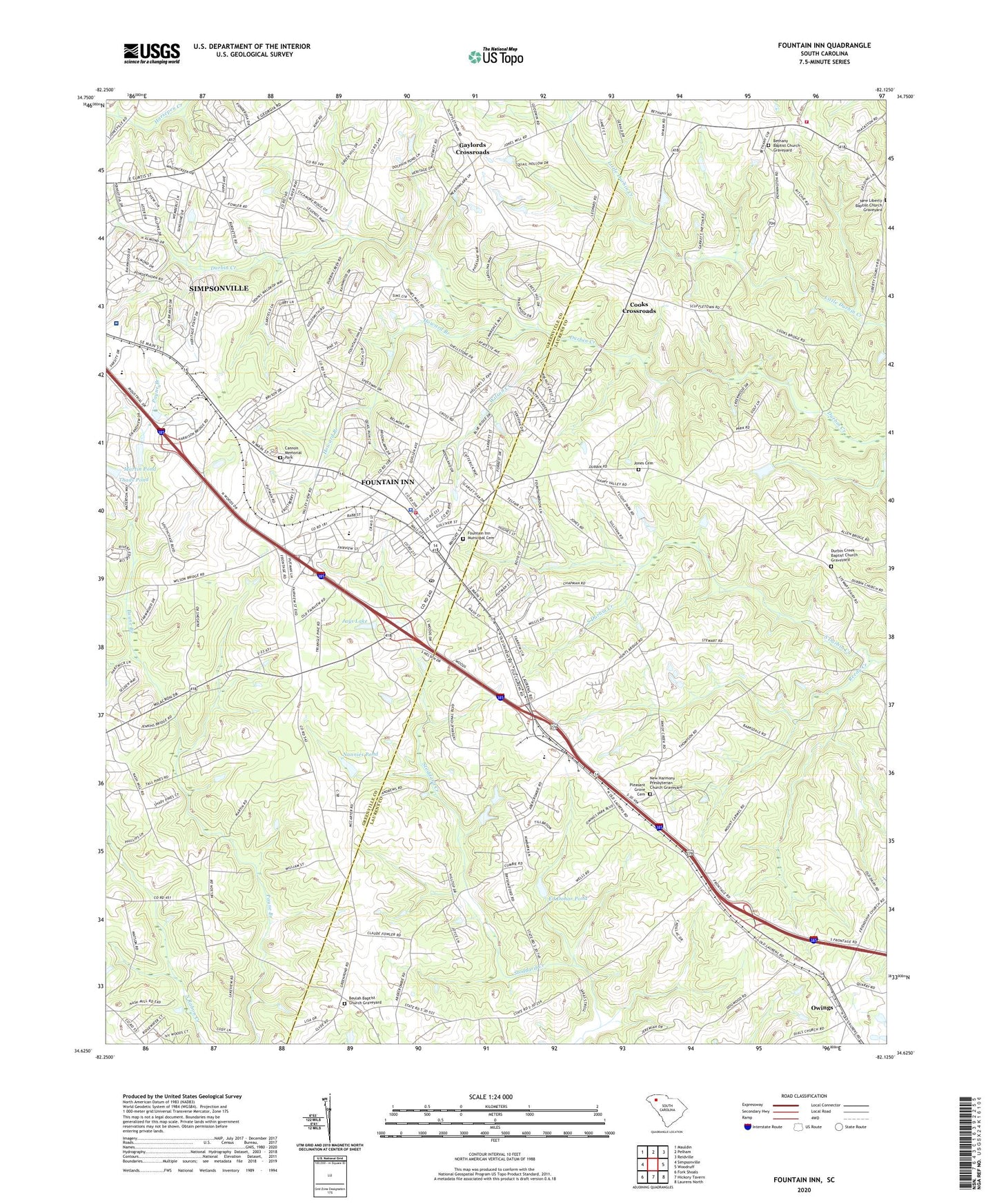
2024 topographic map quadrangle Fountain Inn in the state of South Carolina. Scale: 1:24000. Based on the newly updated USGS 7.5' US Topo map series, this map is in the following counties: Greenville, Laurens. The map contains contour data, water features, and other items you are used to seeing on USGS maps, but also has updated roads and other features. This is the next generation of topographic maps. Printed on high-quality waterproof paper with UV fade-resistant inks.
Quads adjacent to this one:
West: Simpsonville
Northwest: Mauldin
North: Pelham
Northeast: Reidville
East: Woodruff
Southeast: Laurens North
South: Hickory Tavern
Southwest: Fork Shoals
This map covers the same area as the classic USGS quad with code o34082f2.
Contains the following named places: Bethany Baptist Church Graveyard, Bethany Church, Bethany School, Bethlehem Baptist Church Graveyard, Bethlehem Church, Beulah Baptist Church Graveyard, Beulah Church, Bryson Elementary School, Bryson Middle School, Cannon Memorial Park, City of Fountain Inn, Cooks Crossroads, Coopers Large Pond, Coopers Large Pond Dam D-3020, Durbin Creek Baptist Church Graveyard, Durbin Creek Church, Ed Dohar Pond, Ed Dohar Pond Dam D-3007, Faith Church, Fountain Inn, Fountain Inn Division, Fountain Inn Elementary School, Fountain Inn Fire Department Headquarters, Fountain Inn Municipal Cemetery, Fountain Inn Police Department, Fox Run Country Club, Gaylords Crossroads, Gray Court Division, Hillcrest High School, Hillcrest Memorial Hospital, Howard Branch, Jays Lake, Jays Lake Dam D-2912, Jones Cemetery, Laurens County Fire Department Durbin Creek Substation, Martin Pond, Martin Pond Dam D-2906, Mount Carmel African Methodist Episcopal Church Graveyard, Mount Carmel Church, Mount Carmel School, Nannies Pond, Nannies Pond Dam D-2913, New Durbin Church, New Harmony Church, New Harmony Presbyterian Church Graveyard, New Liberty Church, Old Shady Oak Church, Owings, Owings Presbyterian Church Graveyard, Pine Grove Church, Pleasant Grove Cemetery, Pleasant Grove Church, Pleasant View Church, Pleasant View School, Poinsettia, Powderhorn, Powers Shop, Reedy Creek, Riddle Pond Dam D-2966, Simpsonville Division, Sure Trans Medical Transport, Thads Pond, Thads Pond Dam D-2905, The Cedars, Waycross School, WFIS-AM (Fountain Inn), Wilson Creek, ZIP Code: 29644