MyTopo
Hickory Tavern South Carolina US Topo Map
Couldn't load pickup availability
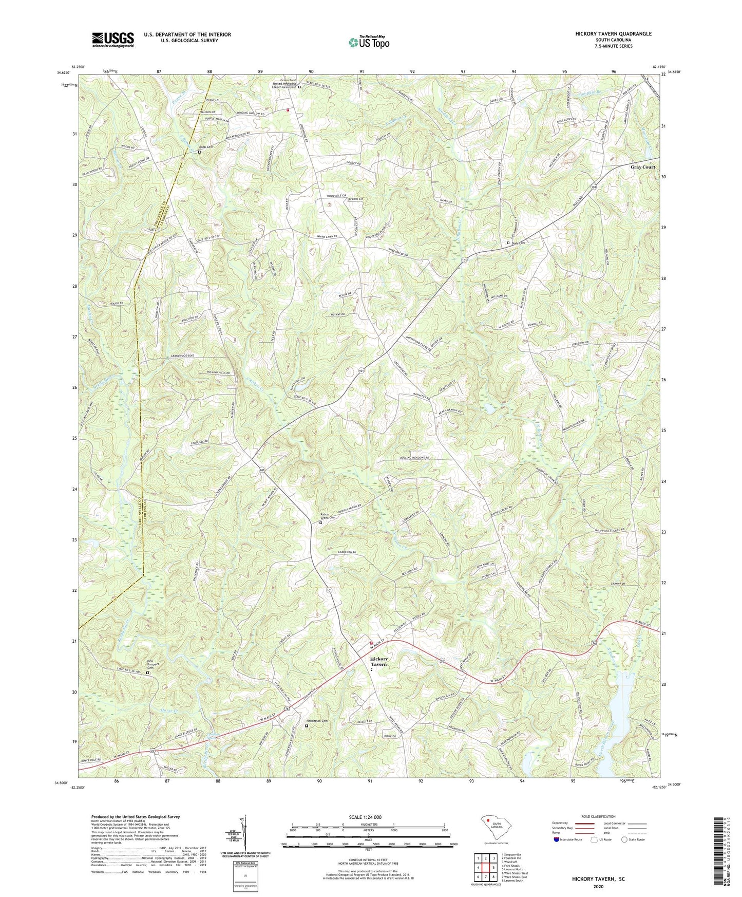
2024 topographic map quadrangle Hickory Tavern in the state of South Carolina. Scale: 1:24000. Based on the newly updated USGS 7.5' US Topo map series, this map is in the following counties: Laurens, Greenville. The map contains contour data, water features, and other items you are used to seeing on USGS maps, but also has updated roads and other features. This is the next generation of topographic maps. Printed on high-quality waterproof paper with UV fade-resistant inks.
Quads adjacent to this one:
West: Fork Shoals
Northwest: Simpsonville
North: Fountain Inn
Northeast: Woodruff
East: Laurens North
Southeast: Laurens South
South: Ware Shoals East
Southwest: Ware Shoals West
This map covers the same area as the classic USGS quad with code o34082e2.
Contains the following named places: Arnolds Mill, Babb Cemetery, Babb Pond Dam D-3018, Campbell Chapel, Center Rabon Church, Center Rabon School, Currys Lake, Dials Cemetery, Dials Church, Edens, Edens School, Green Pond, Green Pond Church, Green Pond School, Green Pond United Methodist Church Graveyard, Henderson Cemetery, Henderson Church, Hickory Tavern, Hickory Tavern School, Horse Creek, Laurens County Fire Department Greenpond, Laurens County Fire Department Hickory Tavern Station 1, Lick Creek, Martin Creek, Mill Rock Church, Mill Rock School, Mountain Creek, New Prospect Cemetery, New Prospect Church, Payne Branch, Pumpkin Branch, Rabon Creek Church, Rabun Creek Cemetery, Reedy River, Riddle Pond, Riddle Pond Dam D-2909, Rocky Mount School, Shiloh Church, Stoddard Creek, Sullivan Mill, Tumbling Shoals, ZIP Code: 29645